 On the last two days of our two-week sojourn through the southern Appalachian Mountains, Don and I returned to Shenandoah National Park. By now we were wiser, and more experienced in the ways of the mountains. This time we planned to drive the length of Skyline Drive from south to north, spending a night at Skyland Resort in the Park, and hopefully getting a little hiking in.
 We found spring a little more advanced since 11 days before. More trees and shrubs had covered their bare brown branches with bright green spring coats. Flowers and trees put out blooms that nicely framed the mountain and valley views. Best of all, we had blue skies and white fluffy clouds – and no fog!
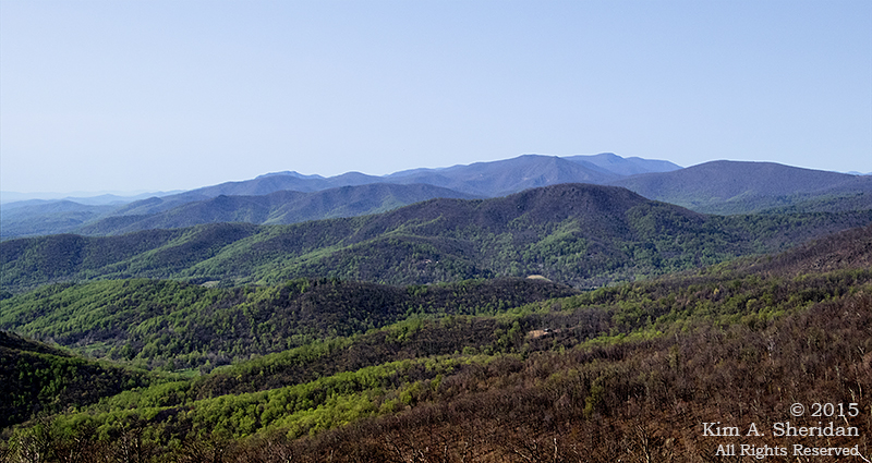
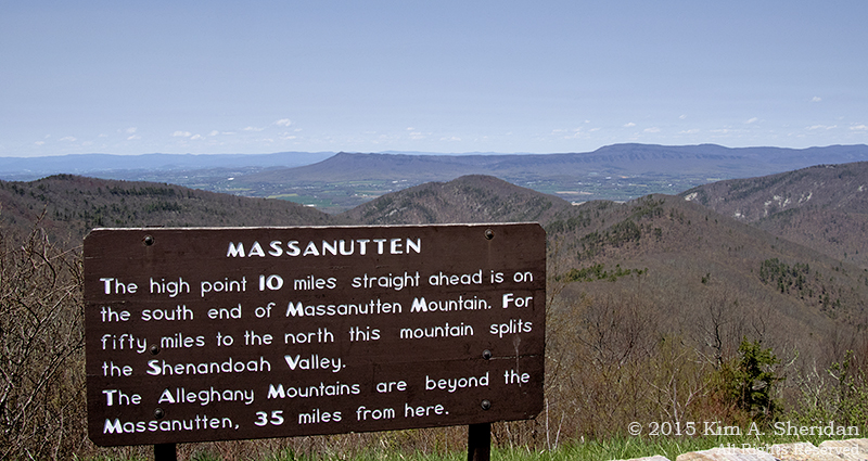 Don was fascinated with a mountain called The Massanutten (yes, it’s called that, and yes, he insists “The” be capitalized.) The Massanutten runs 50 miles down the heart of the Shenandoah Valley. Why is there a mountain in the middle of the valley? As the valley gradually eroded away, the harder Massanutten Sandstone that forms the ridge remained. It makes for spectacular viewing from all along Skyline Drive. This is the southern end.
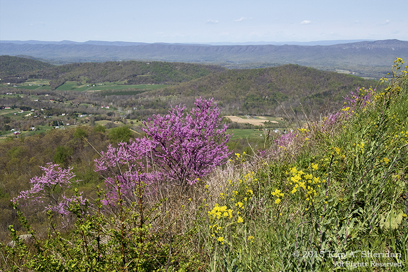
 Mountain pinks on the mountainside.
 Old Rag looks like fun to scramble around on. Peaks like Old Rag exist because the rock they are made of is extremely resistant to the weathering that eroded the softer rock around them. The rock that makes up Old Rag is called – wait for it – Old Rag granite.
 We took a walk at the end of the day on the Stony Man Trail. It’s a 1 ½ mile path to the peak of Stony Man Mountain, which at 4011’ is the second highest peak in Shenandoah NP. Near the peak, red spruce and balsam fir grow, remnants of a colder climate. The trail wound around fascinating boulders before coming out of the woods onto the top of the rock outcropping that forms Stony Man’s profile.
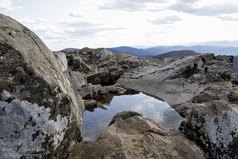 Sky reflection in a boulder puddle. Don and I had a blast scrambling all over the rocks here.
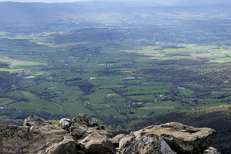 Looking into the valley from Stony Man’s forehead.
 This is the view from my hotel room at Skyland Resort. Not too shabby, huh?
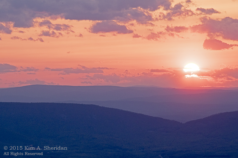 After dinner I spent some time on my porch watching the sun set …
 …And the moon come out.
With the dawn it was time to move on. A beautiful but bittersweet day, as I knew it was our last in the mountains, and we’d be home by nightfall. We spent the morning driving the remaining 40 miles of Skyline Drive to its northern terminus.
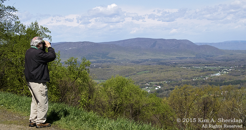
 Looking along the Blue Ridge Mountains. Old Rag, Mary’s Rock and Stony Man are all visible in this vista. Can you find Stony Man?
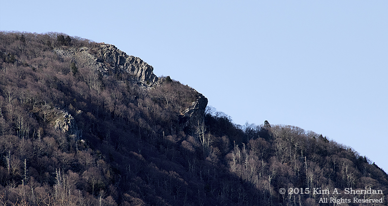 This might help. Here’s the famous Stony Man profile. In April it’s easy to see the shape of the rock outcroppings that form the face.
 Here I am at Franklin Cliffs. More rock scrambling!
At the very north tip of The Massanutten is Signal Knob, a high point used by Confederate troops in the Civil War to send signals. It was lost in the fog on our previous trip through the Park, and Don and I really hoped to get a peek at it this time.
 Signal Knob, at last. Don getting some much-delayed gratification.
 One last glimpse of the mountains and the Shenandoah Valley. Then it was time to leave the Appalachians for good and make our way home. Soon enough the skies darkened and the rain began.
Two weeks is a long time to be on the road, living out of suitcases, eating fast food and sleeping in hotels. Don and I came home thoroughly exhausted. There were a lot of challenges, some uncooperative weather and not nearly enough bears.
But, oh, what a trip! From the waterfalls, balds and peaks of Great Smoky Mountains National Park along the winding path of the Blue Ridge Parkway to the mountain and valley views of Shenandoah National Park, it was a trip I will never forget. Four months later, I have but one parting thought:

I WANT TO GO BACK!
