Almost Heaven: A Spruce Knob Point of View

“Always leave them wanting more.”

I have yet to take a trip where I got enough of the place in one visit, where I didn’t immediately want to go back. For many places, like the Smoky Mountains and the Adirondacks, once may have to be enough. Other locales, a little closer to home, can be visited again and again.

Like Blackwater Falls State Park. You may recall the last trip my friends and I took to the Potomac Highlands region three summers ago. Seneca Rocks & Cavern. Lindy Point. Dolly Sods.

The list of things we didn’t see during that trip was even longer: Spruce Knob. Cathedral State Park. Canaan Valley NWR. Bears. More of Dolly Sods. (One can never get enough of Dolly Sods.)

Clearly, a return trip was in order. And so, on Labor Day weekend 2018, we went home to the mountains of the West Virginia. Continue reading

A Nittany Ramble

161030_pa-mt-nittany_3691acsGuided tours are fine. But sometimes I just want to get out in the woods and ramble!

My friends and I traveled to the center of Pennsylvania on Halloween weekend, to tour Penn’s Cave and Wildlife Park. It was a fascinating and enjoyable visit. It did, however, consist of sitting. In a boat and then a bus, with a small group of other tourists, all confined to a pre-planned route.

By the next day, we three free spirits were ready to strike out on our own for some leisurely exploring.

I’d attended Penn State University before health issues ended my freshman year. Lacking a car in those days, I’d never explored much beyond the campus boundaries.

This was the first time I’d gone back to the region. When Don and Robb were looking for places to hike on this trip, I quickly suggested we climb Mount Nittany. I was delighted when they agreed.

Mount Nittany is a ridge in the Ridge-and-Valley province of the Appalachian Mountains with a peak elevation of 2077’. Penn State lies a couple of miles to the southwest in the Nittany Valley. Penn State’s mountain lion mascot, the Nittany Lion, is named for Mount Nittany.

161030_pa-mt-nittany_3413acsThe hike started with a bit of a climb – 600 feet in the first half mile, up an uneven and rocky trail. Robb and Don clambered up it like a pair of billy goats.

161030_pa-mt-nittany_3495acsI had thought that the trees would have lost all their leaves by late October. I was pleasantly surprised to see lots of fall color on the mountain. This leaf couldn’t make up its mind what hue it wanted to be.

161030_pa-mt-nittany_3575acsOnce we reached the top, the ridge leveled out, and the walking became easier. Two trails go around the top of Mount Nittany. We took the shorter loop. Moss, leaves and a weathered log along the trail.

161030_pa-mt-nittany_3440acsSoon we came to the highlight of a Mount Nittany hike, the Mike Lynch Overlook. From here we had a great view of the campus of Penn State. I hadn’t seen the campus from above before. Happy Valley!

161030_pa-mt-nittany_3476aOf course, before I even got into position, Robb insinuated himself into the view, and my photographs. This is a frequent occurrence. Don joined him to examine a leaf. Because obviously a leaf is more fascinating than the expansive view of Nittany Valley.

161030_pa-mt-nittany_3432acsBeaver Stadium, home of Penn State football. I went to a few games there, long ago.

161030_pa-mt-nittany_3470acsThe cluster of buildings in the center include my old dorm. I don’t remember the buildings around it; they’re either new or remodeled. Somehow the campus seems much more built up than I remember it. But I can still find my dorm!

161030_pa-mt-nittany_3541acsBack on the trail. The path led through woodlands of oaks, maples, mountain laurel and stands of white pine, dark green against the vibrant splashes of red and gold.

161030_pa-mt-nittany_3545acsWitch hazel blossoms. Witch hazel blooms late in the year, a welcome spot of color in a landscape soon to turn brown.

At some point, as often happens when we are in likely habitat, someone suggested we should keep our eyes out for Lycopdium, a clubmoss we refer to as “teeny tiny Christmas trees.”

161030_pa-mt-nittany_3622acsSure enough, we found it. Or rather, I found it. It’s not often I spot something first, so I was pleased to have something to show the guys for a change. Here it is, Lycopdium dendroideum, aka ground pine, everybody’s favorite clubmoss.

161030_pa-mt-nittany_3671acsAnd here’s everybody’s favorite tiny mammal, the irrepressible chipmunk. There were lots of these cute little critters scurrying around. Photography was tough in the gloom of the deep forest, and I wish my images from the day were of a higher quality. But I was glad this fellow stopped long enough for me to get a photo of any kind.

161030_pa-mt-nittany_3699acsWhat goes up must come down, and all too soon we found ourselves making our way down the mountain. Cute critters, wonderful views and beautiful autumn foliage – what more could one ask of a Mount Nittany ramble?

Almost Heaven: Bear Rocks and Bogs

160705_WV Dolly Sods_3578acsWe came to the end of the road – and found a trail.

160705_WV Dolly Sods_3573acsTo the north of the Dolly Sods Wilderness Area in West Virginia lies Bear Rocks, a spectacular outcropping of white sandstone and quartz perched on the Allegheny Front. The rocks are surrounded by the 477-acre Bear Rocks Preserve, owned by the Nature Conservancy, which has been instrumental in preserving and protecting land in the Dolly Sods. After touring Dolly Sods by car, Robb, Don and I were eager to get out and explore on foot, stretch our legs a little.

160705_WV Dolly Sods_3552acsA view of the Bear Rocks trail. No, that’s not a creek, it’s a trail. A very wet trail. After a lot of puddle-jumping, we turned back. The trail doesn’t go to Bear Rocks, which is what we were interested in. So we followed a cobweb of informal trails through the heath barrens to the ridge.

160705_WV Dolly Sods_3575acsI’ve been using the word “heath” a lot. What is it?

“Heaths” are a family of acid-tolerant, low-growing plants. Huckleberry, blueberry, sheep and mountain laurel (left), rhododendron, tea berry, bear oak.

All of these plants are old friends of ours from the low-lying but acidic NJ Pine Barrens. Time and again, we find them in the higher elevations of the Appalachians.

Here they inhabit tundra-like meadows known locally as “huckleberry plains.”

160705_WV Dolly Sods_3590acsFlagged red spruce trees on Bear Rocks.

160705_WV Dolly Sods_3614acsThe view east from the ridge. The Allegheny Front drops 2000’ here to the valley of the South Branch of the Potomac River. Rumor has it that on a clear day, a visitor can see seven mountain ridges, and on the clearest days, Hawksbill and Stony Man peaks in Shenandoah National Park. This wasn’t a clear day. I still can count four ridgelines.

160705_WV Dolly Sods_3634aRocks, rhododendron and red spruce.

We had a lot of fun clambering all over Bear Rocks. Finding our way back through the heath to the main trail was a little challenging. We were glad the plants were so short that we could see right over them.

160705_WV Dolly Sods_3650acsOn the way back through Dolly Sods, we had time for one more stop, the interpretive Northland Loop Nature Trail. Lots of different ecosystems on one short trail.

Also a stern warning about unexploded ordnance. The Dolly Sods was a training area during World War II.

We managed to survive the walk with all limbs intact.

160705_WV Dolly Sods_3666acsThe trail started through a typical forest of red spruce and rhododendrons.

160705_WV Dolly Sods_3731aIt was raining, still, which gave me some nice water droplets to play with.

160705_WV Dolly Sods_3663acsExcept for a few unidentified birds, this was the only wildlife we saw in Dolly Sods. No deer, no chipmunks, NO BEARS. Somehow that absence made this snail all the more welcome.

160705_WV Dolly Sods_3708acsThe highlight of the Northland Loop is Alder Run Bog, a large northern peat bog. Bogs are waterlogged ecosystems where the plants actually grow on the surface of the water. They are unusual at high altitudes, but not in Dolly Sods.

The margins of Alder Run Bog are populated by spruce trees, heaths, sedges and ferns. A boardwalk leads out into the bog, which is covered in sphagnum moss and…

160705_WV Dolly Sods_3717acsSundews! This is a much-loved carnivorous plant we see sometimes in the Pine Barrens. We were unprepared for the vastness of the sundew stands here in Alder Run Bog.

FUN FACT: No more than a couple of inches high, these tiny plants attract insects with a sweet secretion, than trap them with the sticky mucilage of their moveable tentacles. The prey dies of exhaustion or asphyxiation, whereupon the plant digests it. Charming, aren’t they?

160705_WV Dolly Sods_3738acsBack through the forest, we came upon a river of rocks.

160705_WV Dolly Sods_3743aAmong the rocks we found some white reindeer moss. Not a moss but a lichen, it’s common in the Pine Barrens, just like sphagnum moss and sundews. The similarities between the plant life of the Pinelands and that of high-altitude acidic Appalachian ecosystems continues to amaze us.

160705_WV Dolly Sods_3750acsThe road home. We had a wonderful day exploring Dolly Sods, despite the mist and rain. But our time in West Virginia was drawing to a close.

While doing some research for these posts, I have seen many images of Dolly Sods and Bear Rocks unlike any of mine. Photos of clear blue skies, mountain ranges rolling off into the distance, meadows abloom with flowers, heaths ablaze in autumnal reds and golds. Something to aspire to, I guess. Something for a return visit (or two!) to West Virginia. I could spend several days right here in Dolly Sods.

Maybe I’d even see a bear…

Almost Heaven: Hello, Dolly!

160705_WV Dolly Sods_3263aDolly Sods.

The name conjures a magical image in my mind: a rugged, windswept summit of jagged sandstone boulders ablaze with crimson heath. Sometime long ago, I saw photographs of this place, and I vowed that, should the chance ever arise, I would go to see it for myself. I’m not sure I even knew where it was, only that I was captivated.

Well, I know where Dolly Sods is now! I am still captivated, all the more so for having been there. It was both like and unlike the images in my mind. Though the Sods wore a deep summer green rather than the reds and auburns of fall, the landscape was indeed rocky and immense, wild and windswept.

My companions and I spent our last full day in West Virginia exploring Dolly Sods. True to form, it rained lightly most of the day, with a few heavier showers. Our original plan was to park at the picnic area – home to the shortest rustic toilet I have ever encountered – and walk a loop in the southern portion of the Dolly Sods Wilderness.

160705_WV Dolly Sods_3319acsPlans change quickly. The southern end of the Sods is a dense cove forest along the Red Creek drainage. We’d seen plenty of forest, and were itching to see the heath barrens, bogs and sods we had heard about, and the stunted trees Don remembered from a previous visit. So our walking tour was abandoned in favor of driving north, deeper into the Sods.

160705_WV Dolly Sods_3294acsWe hadn’t driven far before the forest opened up to a heath layer with scattered small trees. Everywhere, boulders beckoned. We haven’t met a rock yet that we could resist.

The greater Dolly Sods area spreads over 32,000 acres in northeastern West Virginia, and includes a federal Wilderness Area of 17,371 acres, as well as a Nature Conservancy preserve known as Bear Rocks.

Where does the name “Dolly Sods” come from? A year ago, Don and I encountered the Smoky Mountain high elevation meadows known as “balds.” Here in West Virginia, this type of mountaintop meadow is known as a “sod”.

“Dahle” was a German family that lived in the area in the 1700s; the place name was changed to “Dolly” by the locals some time later, and originally described a small mountaintop meadow near the present day picnic area (top photograph.)

160705_WV Dolly Sods_3383acs“Someday, all this shall be yours, my son.”

160705_WV Dolly Sods_3403acsBeyond the spruce trees, a grassy hilltop meadow. A sod.

160705_WV Dolly Sods_3410acsA little further north, we found more impressive boulders to play around on. Robb went gamboling over them like a gazelle, Don following along in his wake. See that crack? Somehow I found myself in it up to my knee. Don’t know how that happened. (Grateful to come home with bruises, and not a plaster cast!)

Rock scrambling is not without its risks, especially on a rainy day.

160705_WV Dolly Sods_3430acsThe boulders are sandstone, much of it white. Streaks of deep rosy pink caught my eye. The lichens adorning the rocks were impressive in both their variety and sheer number. From a distance they give the rocks a salt and pepper appearance.

160705_WV Dolly Sods_3435acsEqually impressive was the variety of rock formations. We marveled over the angle and the layered nature of the sandstone.

160705_WV Dolly Sods_3486acsA few miles down the road we began to see the one-side trees Don remembered. These are called “flagged” trees; strong prevailing west winds encourage the red spruces to grow only on the eastern side. Weather in Dolly Sods is harsh, and changes rapidly. Daily temperature variation can be extreme. Mist, rain and snow are frequent, and the fog can roll in quickly.

160705_WV Dolly Sods_3499acsYet tiny beauties thrive here. Wild Bleeding Heart and lichens.

160705_WV Dolly Sods_3502acsAfter eleven miles of hilly, potholed dirt roads, at elevations ranging from 3800 to 4000 feet, we reached the northern end of the Dolly Sods Wilderness Area. You might think the adventure would be over.

You would be wrong.

Coming up: Bear Rocks and Bogs

Almost Heaven: After the Rain

160704_WV Blackwater Lindy Point_2865acsOf all the substances on Earth, water is the most awe-inspiring.

160705_WV Pendleton Lake_3033acsConsider a lake on a misty morning, its surface smooth and still. You dive in, and the water parts, sliding supplely around your skin, its touch as light as silk.  It’s evanescent, nearly intangible. Try to hold it in your hand; it slips away.

Consider a single water drop falling on a stone. Perhaps it rolls off onto the ground; perhaps it remains until the sun melts it away. Yet if water drips relentlessly in the same place for centuries, one single soft drop at a time, the stone will wear away. It doesn’t stand a chance.

Now consider trillions of water drops joined together in a raging river. As it cascades down a steeply inclined bed, the force of the water will eat its way through solid rock. Nothing soft and silky here.

Blackwater Canyon in West Virginia has been sculpted by the Blackwater River for centuries. The sandstone towers and ledges of Blackwater Falls demonstrate the force moving water can have. Nothing quite prepared me for witnessing that power in person, though.

160704_WV Blackwater Falls_2751acsHere is the photo I took of the Falls with its three distinct cascades Monday morning.

And then, it rained. Overnight the area got quite a soaking. Tuesday morning, Blackwater Falls looked like this:

160705_WV Blackwater Falls_3185acsWow. Just, WOW. So much water was pouring over the falls that the sandstone ledges weren’t even visible.

160705_WV Blackwater Falls_3114acsUpon hitting the bottom of the falls, water exploded back upwards to blanket the valley in mist. Everything nearby was soaked not from rain, but the river.

160705_WV Blackwater Falls_3186acsWe walked down the steps and the boardwalk, very carefully, to get up close to the falls.

160705_WV Blackwater Falls_3247acsRobb and Don, steeped in Nature’s Majesty. The roar of all that water made it impossible to hear anything quieter than a full-throated shout.

160705_WV Pendleton Point Panorama acsAt Pendleton Point, a panoramic view of Blackwater Canyon. The Blackwater River flows from left to right. In the center, Elakala Falls.

160705_WV Blackwater Pendleton Point_3017acsElakala Falls consists four separate waterfalls along Shays Run, until it finally spills into the Blackwater River.

160705_WV Blackwater Pendleton Point_2968acsThe Blackwater River. Kayaking, anyone?

160705_WV Blackwater River_3132acsThe view from the bridge leading to the lodge. See that flat-topped rock on the right? On a previous visit to Blackwater Falls, Don was particularly impressed with that rock. Ah, fond memories!

160705_WV Blackwater Falls_3102acsBack at the falls, this time from the far side of the canyon.

From there, I made a short, shaky video of Blackwater Falls. (Click the link to see the video. That’s Robb’s voice in the background.) This was taken a lot further away from the falls than my previous video, which makes the roar of the falls all the more impressive.

All that power, all that force, in a material that feels so silken, so insubstantial. It slices through stone like a scythe – yet rests lightly in dewy drops on the gossamer petal of a flower.

Water. It’s amazing!

160704_WV Blackwater Lindy Point_2877acs

Almost Heaven: Raindrops, Moptops and the Lindy Hop

160704_WV Blackwater Lindy Point_2867acsIf it’s the Appalachians, it must be raining.

Like July Fourth last year, and the Appalachian Spring Expedition before it, Independence Day in the mountains of West Virginia was a wet one. The rain started at breakfast, and though light, continued for much of the day.

160704_WV Blackwater Lindy Point_2955acsWith precipitation in our future, the three of us had decided a day spent in and around our home base of Blackwater Falls State Park was in order. So we broke out our dancin’ shoes and Lindy hopped out to Lindy Point.

The short trail wound through woods dense with rhododendron. Sometimes there is beauty to be found in the rain.

160704_WV Blackwater Lindy Point_2891acsThe trail ended at a rocky outcropping, a once-proud craggy castle clinging to a precipice overlooking the Blackwater River Gorge. A two-tiered observation deck awaited us there. Mostly we ignored it in favor of ducking through curtains of greenery to stony alcoves open to the leaden sky. The rock formations and the view drew my complete attention…

160704_WV Blackwater Lindy Point_2930acsWhen I wasn’t distracted by the rhododendron blooms.

160704_WV Blackwater Lindy Point_2842acsA lone turret stood guard over the castle walls.

Made of sandstone and shale, like most of the rock in Blackwater Falls, the tower shows the effects of differential weathering.

Less resistant rock has eroded away, leaving the more resistant rock perched precariously in fantastical shapes.

Please pardon the raindrop blurs. It was raining faster than I could dry the lens.

160704_WV Blackwater Lindy Point_2877acs2Raindrops on rhodies… these are a few of my favorite things.

160704_WV Blackwater Lindy Point_2887acsDon’t lean too far over the edge!

Don and Robb posed for the obligatory portrait on the observation deck. That didn’t satisfy the photographer. Too dull, too… common. Taskmistress that she is, she insisted that they walk around the railing and out onto the rocks, dance from side to side until they were placed just so, and then kneel before Her Majesty.

160704_WV Blackwater Lindy Point_2902acsThe Mage and his staff, and the Wise Fool, on the Castle Lindy parapet.

160704_WV Blackwater Lindy Point_2924acsLuckily for her attendants, they did not displease Her Majesty. In her boundless generosity, she allowed them to return to the safety of the dance floor, er, observation deck.

The tomfoolery continued in the afternoon. Every day, we traveled from our cabin to the Lodge several times. Every time, we passed a certain sign. Every time, I cried out, “Look! There’s a petting zoo!”

This seemed as good a day as any to drop in on the furry residents of the zoo. Chickens, piglets, rabbits, a donkey, a goat and more were tucked into a cozy barn.

160704_WV Blackwater Falls State Park_105436acsRobb and his new friend, Miss Moptop Alpaca. (cellphone image)

160704_WV Thomas_154054acsFrom farm to town, the  whirlwind went on, to the little hamlets of Davis and Thomas. Davis offered a neat artisans’ shop full of local crafts.

Thomas had an opera house, antique shops, and the Purple Fiddle, a local watering hole renowned for its eclectic roster of musical performers. (cellphone image)

Thus another fine day in West Virginia drew to a close, with our merry band snug in our cabin while the rain beat a tattoo on the roof.

Others may have their parades, barbecues and fireworks on Independence Day. Not us. For my companions and I, a day of raindrops, moptops and the Lindy Hop was the perfect recipe for a West Virginia Fourth of July.

160703_WV Seneca Rocks_2487acs

Sites Homestead, Seneca Rocks

Almost Heaven: Seneca Rocks

160703_WV Seneca Rocks_2442acsIt was an up and down kind of day. Our first full day in West Virginia’s Potomac Highlands began at a high rocky cliff and finished deep underground in a cavern.

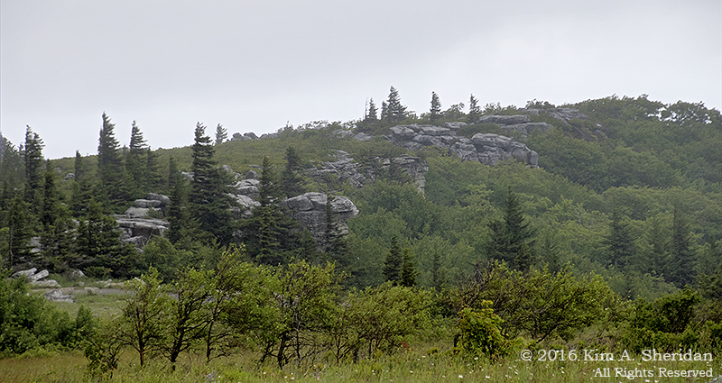
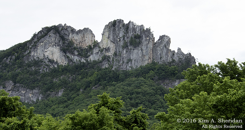
Our first destination? Seneca Rocks, in the Spruce Knob – Seneca Rocks National Recreation Area in Monongahela National Forest. Our goal? To scale the craggy cliffs known as Seneca Rocks.

OK, maybe not. The cliff faces are a popular draw for experienced rock climbers with the technical skill and gear to handle one of the 375 different climbing routes. We were here to ooh and ah over the cliffs from below, and walk the trail to an observation platform just short of the North Peak.

160703_WV Seneca Rocks_2447acs
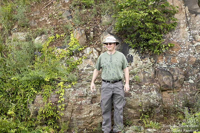
Don posing in front of Seneca Rocks. Do you think he realizes Robb isn’t pointing the camera at him?

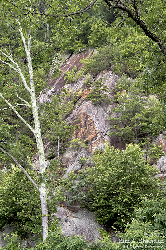
A Geological Diversion: The rocks at Blackwater Falls and many other places in the Potomac Highlands are sandstone, of the Tuscarora Formation. But Seneca Rocks are Tuscarora quartzite. Why?

     The sandstones of the area began forming over 500 million years ago. As mountains to the east were slowly eroded away, sand, silt and pebbles washed westward into a shallow sea that covered West Virginia at the time. The sediment settled and compacted into sandstone.

     About 275 million years ago, the collision of the continental plates forced the continental crust upward to form the Appalachian Mountains, and sandstone formations like Blackwater Falls were created. In some places, however, extreme pressure and heat caused the sandstone to change into quartzite, a metamorphic rock that is highly resistant to the weathering. Over time, softer stone eroded away to expose the “fin” or razorback ridge of Seneca Rocks.

160703_WV Seneca Rocks_2483acsIn the valley we stopped to admire the Sites Homestead, before crossing Seneca Creek.

160703_WV Seneca Rocks_2472acsWe also crossed the Potomac River. The North Fork of the South Branch of the Potomac River, to be exact.

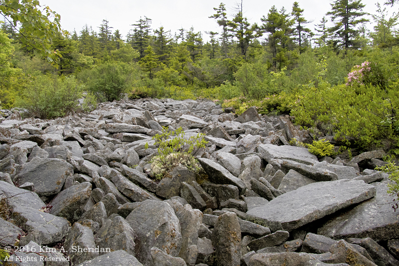
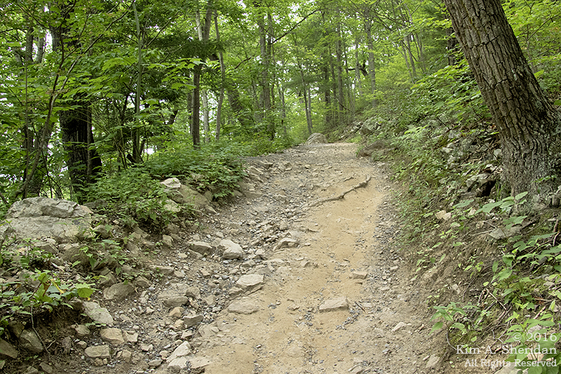
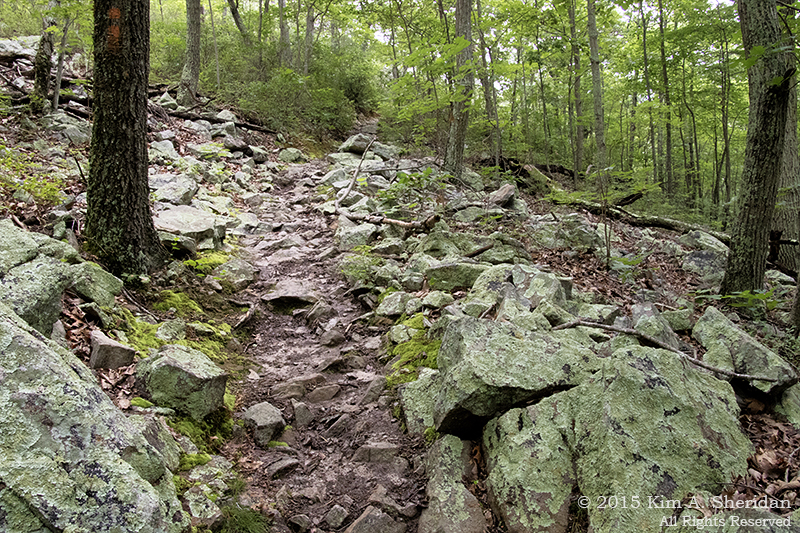
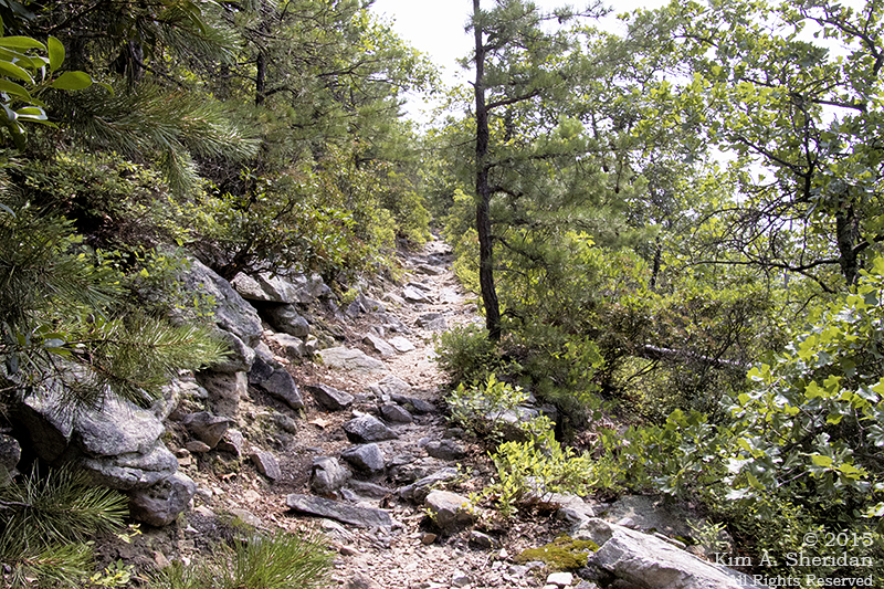
The trail gains 1000′ elevation in 1.5 miles through a series of steps and switchbacks. That’s pretty stiff. By my calculations, over a 12% grade. What fun!

160703_WV Seneca Rocks_2542acs
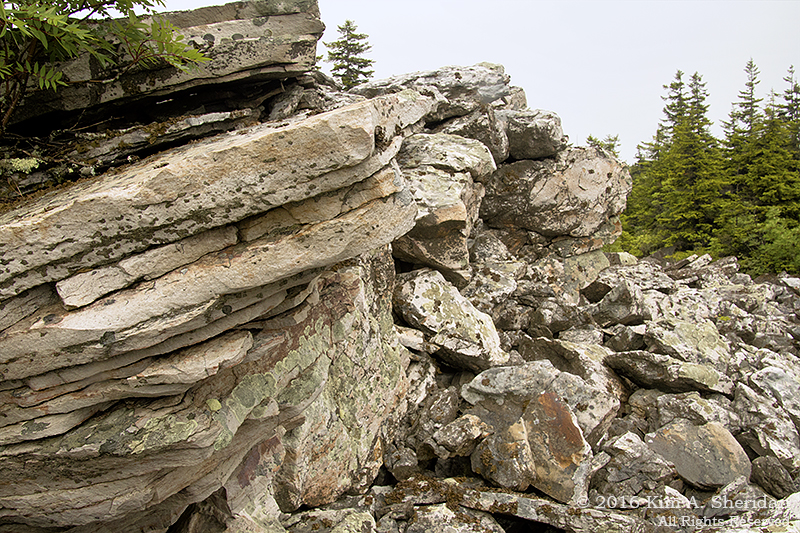
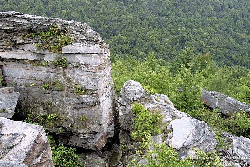
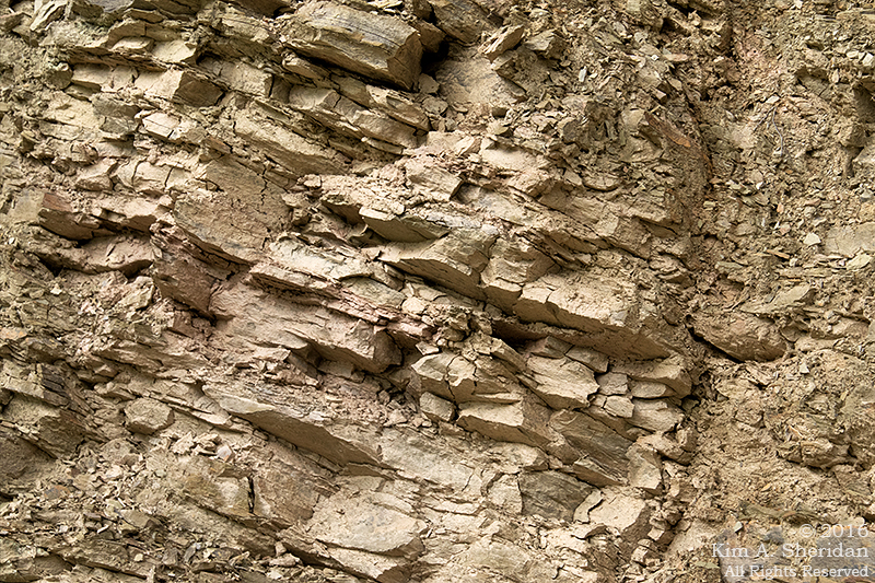
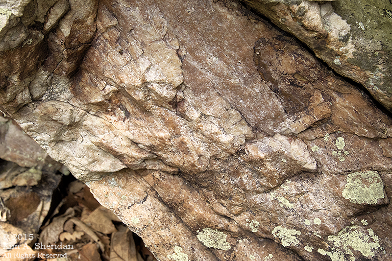
Along the way up we passed a wall of sandstone. No, this photo isn’t crooked. Millions of years of geological uplift have left these layers tilted just so.

160703_WV Seneca Rocks_2559acs
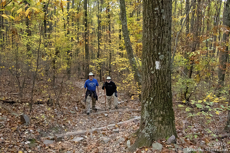
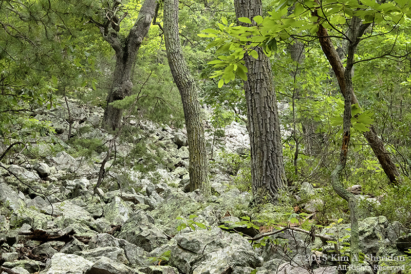
One of many switchbacks. This photo isn’t crooked either, the trees grow that way. Trees like striped maple, birch, beech and oak, and some pines near the summit. I tried to get the entire switchback in the photo, but couldn’t without falling off the mountain.

We heard birds, but didn’t see much wildlife. Perhaps because there were a lot of folks out for a relaxing Sunday stroll. Most of them made it to the top, despite some questionable wardrobe choices. A lot of dogs took the trek, too. Near the start we encountered one little fellow with very short legs that already seemed to be struggling. Darned if he didn’t make it all the way up and back!

160703_WV Seneca Rocks_2576acs
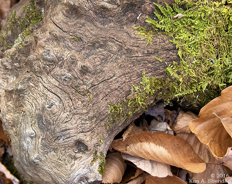
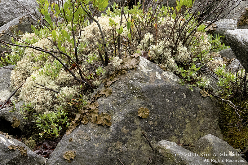
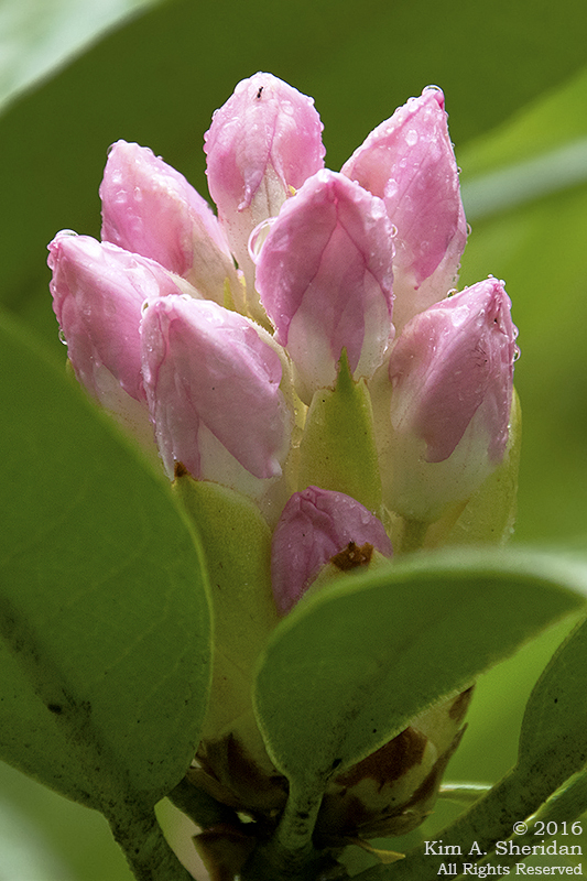
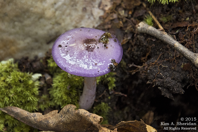
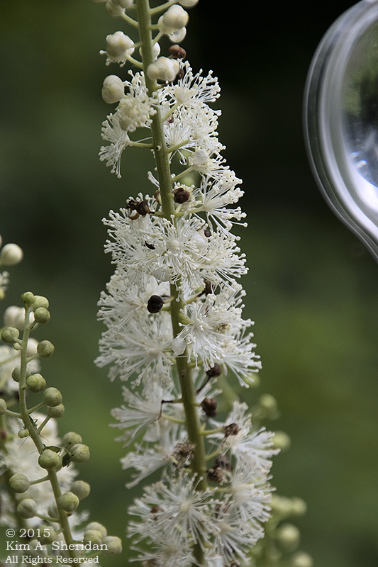
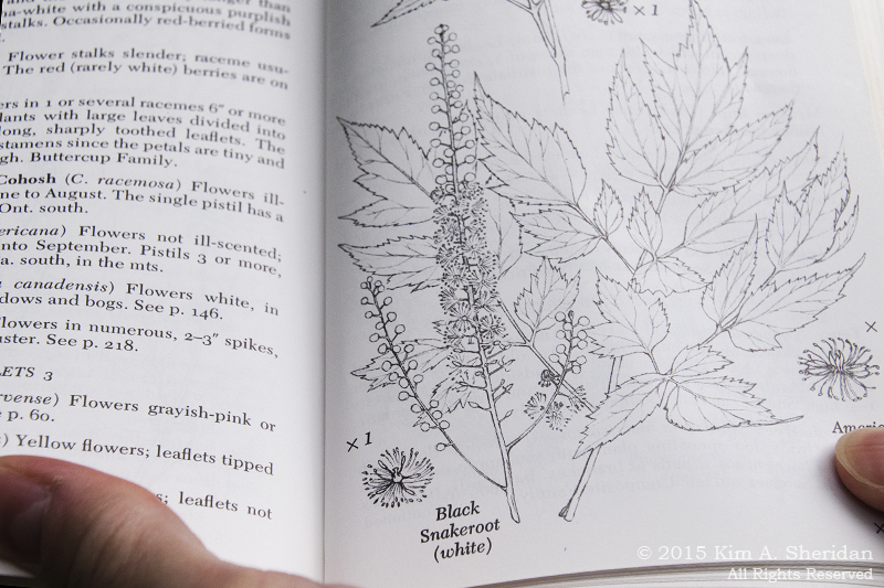
Mushroom. No, the photo isn’t crooked! Plants and rocks alike grow at odd angles on steep mountainsides. Lots of lichens and mosses covered the rocks, and there were ferns everywhere. Wood ferns, sensitive ferns, and – look, Don! Christmas ferns!

160703_WV Seneca Rocks_2601acs
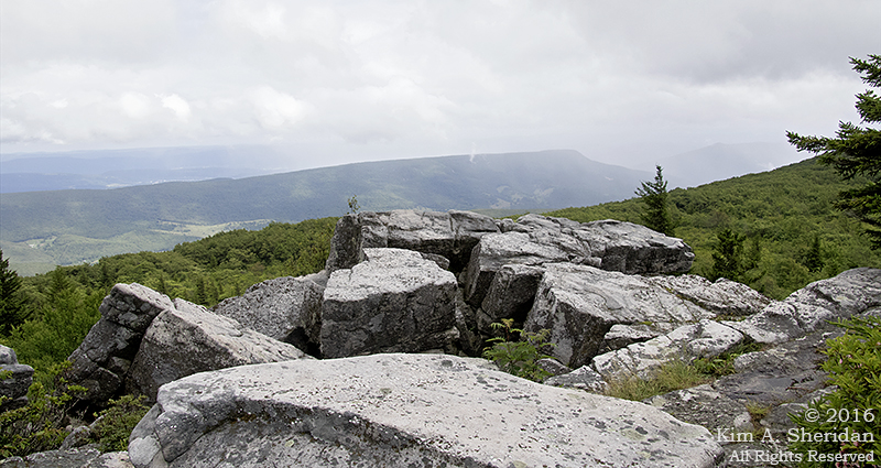
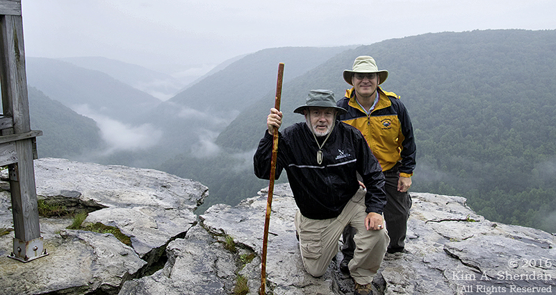
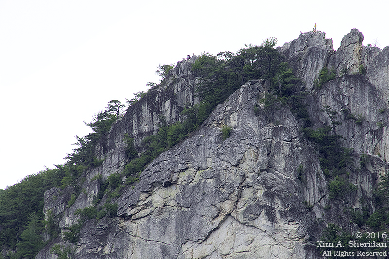
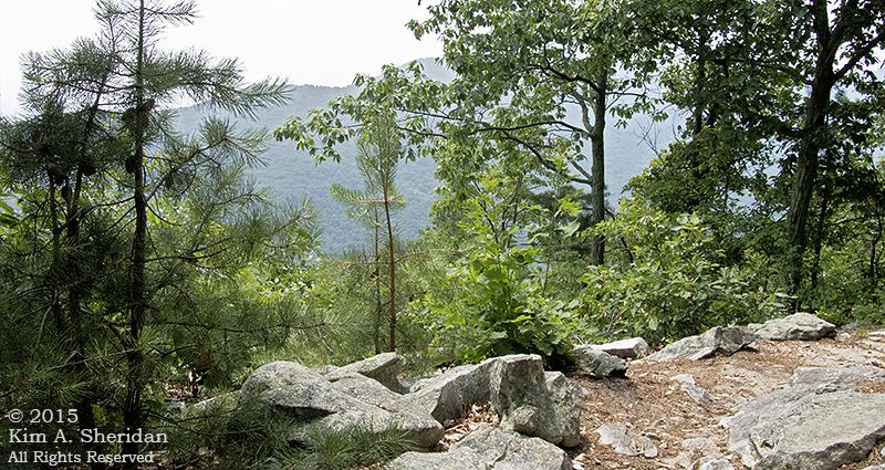
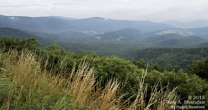
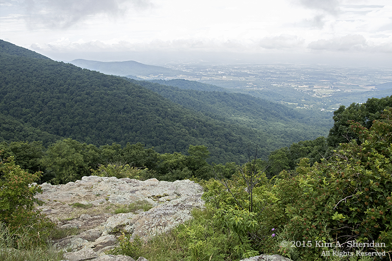
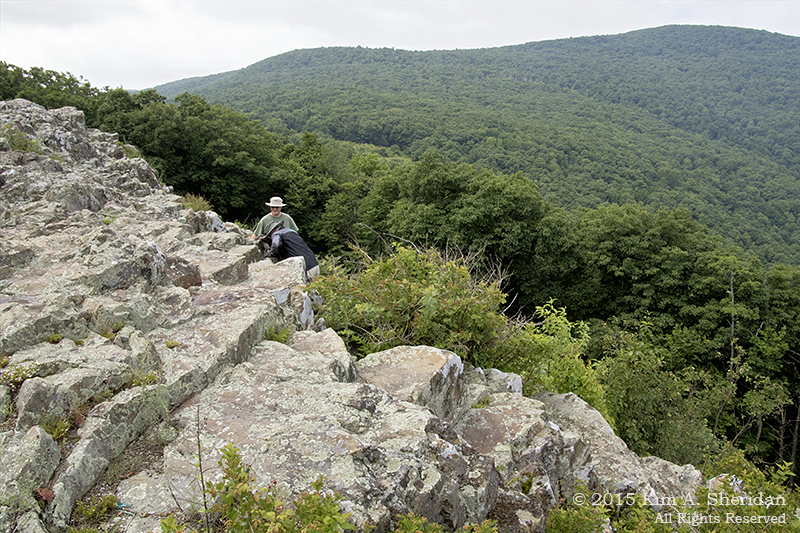
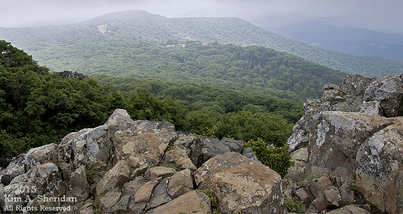
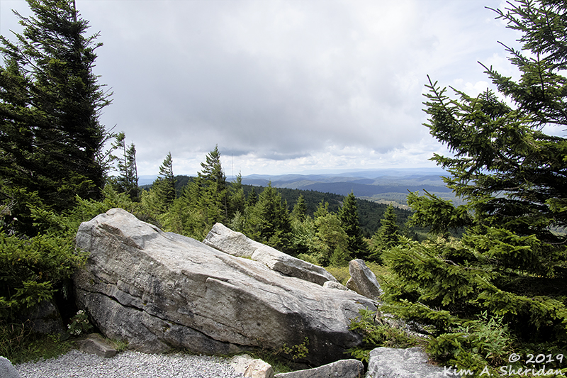
At last! The overlook. I was somehow expecting a close-up view of Seneca Rocks. Instead, the observation platform, perched on the cliff side just below the North Peak, offers a fine view of the valley below and the mountains beyond. Don, front and center.

160703_WV Seneca Rocks_2609acsWhile I rest and enjoy a little snack, why don’t you join Don and take in the view.

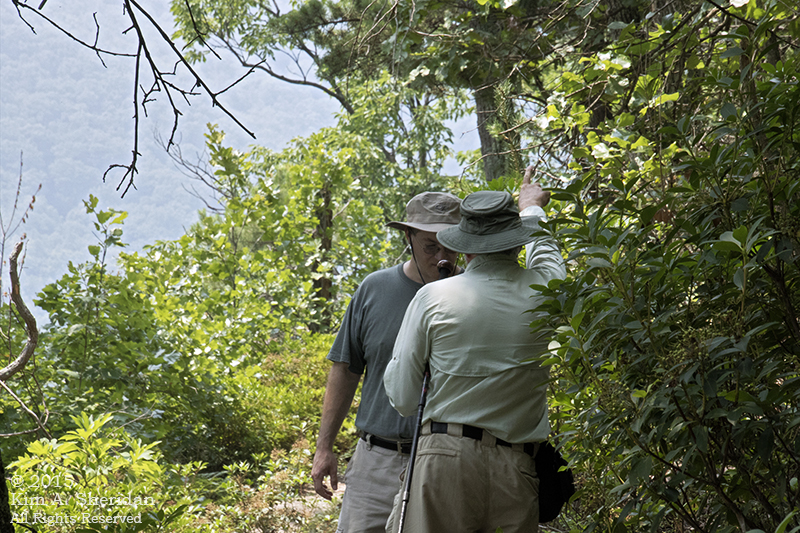
Wait a minute, where’s Robb?

160703_WV Seneca Rocks_2730acs
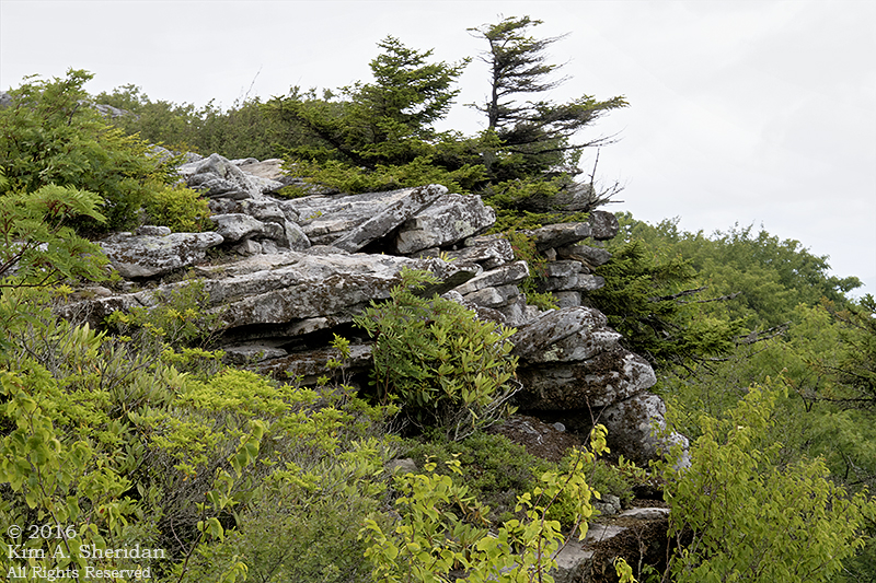
He’s climbed up the rocky trail toward the top of Seneca Rocks, right past the huge STOP! sign warning of death and disaster to all who go past it – which everyone is ignoring. This is the North Peak, accessible without climbing equipment. Just because you can, doesn’t mean you should.

Seneca Rocks_Panorama1acs
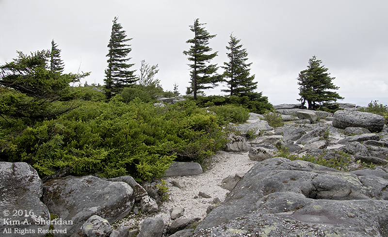
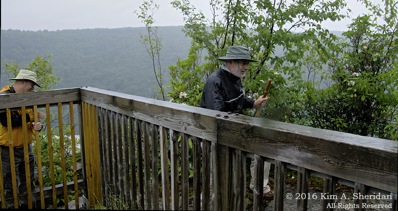
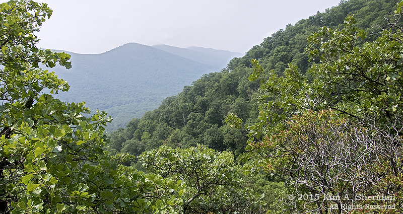
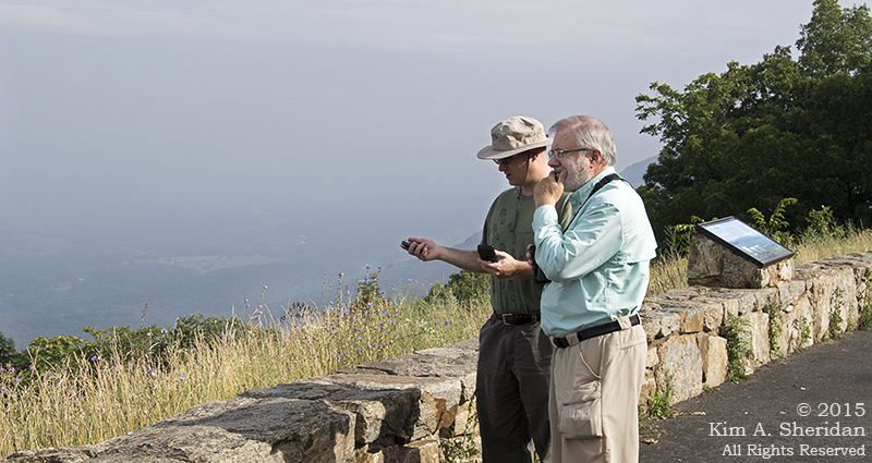
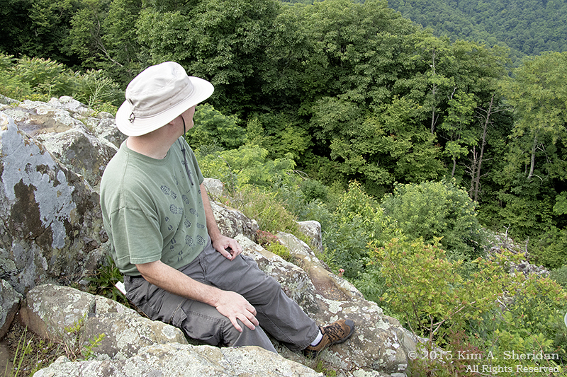
I want to go to the top, too! But just when I’m rejuvenated, Robb reappears, so we both head out onto the platform to enjoy the wonderful panorama. The pines on the right are Pinus pungens or Table Mountain pine, native to the Appalachian Mountains.

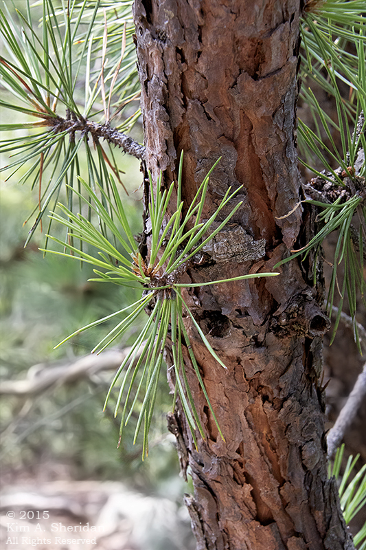
And what’s this? July Fourth weekend, at the top of a mountain; oh, it must be rain. Lovely.

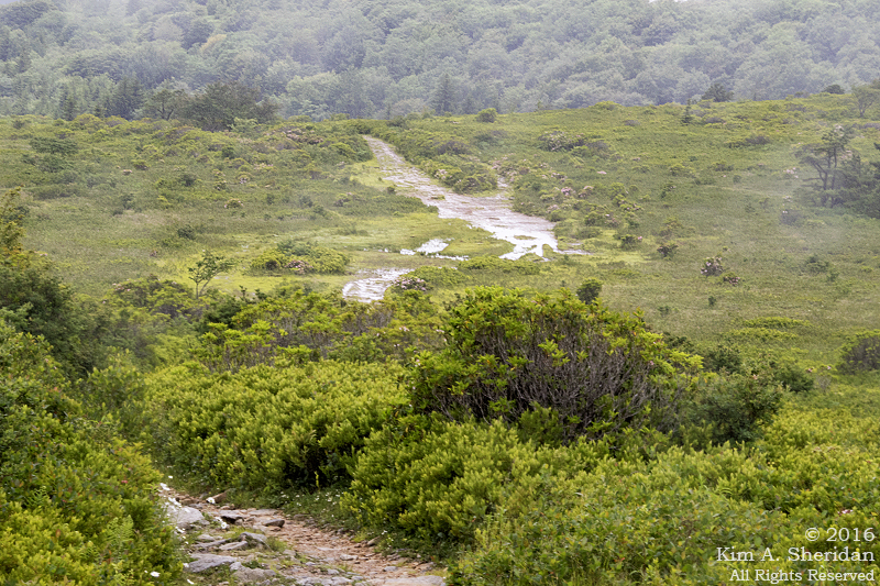
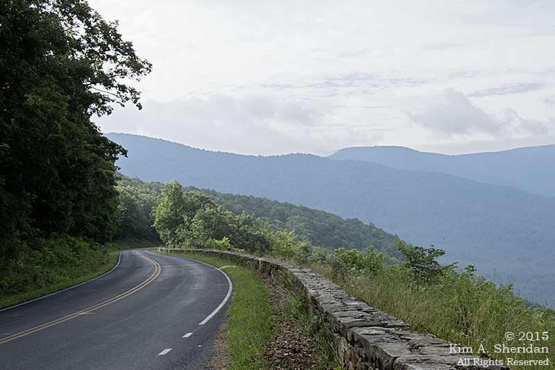
With that, we took our last look over the valley and headed downhill. Fortunately, we were spared a repeat of last year’s Stony Man deluge; the rain this day was light and intermittent. The descent was much easier than the climb, and faster, too. Leaving us with plenty of energy to explore the rocky banks of the Potomac River.

The North Fork of the South Branch of the Potomac River.

160703_WV Seneca Rocks_2651acsA little way upstream, Seneca Creek flows into the river. Don and Robb decided to continue up the creek bed to the bridge, where I would meet them after retracing my steps along the trail.

Except when I got there, they were nowhere to be found, on the bridge or on the creek. I walked back to the Discovery Center in search of both the guys and a signal for my cell phone, and soon ran into Robb. Who claimed that they were RIGHT THERE on the creek bed, had SEEN me on the bridge, and SHOUTED at me repeatedly to no avail.

But I know I didn’t see them down on the creek. Couldn’t have been that I was looking the wrong way, could it? Nope, not me!

160703_WV Seneca Rocks_2703
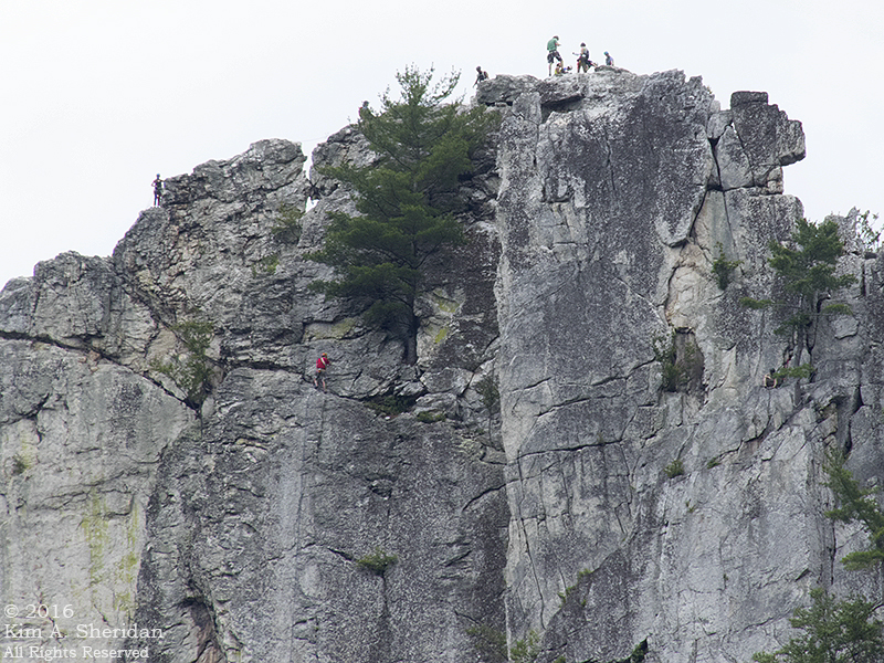
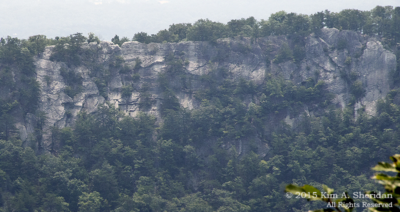
This is the South Peak of Seneca Rocks. Here we find the serious rock climbers doing the serious work of playing on cliff faces. How many climbers do you see? Seven (or more) on the top. Two on the face. Don’t see the second one? He’s at the right edge of the photo, resting in the shade of a tree. Maybe enjoying a good book.

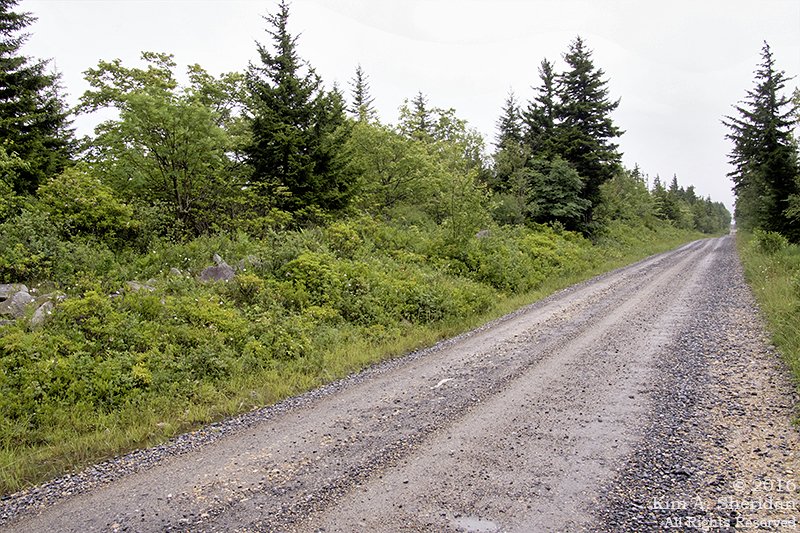
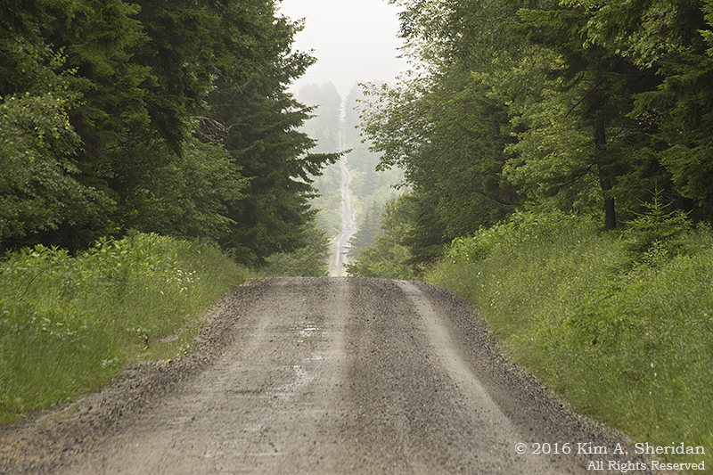
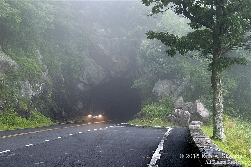
Our plan had been to push on south to Spruce Knob, at 4,863 feet the highest point in West Virginia. When we passed the turnoff for Seneca Caverns, and the sign promised a restaurant, our hunger got the better of us and we changed plans. Happens all the time; besides, it was raining.

160703_WV Seneca Cavern_151809acsWe enjoyed the 45-minute tour through the cavern. It was considerably larger than either of the two Pennsylvania caverns we have been to.

Some of the rooms seemed to soar upward forever.

Then we came to some low, narrow passages that required yoga to weave through.

We never had to wear hard hats in a cavern before, but we were soon grateful for them. The trip leader’s talk was frequently punctuated by a plastic BONK! as one or another of the visitors hit their head on the low ceilings.

We finally emerged from the depths, to more rain and an hour’s drive to our snug cabin in Blackwater Falls.

160703_WV Seneca Rocks_2712acsTo plan for the morrow, and reflect on the highs and lows of a grand day in West Virginia.

Almost Heaven: Falling for West Virginia

160703_WV Seneca Cavern_154328acs

Country roads

Take me home…

Country roads feel like home, for that is where the journeys take place.

Journeys down sandy byways, through pines and marsh grass, to tea-colored rivers and salty bay beaches. Journeys down arrow-straight red dirt tracks, past wooden barns and fertile fields, to high dunes along crystalline lakes. Journeys down twisty two-lane roads, around hilly curves, to cliffs, meadows and waterfalls.

This Independence Day, those country roads took us home to the Appalachian Mountains. Home to a luxurious (and affordable!) cabin in Blackwater Falls State Park in West Virginia. By day, Robb, Don and I explored the Potomac Highlands region, a land of steeply folded mountain ridges, deep gorges and broad valleys.

160702_WV Blackwater State Park_151107CellacsAfter checking into our cushy cabin, acquiring some vittles, and enjoying a yummy buffet at Blackwater Falls Lodge, we took our first look at Blackwater Canyon, 500 feet below. From on high, the Blackwater River is a pale ribbon woven through an undulating blanket of green.

Up close, the forest resolves to trees of Eastern hemlock and red spruce, American beech and striped maple. Bracken ferns carpet the forest floor, alongside dense thickets of rhododendrons.

160704_WV Blackwater Falls_2822acs

Conservation Piece: We saw lush stands of Eastern Hemlock all over the higher elevations of the Potomac Highlands, which top out over 4,000’. It’s hard to imagine the mountains without this beautiful tree. Yet the hemlocks are besieged by an invader from Asia, the hemlock woolly adelgid (ah-DEL-jid.) These sap-sucking insects appear as small white clumps on the twigs and needles and pose a serious threat to Eastern hemlocks throughout the Appalachians.

Not one day in the park could pass without a visit to Blackwater Falls. The trail is a wooden walkway interspersed with strategically placed landings amid more than 200 steps. At the bottom is a long boardwalk with an overlook near the base of the falls.

160704_WV Blackwater Falls_2778acsWe could see glimpses of the falls through the trees as we descended. We could hear the falls even before we got to the trail.

160704_WV Blackwater Falls_2751acsThe classic tableau of Blackwater Falls.

160704_WV Blackwater Falls_2768acsLooking at the Falls in this orientation begins to give an idea of their size. The main drop is 57 feet.

What isn’t conveyed is a feel for the depth of the gorge through which the Blackwater River runs.

Or the force of the water. I asked Don, who’s been to Blackwater Falls a few times, how this stacked up in terms of relative water flow.

He said that this was one of the highest flows he’s witnessed at the falls, though he’d seen it higher.

A photograph can’t convey the other sensory delights of Blackwater Falls: the scent of hemlock, spruce and rich wet earth; the feel of mist blowing back from the falls; the roar of water plunging over the ledges.

Except…my camera takes videos. I rarely remember this feature, but I did this time. Click here for a 20-second video of Blackwater Falls and be sure the audio is turned up!

By the way, all of these photos were taken, not on our first night in the park, but the morning of July Fourth, two days later, while my traveling companions were still in dreamland. Tee-hee – I had the falls to myself. Heaven!

160704_WV Blackwater Falls_2809acsAbove the Falls is a 40-foot cliff of sandstone, a sedimentary rock composed of quartz and sand. We saw a lot of sandstone in the gorge and throughout the Highlands.

160704_WV Blackwater Falls_2756acsThe most prominent ledge of the Falls. A lofty pulpit draped with satin vestments and backed by a rhododendron choir. Say “Hallelujah!” and pay attention to the preacher – there will be a quiz later.

160704_WV Blackwater Falls_2783acs

The baptismal font runneth over.

The Blackwater River gets its dark tea-color – and its name –  from tannins in the soil of the hemlock and spruce woods and marshes through which it passes. Much like the rivers of the Pine Barrens are tea-colored from pine tannins. The similarities between the Pinelands and upper elevation habitats in Appalachia never ceases to amaze me.

160704_WV Blackwater Falls_2765acsAbove the falls, water cascades down a cockeyed staircase.

160704_WV Blackwater Falls_2811acsThe river below the Falls threads through a jumble of sharp sandstone boulders under verdant tree boughs.

160704_WV Blackwater Falls_2773acsLong after the trees are gone…

and the rocks tumbled to sand…

the mountains will endure…

yielding but ever so slowly to dark water’s caress beneath the bridges of time.

160704_WV Blackwater Falls_2789acs

Life is old there, older than the trees

Younger than the mountains, growin’ like a breeze

Country Roads…

Where will you take us next?

Lyrics to “Country Roads” by John Denver, et al.


On The Massanutten

150705_VA Massanutten_0708acsOn Skyline Drive, in all but the deepest fog, there is no missing the Massanutten. How can you overlook a 50 mile long mountain that runs through the heart of the Shenandoah Valley? It’s so big it has its own valley, for gosh sakes!

Signal Knob, Massanutten’s northern peak, has long held a fascination for my friends and me. So, naturally, we wanted to climb to the top of it.

5 miles each way? 2700 feet of elevation gain?

What could go wrong?

150705_VA Massanutten_0799aAt first, the narrow Signal Knob trail climbed gently along a small run through deep moist woods. Ferns, mosses and shrubs adorned the understory. We passed on old building and then a spring. Beyond that the trail turned sharply and began to climb steeply.

150705_VA Massanutten_0774acsJust past the spring I found a purple mushroom. Purple!

150705_VA Massanutten_0800acsThe forest became drier as we climbed higher, and we started seeing talus slopes to the left. Talus, or scree, is an accumulation of broken rock and boulders that have crumbled, and then tumbled, from cliffs higher on the mountain. The lichens that cover the rocks give them their greenish tint.

150705_VA Massanutten_1011acsThe trees thinned to the right and we began to get views across a valley to another slope. An argument ensued between Don, who was certain we were hiking on the west arm of the Massanutten and looking at the east arm, and Robb, who was certain he knew where north was and that Don had it backwards. This argument continued for most of the walk, and I am not certain it ever got cleared up satisfactorily.

Because they weren’t listening to me. I suggested that we were hiking on the east arm of the Massanutten, and looking across a small valley at another ridge on the same east arm, in the opposite direction of the other arm of the mountain. Guess who was right?

You got it. But does anyone ever listen to me? Nope, no one ever listens to me.

150705_VA Massanutten_0992acsArguments (temporarily) shelved, we continued up the trail. Soon the habitat got seriously weird.

150705_VA Massanutten_0853acsThe first hint was the presence of low-bush blueberry.

150705_VA Massanutten_0990aFollowed by black jack oak. Mountain laurel. Sand on the trail.

150705_VA Massanutten_0987acsPines with three needles, and – oh look! Needles growing out of the trunk. Pitch pines!

Wait, did we take a wrong turn? How did we end up in the New Jersey Pine Barrens?

We didn’t, of course. In this part of the Appalachians, dry southwest-facing slopes with poor sandy soil support many of the same trees and plants we see in the Pine Barrens.

The similarity in flora to the Pinelands fascinated us for the rest of the hike.

150705_VA Massanutten_0856acsHere’s one of the rare rocks that wasn’t covered in lichen and moss. The weathering of the quartz-rich stone here was the source of the sand under our feet.

150705_VA Massanutten_0893acsThere were lots of rock formations along the way, one of which Robb just had to climb…

150705_VA Massanutten_0931acs1Don just had to follow…

and then me too, because it was such a nice cool place to rest.

Then I just had to take their picture.

150705_VA Massanutten_1034acsA short time later we reached the Buzzard Rock Overlook. That’s “Overlook.” I thought we were standing on Buzzard Rock, and was unimpressed.

150705_VA Massanutten_1047acsThen I learned we were looking across the valley at Buzzard Rock, which was a dramatic rock formation on the other side of the Passage Creek valley.

At this point we had been hiking for 2½ hours but had covered only 1½ miles of the 5 miles to Signal Knob. The trail from there only gets steeper and rockier. By now, any thought Don had of getting to Signal Knob had vanished, and we all agreed Buzzard Rock Overlook was enough. Besides, it was time for lunch.

With that, we turned around and walked down the way we had come up. A 10 mile hike to Signal Knob turned into a 3 mile walk to Buzzard Rock Overlook. Don claimed that was the plan all along. Conquer the Massanutten?

150705_VA Massanutten_1004acsMaybe we gentled it a little.

No matter. We’d scrambled over rocks, argued over directions, puzzled over trees and shrubs, exclaimed over magic mushrooms, marveled over views. In the end, we’d gained something far more awesome than we’d bargained for, an intimate experience with a massive mountain.

All in a day on the Massanutten.

Oh, Shenandoah! (Reprise)

150704_VA Shenandoah National Park_0514acsIndependence Day, 2015. The day Don and I returned to the scene of the crime. The offense? Visiting a National Treasure without Robb. This Fourth of July we were to serve the term of our punishment.

Three months after we left Shenandoah National Park, we returned for a weekend, this time with Robb in tow. A chance for Don and I to introduce him to the wonders of Skyline Drive.

150704_VA Shenandoah National Park_0485 aWhat a change in the landscape! When we left in April, the mountainsides were mostly brown with tinges of the lime green of new spring growth. Now all is lush dark green.

150704_VA Shenandoah National Park_0400 acsWith plans to hike to up The Massanutten toward Signal Knob the next day, Robb and Don took the opportunity to take a compass heading and puzzle over the proper approach.

150704_VA Shenandoah National Park_0423 acsRobb on one of the rock faces that line parts of the east side of Skyline Drive. Now who’s doing the hard time?

150704_VA Shenandoah National Park_0551acsWith all these vast mountain vistas and valley views in a new environment, what’s Robb looking at? Plants, of course.

There’s this one spiky flower we kept seeing along the roadsides as we were driving.

We couldn’t identify it on the move, but it was never present at the overlooks.

Finally Robb and I walked back along the road to take a closer look.

150704_VA Shenandoah National Park_0559acsArmed with a hand lens and Newcomb’s Wildflower Guide, we were able to identify it as Cimicifuga racemes, commonly called Black Snakeroot or Black Cohosh. Mystery solved!

150704_VA Shenandoah National Park_0616acsA tree and granite vignette.

150704_VA Shenandoah National Park_0585acsHeadlights appear from the mist. Shenandoah’s only tunnel bores 670 feet through the granite of Marys Rock. Fog along the Skyline Drive. How – familiar.

150704_VA Shenandoah National Park_0619acsFranklin Cliffs never ceases to delight. I could spend the whole day here, clambering around on the rocks. Who says crime doesn’t pay?

150704_VA Shenandoah National Park_0647acsMan vs. mountain. From the looks of it, the mountain won.

150704_VA Shenandoah National Park_0686acsAlways an argument with these two.

150704_VA Shenandoah National Park_0628acsCedar Waxwing, wearing a robber’s mask.

150704_VA Shenandoah National Park_0548acs copyColumbine.

Robb and I had wanted to walk to a waterfall. Small problem – the crowds. It was the Fourth of July in one of America’s most popular National Parks, after all.

We opted instead to take the hike to the top of Stony Man, knowing Robb would love scrambling around on the boulders.


150704_VA Shenandoah National Park_0690acsExcept that those boulders were covered with people. On the horizon, ominous dark clouds were quickly swallowing the views. And as we turned to leave, the skies opened up.

Oh great. Thunder and lightning. And there were Don and I on the second highest peak in Shenandoah, clutching metal trekking poles. Cruel and unusual punishment.

The rain was relentless, and we were walking downhill in a rushing streambed that used to be a trail. Oddly, I was thoroughly enjoying it. I’d not been feeling well that day, but the rain was cooling and rejuvenating. Even when I had to pour it out of my “waterproof” boots at trail’s end.

As we reached our car, the rains stopped. But of course. By the time we returned to Skyland Resort for a brief stop, the skies were clearing and the sun was coming out. The mountain air had a delicious washed-clean feel to it.

Later, in a nondescript hotel room, a different kind of washing took place. Don used a hair dryer on his cash, blowing dry each individual paper bill. Money laundering at its most elemental.

Same scenery, different crime.

150704_VA Shenandoah National Park_0666aRobb relishing the view from Franklin Cliffs, while Don and I served out our sentence for neglecting him, with no time off for good behavior.

If spending a day in Shenandoah National Park is “punishment”, I’m going to have to be very, very naughty.