 One of the fun parts about a trip to West Virginia is driving the country roads. Winding, twisty mountain roads through farmland and forests. There are roadside attractions aplenty, from the historic to the quirky. Adventures and misadventures abound. Continue reading
Category Archives: West Virginia
Almost Heaven: In the Land of Canaan
 West Virginia is full of surprises. Take the Canaan Valley for instance. In a land of densely forested mountains, who would expect a bowl-shaped valley that, at 3200’ in elevation, is the highest large valley east of the Rockies? And who would expect that valley to hold such rich and extensive wetlands, with a climate and flora more typical of Maine and Canada? Continue reading
Almost Heaven: Life On the Forest Floor
 Magnificent vistas and majestic trees abound in West Virginia. Down every country road lie mountains, farms and forests that fill the eye and viewfinder with grand lush life. Raptors soar overhead, while bears, bobcats and foxes lurk around every bend.
But no more than a bear can pass up a blueberry bush could I ignore the small treasures encountered on the trails. It’s just who I am, a champion of the small and overlooked.
There’s a lot of life on the forest floor. Continue reading
Almost Heaven: Sunday Services at the Cathedral of the Hemlocks
 Welcome, Friend, to the Cathedral of the Hemlocks. Walk quietly up the aisle and join us for our Sunday Service. Continue reading
Almost Heaven: A Spruce Knob Point of View
 “Always leave them wanting more.”
I have yet to take a trip where I got enough of the place in one visit, where I didn’t immediately want to go back. For many places, like the Smoky Mountains and the Adirondacks, once may have to be enough. Other locales, a little closer to home, can be visited again and again.
Like Blackwater Falls State Park. You may recall the last trip my friends and I took to the Potomac Highlands region three summers ago. Seneca Rocks & Cavern. Lindy Point. Dolly Sods.
The list of things we didn’t see during that trip was even longer: Spruce Knob. Cathedral State Park. Canaan Valley NWR. Bears. More of Dolly Sods. (One can never get enough of Dolly Sods.)
Clearly, a return trip was in order. And so, on Labor Day weekend 2018, we went home to the mountains of the West Virginia. Continue reading
Almost Heaven: Bear Rocks and Bogs
 We came to the end of the road – and found a trail.
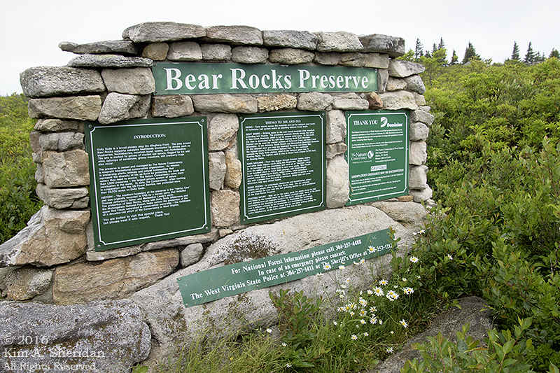
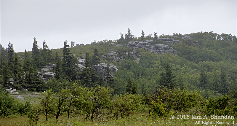 To the north of the Dolly Sods Wilderness Area in West Virginia lies Bear Rocks, a spectacular outcropping of white sandstone and quartz perched on the Allegheny Front. The rocks are surrounded by the 477-acre Bear Rocks Preserve, owned by the Nature Conservancy, which has been instrumental in preserving and protecting land in the Dolly Sods. After touring Dolly Sods by car, Robb, Don and I were eager to get out and explore on foot, stretch our legs a little.
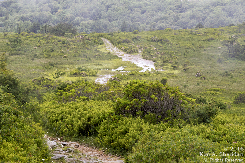 A view of the Bear Rocks trail. No, that’s not a creek, it’s a trail. A very wet trail. After a lot of puddle-jumping, we turned back. The trail doesn’t go to Bear Rocks, which is what we were interested in. So we followed a cobweb of informal trails through the heath barrens to the ridge.
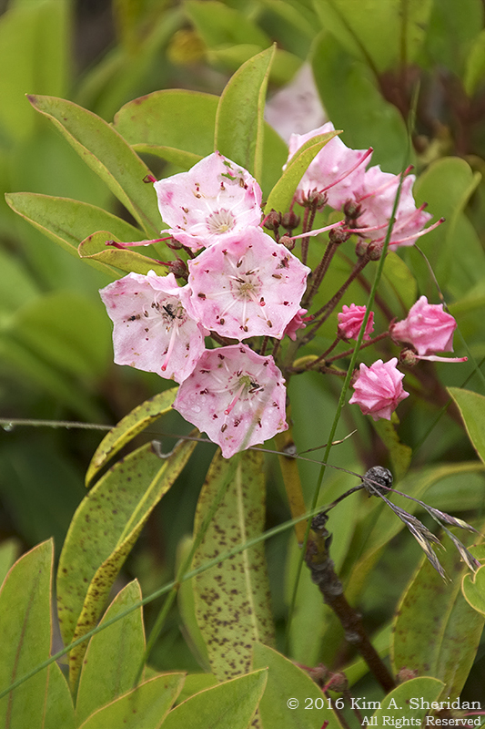 I’ve been using the word “heath” a lot. What is it?
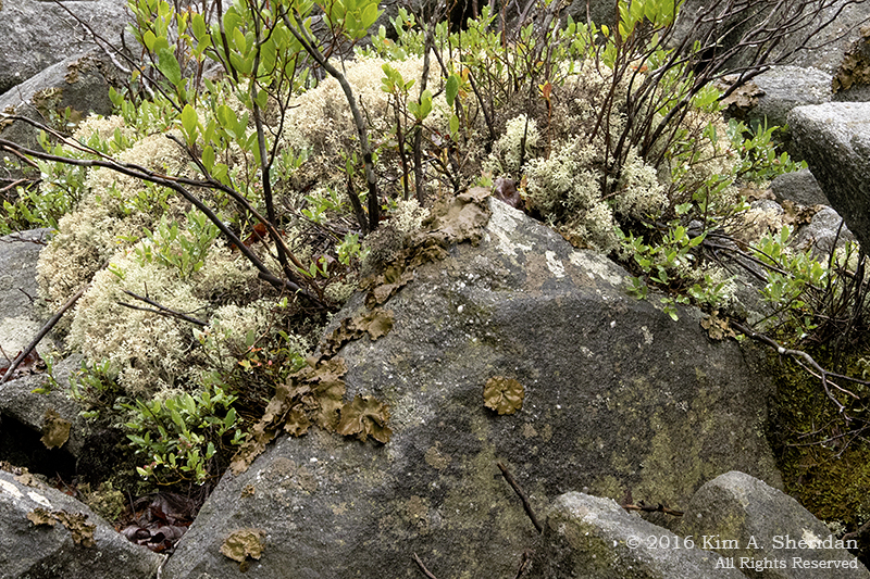
“Heaths” are a family of acid-tolerant, low-growing plants. Huckleberry, blueberry, sheep and mountain laurel (left), rhododendron, tea berry, bear oak.
All of these plants are old friends of ours from the low-lying but acidic NJ Pine Barrens. Time and again, we find them in the higher elevations of the Appalachians.
Here they inhabit tundra-like meadows known locally as “huckleberry plains.”
 Flagged red spruce trees on Bear Rocks.
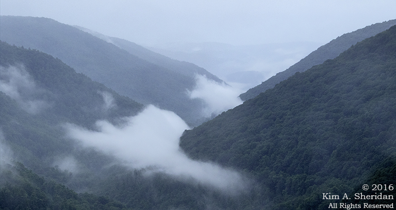
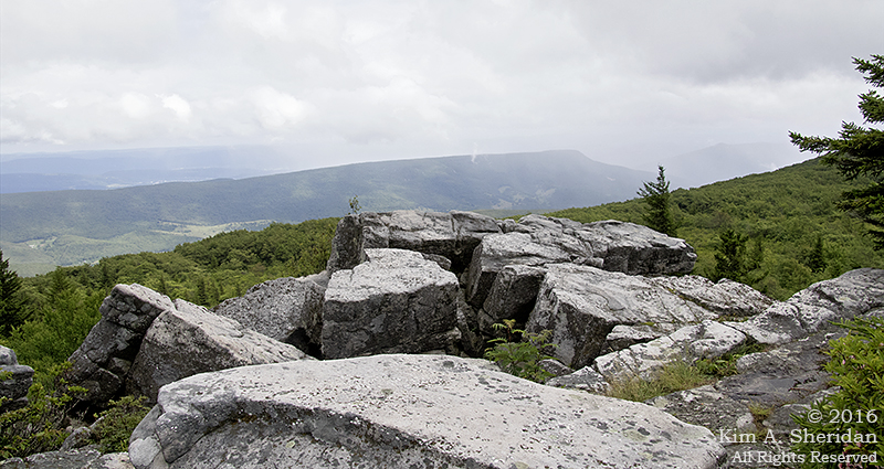 The view east from the ridge. The Allegheny Front drops 2000’ here to the valley of the South Branch of the Potomac River. Rumor has it that on a clear day, a visitor can see seven mountain ridges, and on the clearest days, Hawksbill and Stony Man peaks in Shenandoah National Park. This wasn’t a clear day. I still can count four ridgelines.
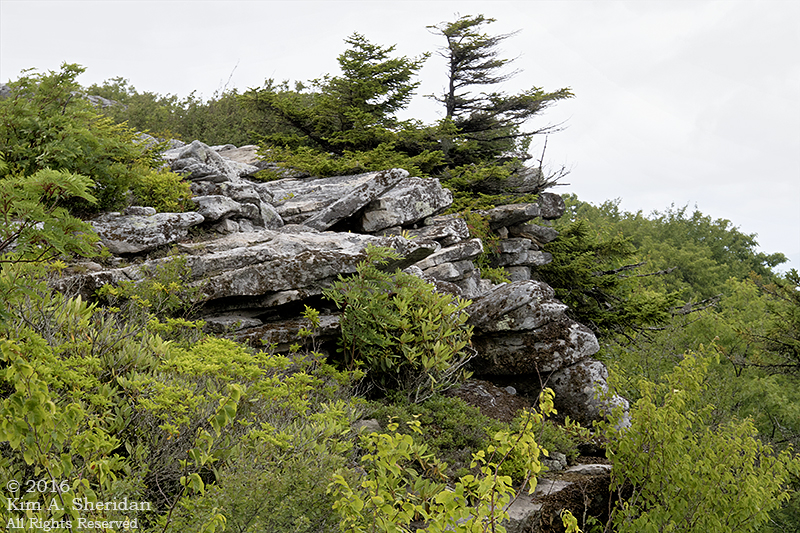 Rocks, rhododendron and red spruce.
We had a lot of fun clambering all over Bear Rocks. Finding our way back through the heath to the main trail was a little challenging. We were glad the plants were so short that we could see right over them.
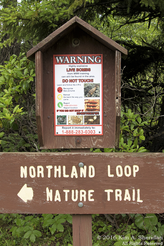 On the way back through Dolly Sods, we had time for one more stop, the interpretive Northland Loop Nature Trail. Lots of different ecosystems on one short trail.
Also a stern warning about unexploded ordnance. The Dolly Sods was a training area during World War II.
We managed to survive the walk with all limbs intact.
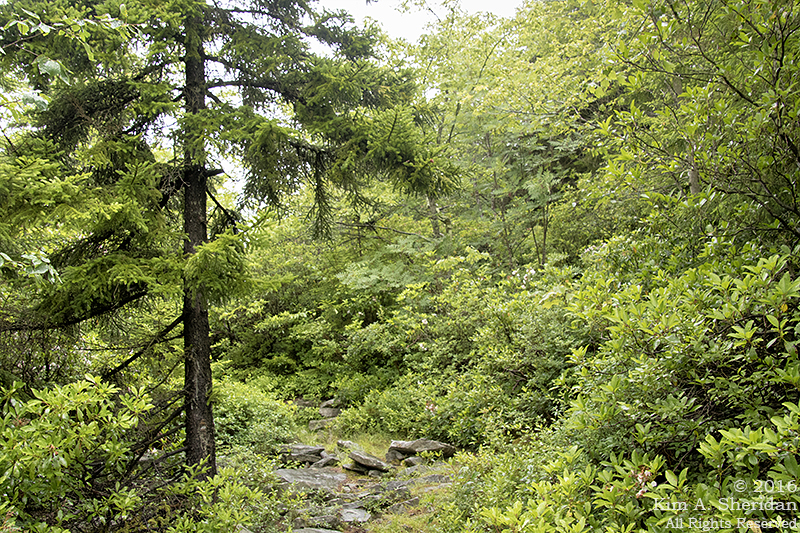 The trail started through a typical forest of red spruce and rhododendrons.
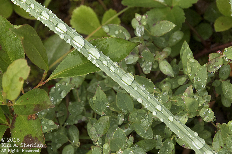 It was raining, still, which gave me some nice water droplets to play with.
 Except for a few unidentified birds, this was the only wildlife we saw in Dolly Sods. No deer, no chipmunks, NO BEARS. Somehow that absence made this snail all the more welcome.
 The highlight of the Northland Loop is Alder Run Bog, a large northern peat bog. Bogs are waterlogged ecosystems where the plants actually grow on the surface of the water. They are unusual at high altitudes, but not in Dolly Sods.
The margins of Alder Run Bog are populated by spruce trees, heaths, sedges and ferns. A boardwalk leads out into the bog, which is covered in sphagnum moss and…
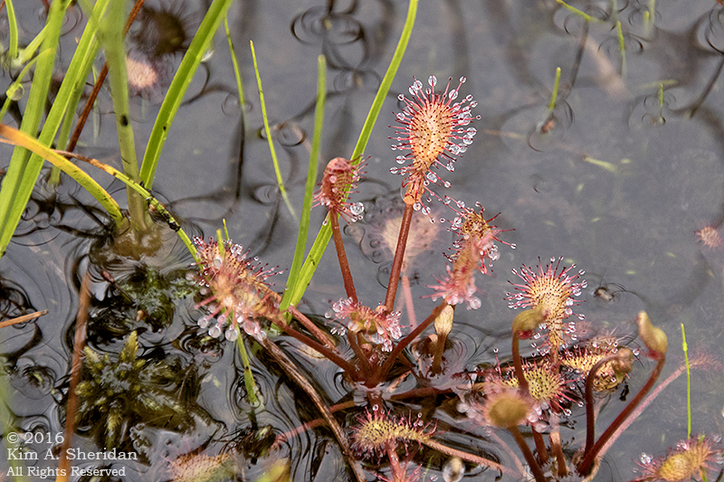 Sundews! This is a much-loved carnivorous plant we see sometimes in the Pine Barrens. We were unprepared for the vastness of the sundew stands here in Alder Run Bog.
FUN FACT: No more than a couple of inches high, these tiny plants attract insects with a sweet secretion, than trap them with the sticky mucilage of their moveable tentacles. The prey dies of exhaustion or asphyxiation, whereupon the plant digests it. Charming, aren’t they?
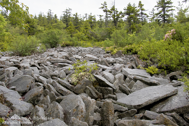 Back through the forest, we came upon a river of rocks.
 Among the rocks we found some white reindeer moss. Not a moss but a lichen, it’s common in the Pine Barrens, just like sphagnum moss and sundews. The similarities between the plant life of the Pinelands and that of high-altitude acidic Appalachian ecosystems continues to amaze us.
 The road home. We had a wonderful day exploring Dolly Sods, despite the mist and rain. But our time in West Virginia was drawing to a close.
While doing some research for these posts, I have seen many images of Dolly Sods and Bear Rocks unlike any of mine. Photos of clear blue skies, mountain ranges rolling off into the distance, meadows abloom with flowers, heaths ablaze in autumnal reds and golds. Something to aspire to, I guess. Something for a return visit (or two!) to West Virginia. I could spend several days right here in Dolly Sods.
Maybe I’d even see a bear…
Almost Heaven: Hello, Dolly!
 Dolly Sods.
The name conjures a magical image in my mind: a rugged, windswept summit of jagged sandstone boulders ablaze with crimson heath. Sometime long ago, I saw photographs of this place, and I vowed that, should the chance ever arise, I would go to see it for myself. I’m not sure I even knew where it was, only that I was captivated.
Well, I know where Dolly Sods is now! I am still captivated, all the more so for having been there. It was both like and unlike the images in my mind. Though the Sods wore a deep summer green rather than the reds and auburns of fall, the landscape was indeed rocky and immense, wild and windswept.
My companions and I spent our last full day in West Virginia exploring Dolly Sods. True to form, it rained lightly most of the day, with a few heavier showers. Our original plan was to park at the picnic area – home to the shortest rustic toilet I have ever encountered – and walk a loop in the southern portion of the Dolly Sods Wilderness.
 Plans change quickly. The southern end of the Sods is a dense cove forest along the Red Creek drainage. We’d seen plenty of forest, and were itching to see the heath barrens, bogs and sods we had heard about, and the stunted trees Don remembered from a previous visit. So our walking tour was abandoned in favor of driving north, deeper into the Sods.
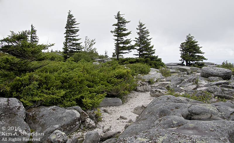
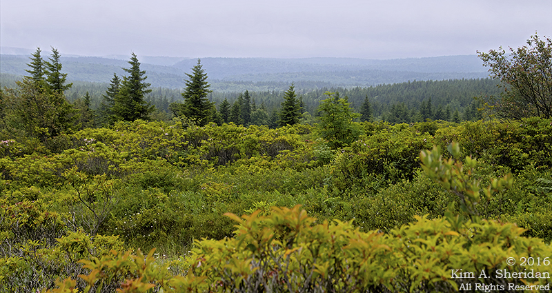
 We hadn’t driven far before the forest opened up to a heath layer with scattered small trees. Everywhere, boulders beckoned. We haven’t met a rock yet that we could resist.
The greater Dolly Sods area spreads over 32,000 acres in northeastern West Virginia, and includes a federal Wilderness Area of 17,371 acres, as well as a Nature Conservancy preserve known as Bear Rocks.
Where does the name “Dolly Sods” come from? A year ago, Don and I encountered the Smoky Mountain high elevation meadows known as “balds.” Here in West Virginia, this type of mountaintop meadow is known as a “sod”.
“Dahle” was a German family that lived in the area in the 1700s; the place name was changed to “Dolly” by the locals some time later, and originally described a small mountaintop meadow near the present day picnic area (top photograph.)
 “Someday, all this shall be yours, my son.”
 Beyond the spruce trees, a grassy hilltop meadow. A sod.
 A little further north, we found more impressive boulders to play around on. Robb went gamboling over them like a gazelle, Don following along in his wake. See that crack? Somehow I found myself in it up to my knee. Don’t know how that happened. (Grateful to come home with bruises, and not a plaster cast!)
Rock scrambling is not without its risks, especially on a rainy day.
 The boulders are sandstone, much of it white. Streaks of deep rosy pink caught my eye. The lichens adorning the rocks were impressive in both their variety and sheer number. From a distance they give the rocks a salt and pepper appearance.
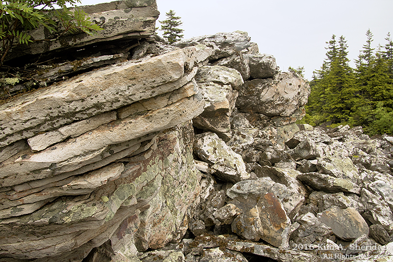 Equally impressive was the variety of rock formations. We marveled over the angle and the layered nature of the sandstone.
 A few miles down the road we began to see the one-side trees Don remembered. These are called “flagged” trees; strong prevailing west winds encourage the red spruces to grow only on the eastern side. Weather in Dolly Sods is harsh, and changes rapidly. Daily temperature variation can be extreme. Mist, rain and snow are frequent, and the fog can roll in quickly.
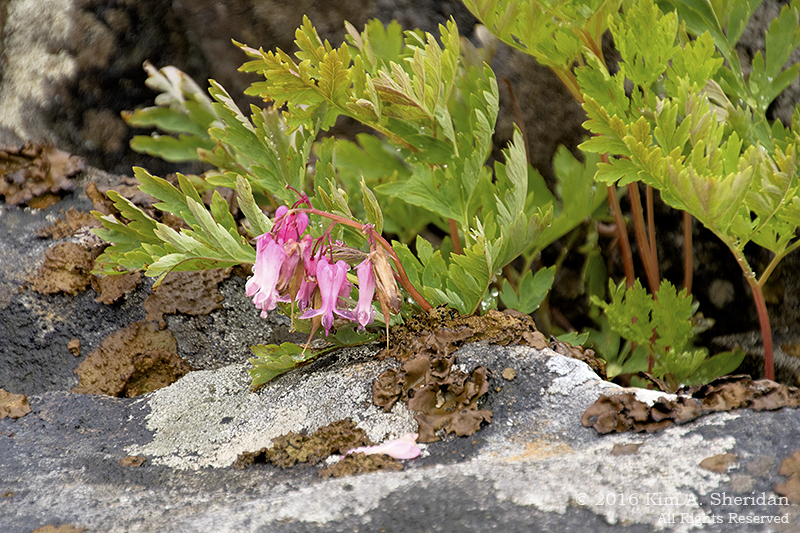 Yet tiny beauties thrive here. Wild Bleeding Heart and lichens.
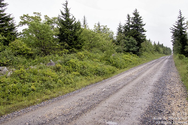
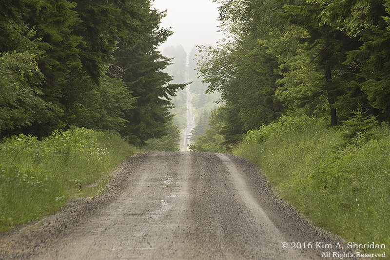
 After eleven miles of hilly, potholed dirt roads, at elevations ranging from 3800 to 4000 feet, we reached the northern end of the Dolly Sods Wilderness Area. You might think the adventure would be over.
You would be wrong.
Coming up: Bear Rocks and Bogs
Almost Heaven: After the Rain
 Of all the substances on Earth, water is the most awe-inspiring.
 Consider a lake on a misty morning, its surface smooth and still. You dive in, and the water parts, sliding supplely around your skin, its touch as light as silk. It’s evanescent, nearly intangible. Try to hold it in your hand; it slips away.
Consider a single water drop falling on a stone. Perhaps it rolls off onto the ground; perhaps it remains until the sun melts it away. Yet if water drips relentlessly in the same place for centuries, one single soft drop at a time, the stone will wear away. It doesn’t stand a chance.
Now consider trillions of water drops joined together in a raging river. As it cascades down a steeply inclined bed, the force of the water will eat its way through solid rock. Nothing soft and silky here.
Blackwater Canyon in West Virginia has been sculpted by the Blackwater River for centuries. The sandstone towers and ledges of Blackwater Falls demonstrate the force moving water can have. Nothing quite prepared me for witnessing that power in person, though.
 Here is the photo I took of the Falls with its three distinct cascades Monday morning.
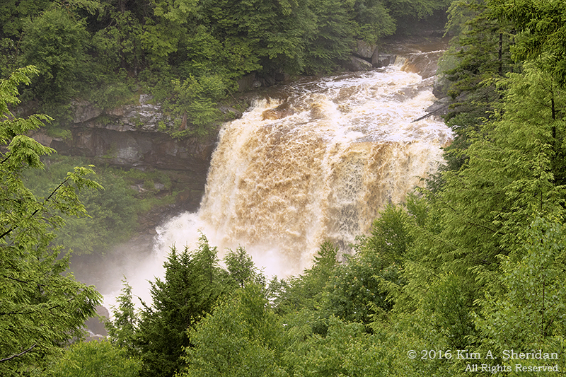
And then, it rained. Overnight the area got quite a soaking. Tuesday morning, Blackwater Falls looked like this:
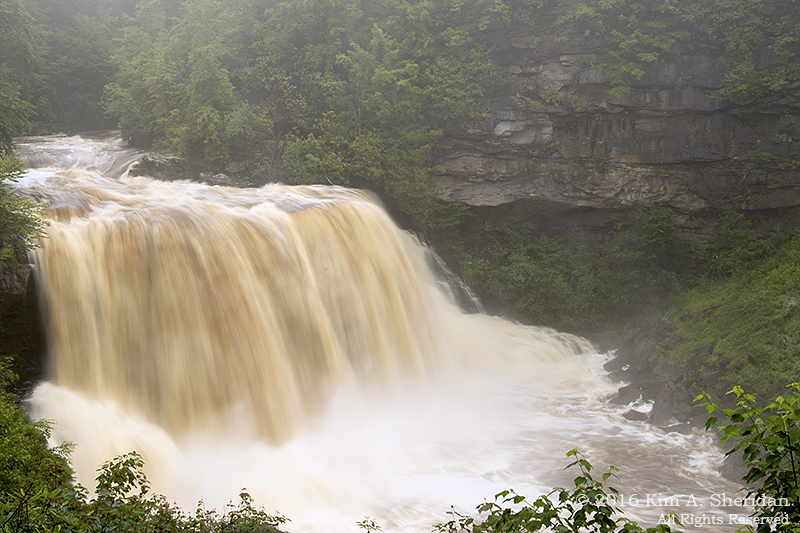 Wow. Just, WOW. So much water was pouring over the falls that the sandstone ledges weren’t even visible.
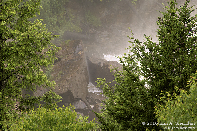 Upon hitting the bottom of the falls, water exploded back upwards to blanket the valley in mist. Everything nearby was soaked not from rain, but the river.
 We walked down the steps and the boardwalk, very carefully, to get up close to the falls.
 Robb and Don, steeped in Nature’s Majesty. The roar of all that water made it impossible to hear anything quieter than a full-throated shout.
 At Pendleton Point, a panoramic view of Blackwater Canyon. The Blackwater River flows from left to right. In the center, Elakala Falls.
 Elakala Falls consists four separate waterfalls along Shays Run, until it finally spills into the Blackwater River.
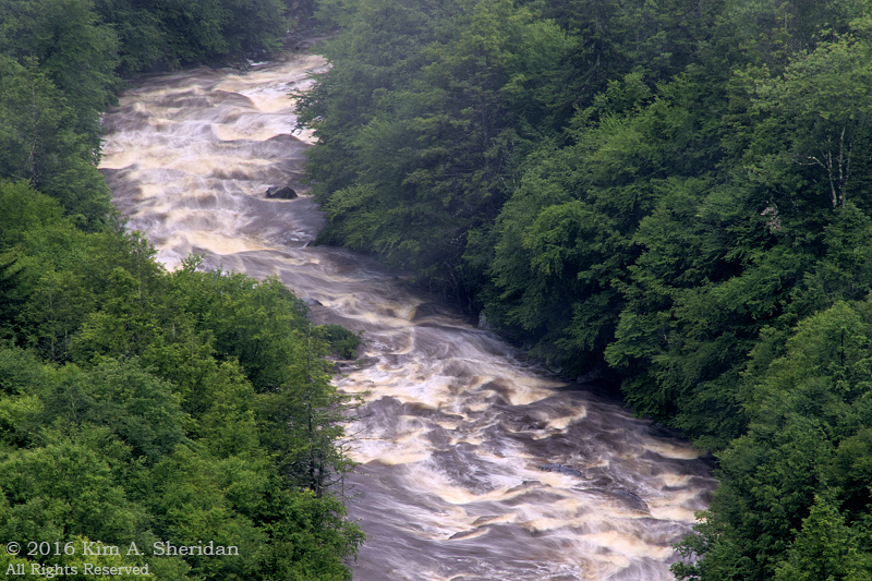 The Blackwater River. Kayaking, anyone?
 The view from the bridge leading to the lodge. See that flat-topped rock on the right? On a previous visit to Blackwater Falls, Don was particularly impressed with that rock. Ah, fond memories!
 Back at the falls, this time from the far side of the canyon.
From there, I made a short, shaky video of Blackwater Falls. (Click the link to see the video. That’s Robb’s voice in the background.) This was taken a lot further away from the falls than my previous video, which makes the roar of the falls all the more impressive.
All that power, all that force, in a material that feels so silken, so insubstantial. It slices through stone like a scythe – yet rests lightly in dewy drops on the gossamer petal of a flower.
Water. It’s amazing!

Almost Heaven: Raindrops, Moptops and the Lindy Hop
 If it’s the Appalachians, it must be raining.
Like July Fourth last year, and the Appalachian Spring Expedition before it, Independence Day in the mountains of West Virginia was a wet one. The rain started at breakfast, and though light, continued for much of the day.
 With precipitation in our future, the three of us had decided a day spent in and around our home base of Blackwater Falls State Park was in order. So we broke out our dancin’ shoes and Lindy hopped out to Lindy Point.
The short trail wound through woods dense with rhododendron. Sometimes there is beauty to be found in the rain.
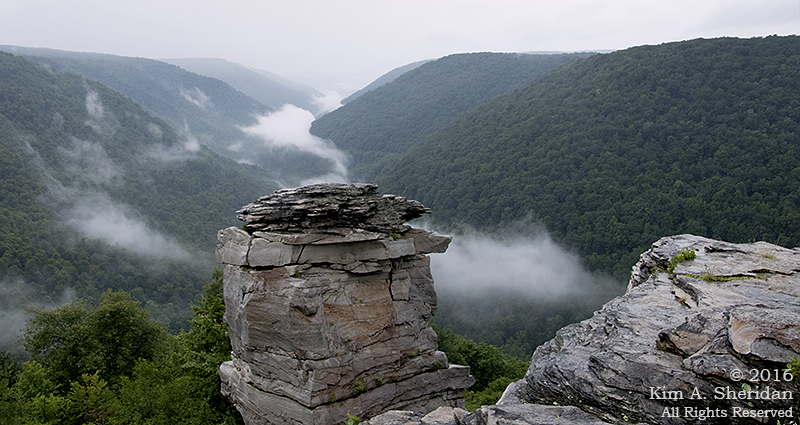
 The trail ended at a rocky outcropping, a once-proud craggy castle clinging to a precipice overlooking the Blackwater River Gorge. A two-tiered observation deck awaited us there. Mostly we ignored it in favor of ducking through curtains of greenery to stony alcoves open to the leaden sky. The rock formations and the view drew my complete attention…
 When I wasn’t distracted by the rhododendron blooms.
 A lone turret stood guard over the castle walls.
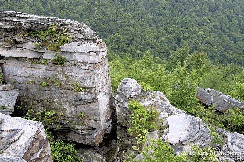
Made of sandstone and shale, like most of the rock in Blackwater Falls, the tower shows the effects of differential weathering.
Less resistant rock has eroded away, leaving the more resistant rock perched precariously in fantastical shapes.
Please pardon the raindrop blurs. It was raining faster than I could dry the lens.
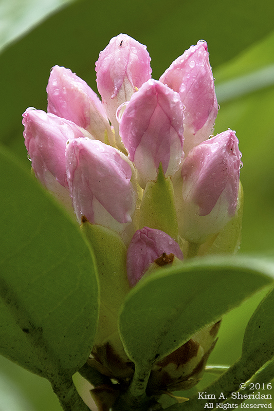
 Raindrops on rhodies… these are a few of my favorite things.
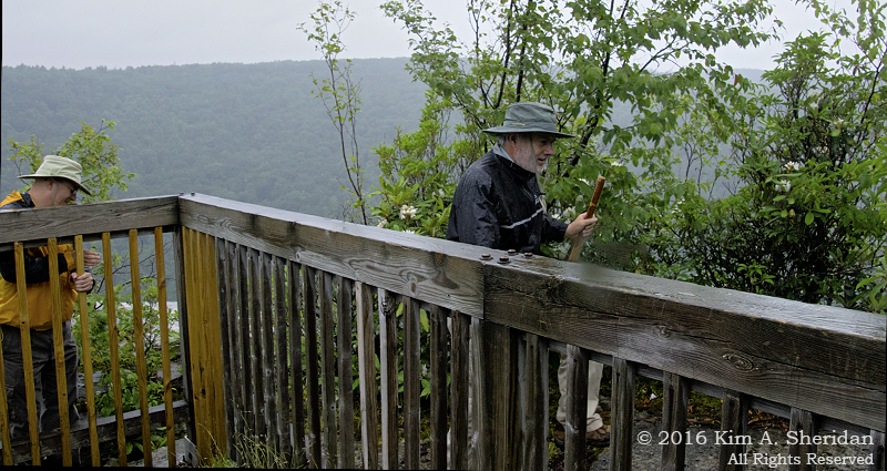
 Don’t lean too far over the edge!
Don and Robb posed for the obligatory portrait on the observation deck. That didn’t satisfy the photographer. Too dull, too… common. Taskmistress that she is, she insisted that they walk around the railing and out onto the rocks, dance from side to side until they were placed just so, and then kneel before Her Majesty.
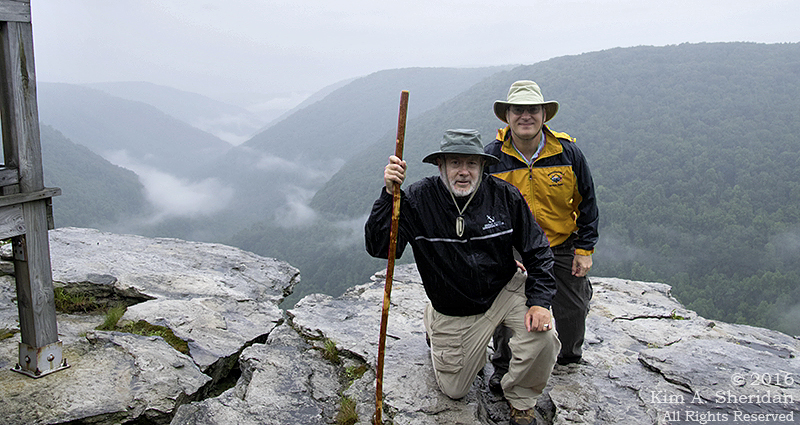 The Mage and his staff, and the Wise Fool, on the Castle Lindy parapet.
 Luckily for her attendants, they did not displease Her Majesty. In her boundless generosity, she allowed them to return to the safety of the dance floor, er, observation deck.
The tomfoolery continued in the afternoon. Every day, we traveled from our cabin to the Lodge several times. Every time, we passed a certain sign. Every time, I cried out, “Look! There’s a petting zoo!”
This seemed as good a day as any to drop in on the furry residents of the zoo. Chickens, piglets, rabbits, a donkey, a goat and more were tucked into a cozy barn.
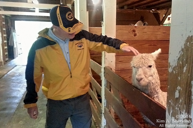 Robb and his new friend, Miss Moptop Alpaca. (cellphone image)
 From farm to town, the whirlwind went on, to the little hamlets of Davis and Thomas. Davis offered a neat artisans’ shop full of local crafts.
Thomas had an opera house, antique shops, and the Purple Fiddle, a local watering hole renowned for its eclectic roster of musical performers. (cellphone image)
Thus another fine day in West Virginia drew to a close, with our merry band snug in our cabin while the rain beat a tattoo on the roof.
Others may have their parades, barbecues and fireworks on Independence Day. Not us. For my companions and I, a day of raindrops, moptops and the Lindy Hop was the perfect recipe for a West Virginia Fourth of July.
Sites Homestead, Seneca Rocks
Almost Heaven: Seneca Rocks
 It was an up and down kind of day. Our first full day in West Virginia’s Potomac Highlands began at a high rocky cliff and finished deep underground in a cavern.
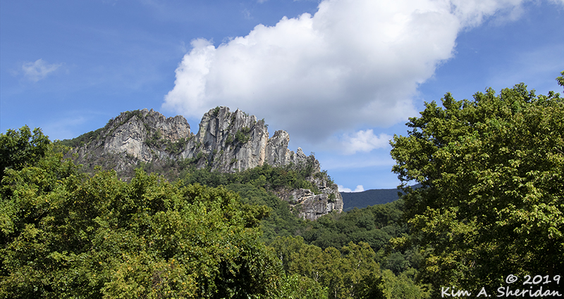
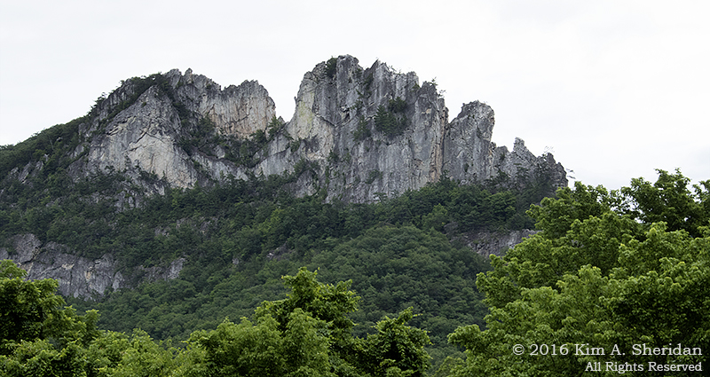
Our first destination? Seneca Rocks, in the Spruce Knob – Seneca Rocks National Recreation Area in Monongahela National Forest. Our goal? To scale the craggy cliffs known as Seneca Rocks.
OK, maybe not. The cliff faces are a popular draw for experienced rock climbers with the technical skill and gear to handle one of the 375 different climbing routes. We were here to ooh and ah over the cliffs from below, and walk the trail to an observation platform just short of the North Peak.
 Don posing in front of Seneca Rocks. Do you think he realizes Robb isn’t pointing the camera at him?
A Geological Diversion: The rocks at Blackwater Falls and many other places in the Potomac Highlands are sandstone, of the Tuscarora Formation. But Seneca Rocks are Tuscarora quartzite. Why?
The sandstones of the area began forming over 500 million years ago. As mountains to the east were slowly eroded away, sand, silt and pebbles washed westward into a shallow sea that covered West Virginia at the time. The sediment settled and compacted into sandstone.
About 275 million years ago, the collision of the continental plates forced the continental crust upward to form the Appalachian Mountains, and sandstone formations like Blackwater Falls were created. In some places, however, extreme pressure and heat caused the sandstone to change into quartzite, a metamorphic rock that is highly resistant to the weathering. Over time, softer stone eroded away to expose the “fin” or razorback ridge of Seneca Rocks.
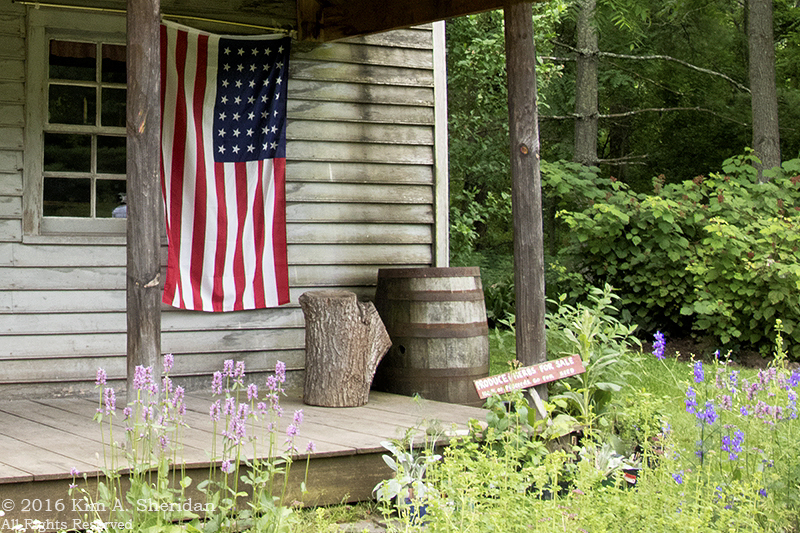
 In the valley we stopped to admire the Sites Homestead, before crossing Seneca Creek.
 We also crossed the Potomac River. The North Fork of the South Branch of the Potomac River, to be exact.
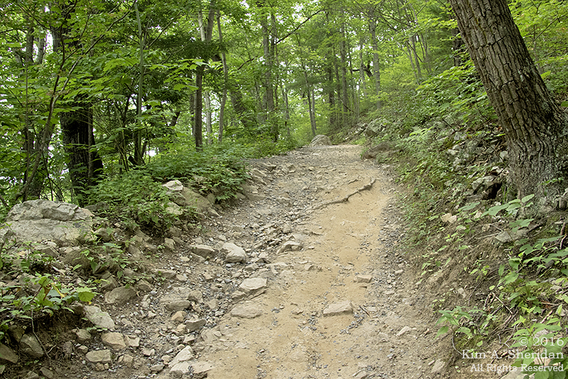
The trail gains 1000′ elevation in 1.5 miles through a series of steps and switchbacks. That’s pretty stiff. By my calculations, over a 12% grade. What fun!
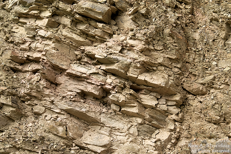 Along the way up we passed a wall of sandstone. No, this photo isn’t crooked. Millions of years of geological uplift have left these layers tilted just so.
 One of many switchbacks. This photo isn’t crooked either, the trees grow that way. Trees like striped maple, birch, beech and oak, and some pines near the summit. I tried to get the entire switchback in the photo, but couldn’t without falling off the mountain.
We heard birds, but didn’t see much wildlife. Perhaps because there were a lot of folks out for a relaxing Sunday stroll. Most of them made it to the top, despite some questionable wardrobe choices. A lot of dogs took the trek, too. Near the start we encountered one little fellow with very short legs that already seemed to be struggling. Darned if he didn’t make it all the way up and back!
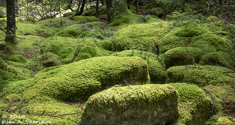
 Mushroom. No, the photo isn’t crooked! Plants and rocks alike grow at odd angles on steep mountainsides. Lots of lichens and mosses covered the rocks, and there were ferns everywhere. Wood ferns, sensitive ferns, and – look, Don! Christmas ferns!
 At last! The overlook. I was somehow expecting a close-up view of Seneca Rocks. Instead, the observation platform, perched on the cliff side just below the North Peak, offers a fine view of the valley below and the mountains beyond. Don, front and center.
 While I rest and enjoy a little snack, why don’t you join Don and take in the view.
Wait a minute, where’s Robb?
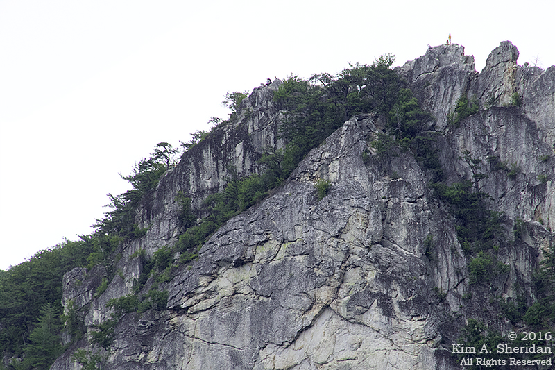 He’s climbed up the rocky trail toward the top of Seneca Rocks, right past the huge STOP! sign warning of death and disaster to all who go past it – which everyone is ignoring. This is the North Peak, accessible without climbing equipment. Just because you can, doesn’t mean you should.
 I want to go to the top, too! But just when I’m rejuvenated, Robb reappears, so we both head out onto the platform to enjoy the wonderful panorama. The pines on the right are Pinus pungens or Table Mountain pine, native to the Appalachian Mountains.
And what’s this? July Fourth weekend, at the top of a mountain; oh, it must be rain. Lovely.
With that, we took our last look over the valley and headed downhill. Fortunately, we were spared a repeat of last year’s Stony Man deluge; the rain this day was light and intermittent. The descent was much easier than the climb, and faster, too. Leaving us with plenty of energy to explore the rocky banks of the Potomac River.
The North Fork of the South Branch of the Potomac River.
 A little way upstream, Seneca Creek flows into the river. Don and Robb decided to continue up the creek bed to the bridge, where I would meet them after retracing my steps along the trail.
Except when I got there, they were nowhere to be found, on the bridge or on the creek. I walked back to the Discovery Center in search of both the guys and a signal for my cell phone, and soon ran into Robb. Who claimed that they were RIGHT THERE on the creek bed, had SEEN me on the bridge, and SHOUTED at me repeatedly to no avail.
But I know I didn’t see them down on the creek. Couldn’t have been that I was looking the wrong way, could it? Nope, not me!
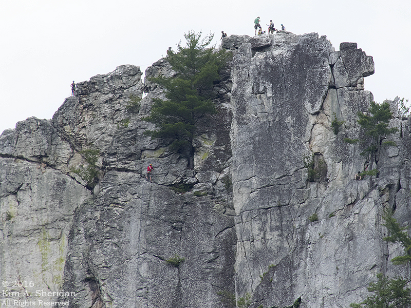 This is the South Peak of Seneca Rocks. Here we find the serious rock climbers doing the serious work of playing on cliff faces. How many climbers do you see? Seven (or more) on the top. Two on the face. Don’t see the second one? He’s at the right edge of the photo, resting in the shade of a tree. Maybe enjoying a good book.
Our plan had been to push on south to Spruce Knob, at 4,863 feet the highest point in West Virginia. When we passed the turnoff for Seneca Caverns, and the sign promised a restaurant, our hunger got the better of us and we changed plans. Happens all the time; besides, it was raining.
 We enjoyed the 45-minute tour through the cavern. It was considerably larger than either of the two Pennsylvania caverns we have been to.
Some of the rooms seemed to soar upward forever.
Then we came to some low, narrow passages that required yoga to weave through.
We never had to wear hard hats in a cavern before, but we were soon grateful for them. The trip leader’s talk was frequently punctuated by a plastic BONK! as one or another of the visitors hit their head on the low ceilings.
We finally emerged from the depths, to more rain and an hour’s drive to our snug cabin in Blackwater Falls.
 To plan for the morrow, and reflect on the highs and lows of a grand day in West Virginia.
