 Before I came to Ithaca, NY, I never really questioned why waterfalls occur where they do. It’s a simple equation: Steep mountainsides + creeks = waterfalls.
I wouldn’t have called the Finger Lakes Region “mountainous,” though. Not compared to the Adirondacks or the Appalachians. “Rolling hills” is more like it. So where did all these gorges and waterfalls come from?
To find out, I walked through Taughannock Gorge – and back through time.
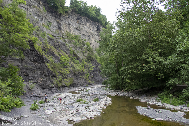
 On a hot day in July, my cousins Becky & Ron, their friend Carol, and I visited Taughannock (“tuh-GAN-uck”) State Park, home to Taughannock Falls. A ¾-mile trail led through the gorge, wide and flat, easily walked. Wider still was the creek bed on our right. In summer, what little water there was flowed in a narrow ribbon over exposed rock. One can only imagine the sight when the creek is raging with spring snow melt.
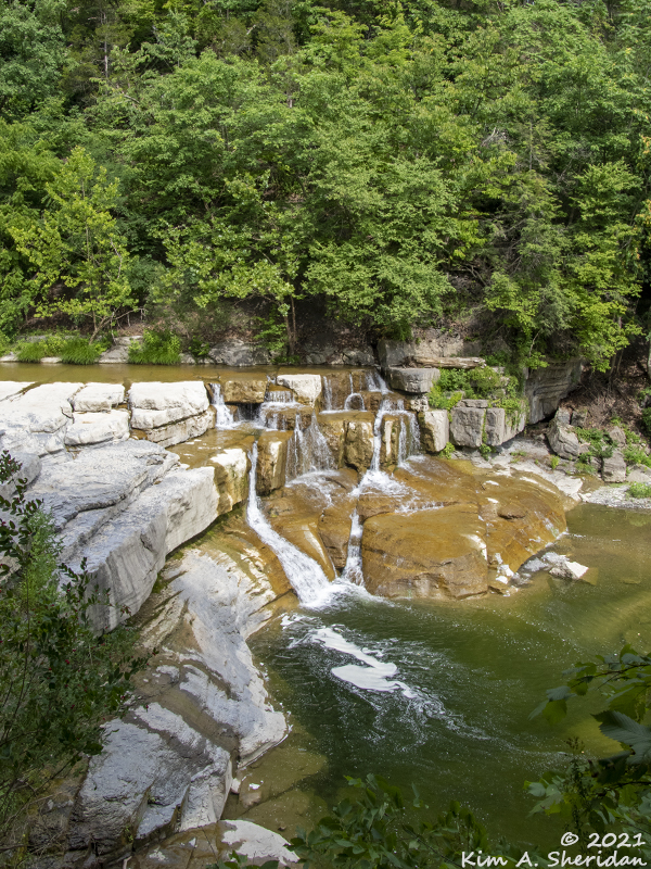
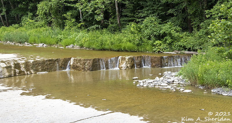
 We quickly came to a nice little cascade. Just a few feet high, but a delight to see and photograph. The layered nature of the rocks here is pretty obvious.
Ready for that geology lesson I promised? There’s a sign in the park that explains all the geologic processes that have occurred in the last 400 million years, and I’ll share it in bite-sized pieces as we walk along. Be sure to click on the map images to see a larger size. (Courtesy of New York State Parks, Recreation and Historic Restoration.)
LAYERS
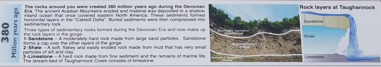
 Rock layers tell the creation story of the earth, if you know how to read them. The layers in Taughannock Gorge are limestone, shale, and sandstone – in order from bottom to top, oldest to youngest. All are sedimentary rocks, formed from an accumulation of minerals and rock fragments. The sediment, deposited over hundreds of millions of years, becomes compacted by the weight of material above and hardens into stone.
 Limestone is hard, calcium-rich rock made from fine marine sediments. Found here in the exposed creek bed, it frequently contains fossils. We wandered out onto the floor of the dry creek to take a closer look. I searched for fossils embedded in the pale gray limestone, but didn’t find any. Phooey.
 We did find rock cairns. Anywhere there are rocks, humans like to stack them into art forms.
 The sharp angles of the terraced steps and ledges fascinated me.
 Back on the trail: Carol in the foreground, Ron and Becky further ahead.
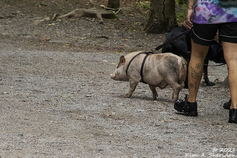 Pay no attention to the pig.
For the first time, I really took note of a phenomenon I’m sure I’ve seen many times – the contrast in the vegetation on opposite sides of the gorge. Different microclimates make for different microhabitats. We walked on the southern side of the gorge, shaded and cool and damp. Coniferous hemlock trees dominated here, along with sugar maples and yellow birches that like their homes moist.
Right across the way on the northern slope, it’s a different story. Exposed to the sun, warm and dry, it’s the perfect habitat for deciduous trees like maples, oaks, and eastern red cedar.
FRACTURES
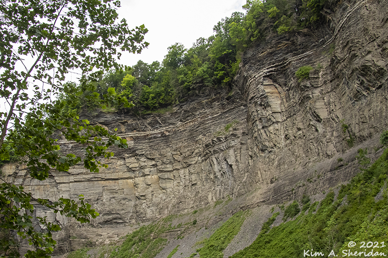
 The area of Taughannock Creek known as Big Bend showcased the stresses placed on the rocky walls of the gorge over the ages. The limestone layers at the bottom and sandstone at the top of the cliffs are both moderately hard rocks that don’t erode easily. Shale is sandwiched between those layers, like the cream in an Oreo cookie – softer, easily eroded, brittle.
 As the ancient continents moved against each other, weak areas in the rock layers fractured along parallel lines known as joints. When the direction of continental movement changed, more joints were formed, perpendicularly to the first set. Over time, the shale has eroded and collapsed along those fracture lines, leading to the sharp corners you see here.
 We crossed over the creek to reach Taughannock Falls. A sign read “Please do not stop on bridge.” Yeah, right. Like that is going to happen.
There are photos to be made, and you can’t rush art.
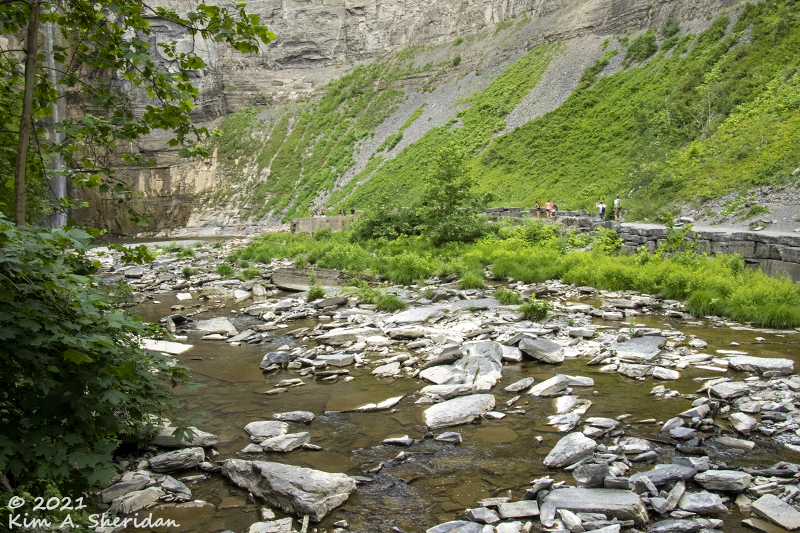
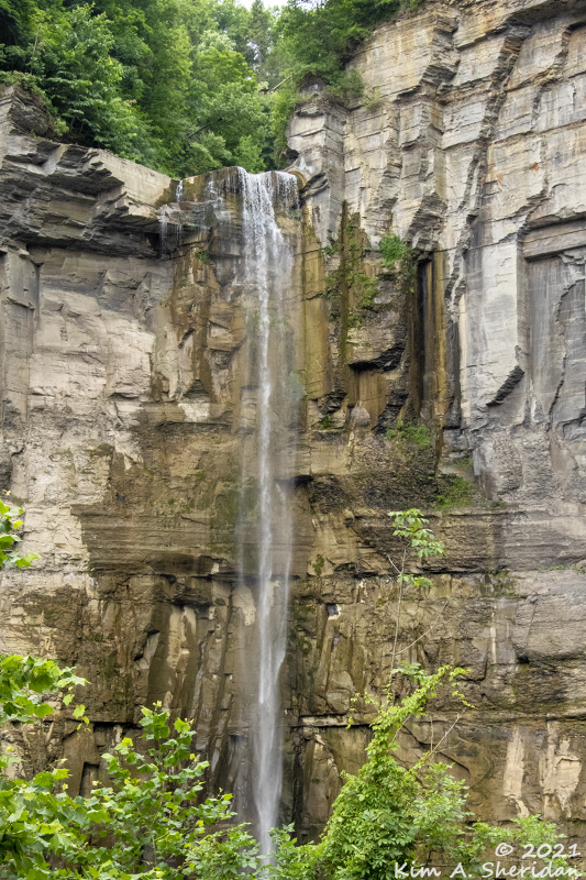
 We entered into the amphitheater of Taughannock Falls, a towering horseshoe of rock cliffs. On the far wall, a thin braid cascaded 215’ to the pool below. These falls are the tallest single drop falls in the Northeast United States. Taller even than Niagara Falls!
In the heat of July, the waterfall was a shell of its usual self. I was left to imagine the falls at full force. Even in dry weather, the height of the falls and the tall cliffs around it were awe-inspiring.
VALLEYS

 So how did Taughannock Gorge form from all of those rock layers?
Two million years ago, the Finger Lakes and the gorges of Ithaca didn’t exist. Instead, rivers ran through shallow, V-shaped valleys. Over time, glaciers advanced and retreated repeatedly through the region, gouging the valleys into deep, U-shaped troughs.
When the last glacier retreated, it left those troughs filled with water, creating the Finger Lakes.
But the changes didn’t stop there. 10,000 years ago, the surface of Cayuga lake was 600’ higher than it is today. As the water level dropped, it left the creek valleys stranded atop steep hillsides high above the lakes. At that time, creeks like Taughannock flowed through these hanging valleys and dropped directly into the lake.
MIGRATION
 So why is Taughannock Falls so far from the lakeshore today? Here’s where erosion and the fracture-prone nature of the shale comes into play. The sandstone above the shale layer is a relatively hard rock made of large sand particles. It doesn’t erode easily, and the waters of the creek had little effect on it. But those same waters seeped down into the cracks and joints of the shale below.
 Once in the joints, the water froze and expanded, wearing away the shale. Unsupported, the sandstone above it broke and tumbled to the valley floor in large blocks. This cycle repeated yearly, and over time Taughannock Falls has crept its way back from the shore of Cayuga Lake, inches at a time. A full three-quarters of a mile – long-distance migration for a waterfall!
 I heard several people talking about the eagles flying around. I looked – and spotted this. Um, that’s a turkey vulture. Quite a few of their kind soared around the bowl or perched on the cliffs. A kingfisher rattled noisily past us from time to time.
 One of the nice things about Taughannock Falls for photographers is that no one can get to the bottom of it to swim.
You can make the waterfall the sole centerpiece of your images.
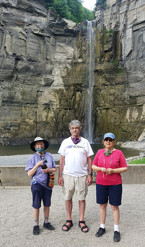
Or – pose your favorite people in front of it. Carol, Ron and Becky.
After an easy stroll back to the trailhead, we drove around to the overlook. Down some stairs was a viewing area that offered a panoramic view of Taughannock Gorge and Falls.
 From here, all of history is on display – the layers of sandstone, shale and limestone, the perpendicular fractures, the deep horseshoe shaped hanging valley.
If you want to understand the geology of the Finger Lakes – to learn why “Ithaca is Gorges” – there is no better teacher than the walk through time to Taughannock Falls.

So interesting!