
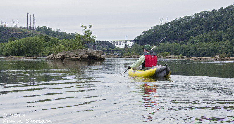
 We dipped our paddles into the rippled waters of the Susquehanna River, and paddled back in time.
Back nearly a thousand years ago, to a time when Native Americans of Algonquin and Shenks Ferry cultures inhabited the Susquehanna Valley. Back to a time when they hunted game, and grew corn, squash and beans near small villages. Back to a time when a tribal member might canoe through turbulent water to land on a rocky islet and with hammer stone and chisel, carve strange symbols on the island’s surface.
 The Shenks Ferry people disappeared when the Susquehannocks arrived; the Susquehannocks scattered in turn when white settlers inhabited the valley. Then came the roads, the mills, and the canals. The petroglyphs became curiosities for study, first by Professor T. C. Porter of the Linnaean Society of Lancaster County in 1863, then by Donald A. Cadzow of the Pennsylvania Historical Commission in the early 1930s.
The hydroelectric dams followed – Safe Harbor, Holtwood, Conowingo – and the petroglyphs disappeared, like their makers.
Except for Big and Little Indian Rock below Safe Harbor Dam. When the Susquehanna is low enough, they reveal their archeological treasures. My friends and I had paddled out, seeking a connection with an ancient civilization, to see the rock art left behind.
 Known as the Safe Harbor petroglyphs, these rock carvings can be found at least seven rocks, of which Big and Little Indian Rock are the best known. Local historian and petroglyph expert Paul Nevin has documented over 400 Native designs including humans, animals, animal and bird tracks, human footprints, circles, dots, serpentine lines and “thunderbirds.”
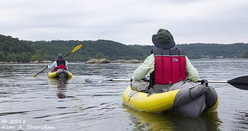
 But how to find that rock art? The Susquehanna is nearly ¾ mile wide, and it’s nothing but rocks! Finding two small islets among the many – from kayaks, no less – was going to be a challenge. I came armed with satellite images, and distances measured using Google maps to guide us to the general location. I also had photographs and Cadzow’s drawings of the rocks for reference. And still we missed them.
After too long paddling downstream, it became obvious we’d gone too far. Back upstream we went. Along the way, we stopped at an island – not one of our targets – for a break.
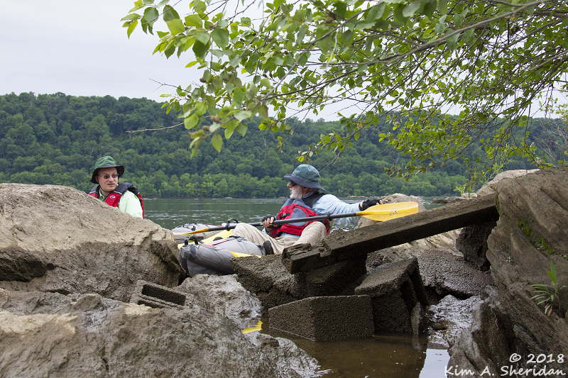 Don decided he wanted to get out and walk around on the island. Robb tried to talk him out of it, but Don was determined.
With his kayak wedged between the lee side of the rock and our boats, he managed to crawl up the very slick mud-covered rock. Barely.
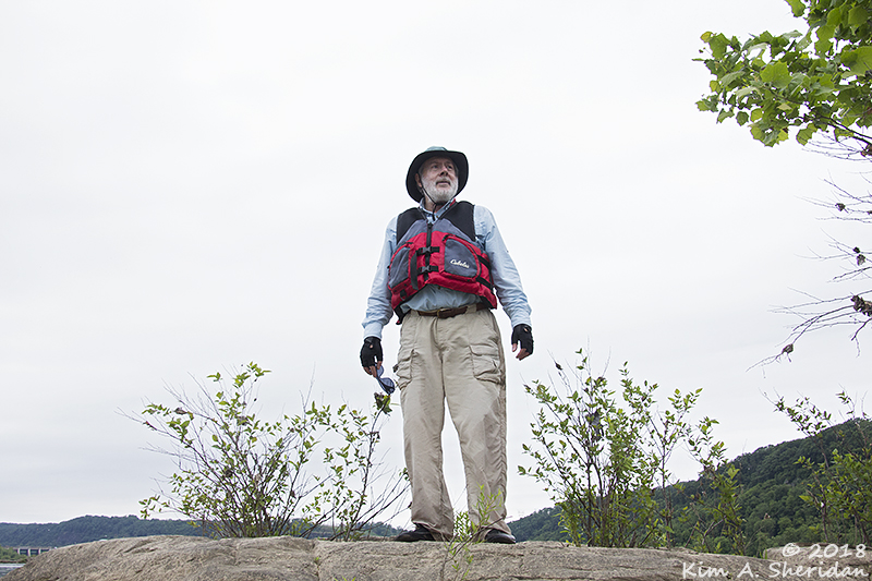 Getting back into his kayak was equally undignified, but for a moment he was master of all he surveyed.
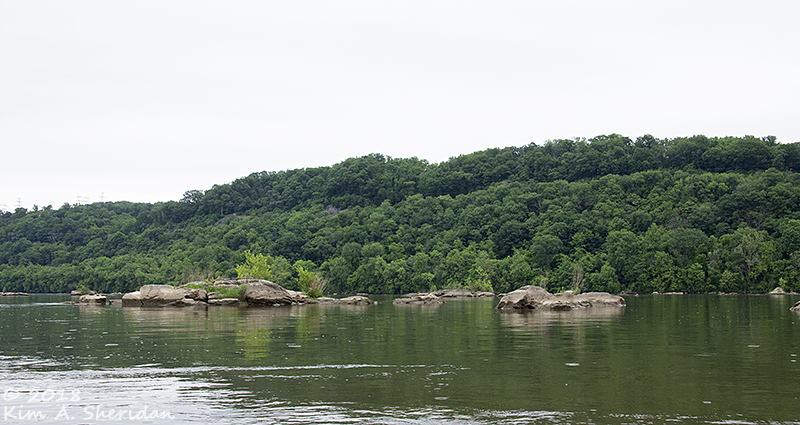
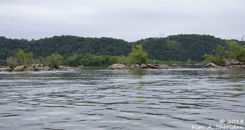
I tried to imagine the river a thousand years ago as the Native Americans would have seen it. With no dams, it would have been a series of rapids and rushing channels winding amidst the rocks, not this wide river scattered with boulders.
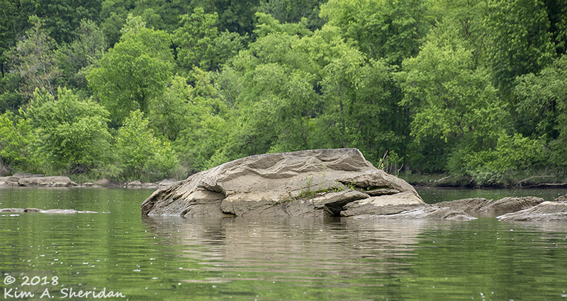
 Soon enough, Robb and I spotted a large rock that looked likely. When we drew close, I recognized it – we’d found Big Indian Rock!
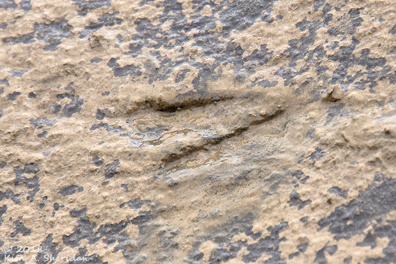
It was obvious from Don’s experience that we would not be getting onto the rock to see the petroglyphs. We had to view and photograph them from our kayaks. The carvings are shallow, less than 3/8” deep, and not easy to make out. Wetting the surface with water helped, a little.
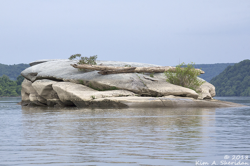
 Petroglyph on Big Indian Rock.
Seeing it so close, I tried picture its maker, perched on the island, chipping away with stone and chisel. It would have been long and difficult work, too much effort for mere grafitti. What was the artist thinking?
These petroglyphs were a form of communication. What they were communicating is the subject of continued speculation. They could have marked tribal boundaries, or directions to hunting grounds. Big and Little Indian Rocks could have been teaching rocks. Or sacred spaces for shamans and tribal members on a vision quest, the carvings animal or spirit totems.
I shut my eyes, and imagined a youth fasting on the rock through cold rain and blistering sun. Then making a carving to honor his vision.
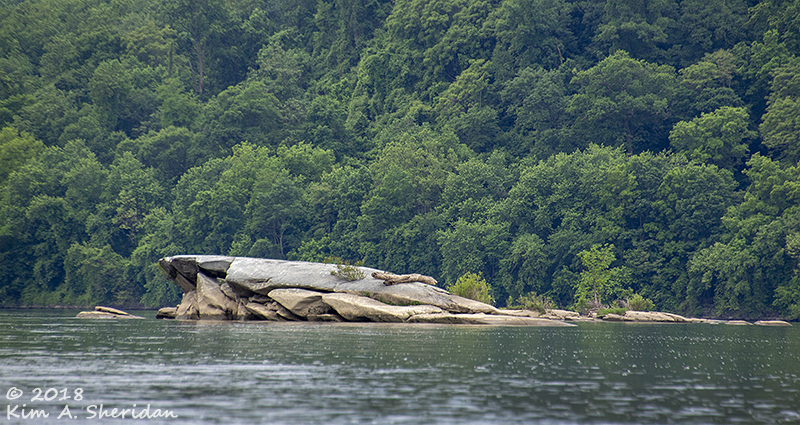
 Having found Big Indian Rock, we were now able to locate Little Indian Rock easily. The island, to Robb’s left and topped by trees, has the largest concentration of petroglyphs of the Safe Harbor site.
 Of which we could see but a few.
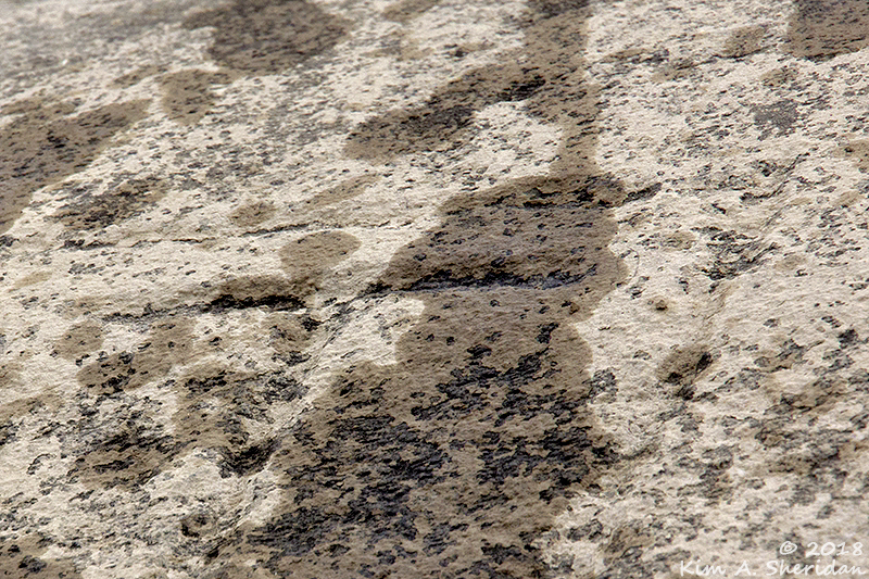 If you look closely at this photo you may be able to make out two serpentine lines. According to Paul Nevin, these snakelike lines align with the sunrise at the spring and fall equinoxes. Another serpentine line appears to align with sunrise at the winter solstice. The work of ancient astronomers?
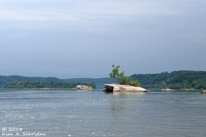 With one last look downstream at Little Indian Rock in the foreground, and Big Indian behind it, we reluctantly turned away and paddled back to civilization.
For a brief moment we had bonded with an ancient people, had seen their ancient carvings, had touched the very rock once touched by a Native culture so many years before.
For a moment, we had paddled back in time.
WARNING: Paddling close to Safe Harbor Dam (below) is NOT recommended by this writer. Kayaking near the petroglyphs is not difficult, but closer to the dam the waters can be swift and turbulent. Some articles online recommend traveling downstream from Conestoga River Park. We tried this but it was a mistake; we were unable to return upstream to the Conestoga River, ended up bailing out to the Pequea boat launch downstream and bribed two fishermen for a ride to our car.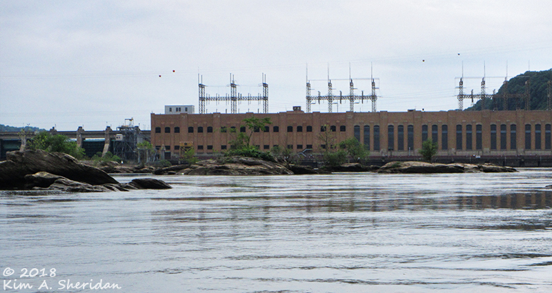
If you want to see the petroglyphs, use the Pequea boat launch, and paddle two miles upstream to the islands, then return downstream. Or look into one of the petroglyph tours offered by Shank’s Mare Outfitters. http://www.shanksmare.com/paddle-tours–trips.htm
Please be mindful of safety and petroglyph etiquette – don’t touch the petroglyphs or use any substance to mark them. Leave them as they are for others to enjoy.
BIBLIOGRAPHY
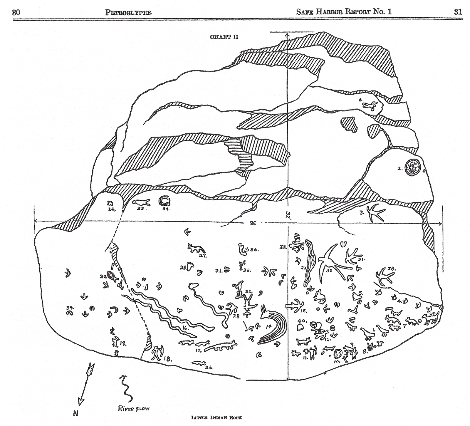
LITTLE INDIAN ROCK by Donald A. Cadzow
Click for a larger image
Donald A. Cadzow. Petroglyphs in the Susquehanna River near Safe Harbor, Pennsylvania, Pennsylvania Historical and Museum Commission, 1934.
Nevin, Paul. “Rock-Art Sites on the Susquehanna River.” The Rock-Art of Eastern North America: Capturing Images and Insight, edited by Diaz-Granados, Carol, and James R. Duncan, University of Alabama Press, 2004.
“Petroglyphs of Pennsylvania.” Pennsylvania Archaeology, Pennsylvania Historical and Museum Commission, 2015. http://www.phmc.state.pa.us/portal/communities/archaeology/native-american/petroglyphs.html
Carr, Kurt W. and Nevin, Paul A., Advanced Technology Rubs Ancient Past. Pennsylvania Heritage, Vol. XXXIV, No. 4, Fall 2008. http://www.phmc.state.pa.us/portal/communities/pa-heritage/advanced-technology-rubs-ancient-past.html

Kim…This was a refreshing journey for this reader! Thanks for taking me along on your blog….
Very interesting. Thanks for posting!