Oh, Shenandoah! (Verse 1)

Appalachian Spring Title Subtitle2150729_VA SNP Books_2483acs
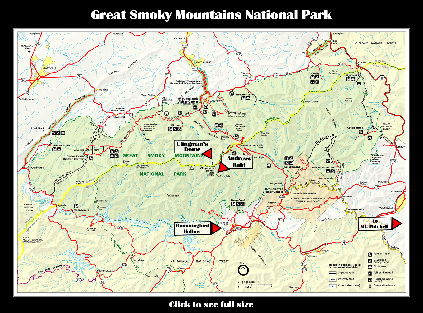
The Great Appalachian Odyssey of 2015 filled a shelf full of adventure tales for Don and me this April. Each day was like opening a brand-new book and not knowing what to expect. One day in Nashville, six days in Great Smoky Mountains National Park, four days on the Blue Ridge Parkway. Shenandoah National Park played the role of bookends. We visited there on the drive down, and again on the drive back, spending two half days each time. The two visits could not have been more different.

SNP Full Map
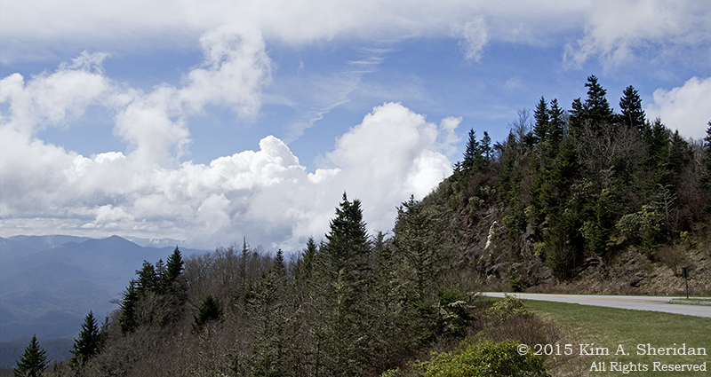
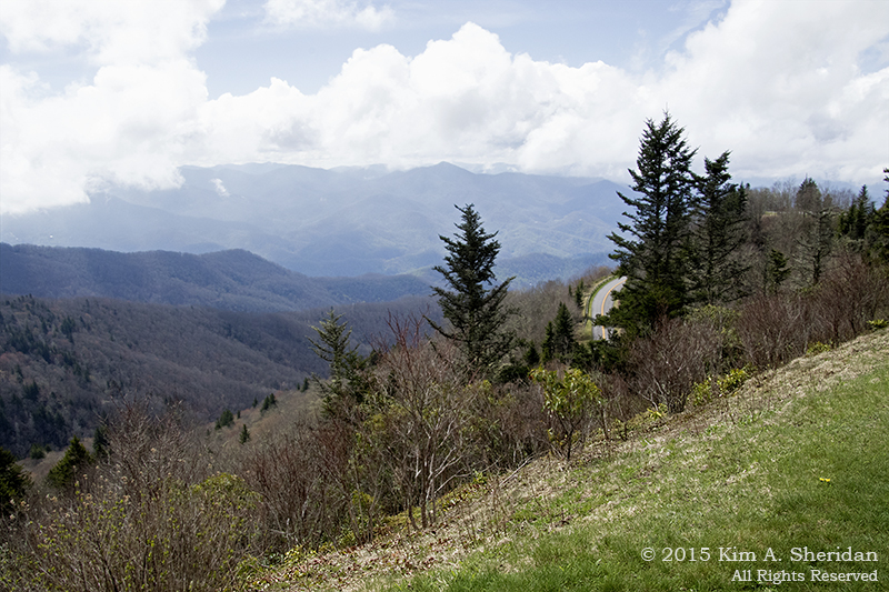
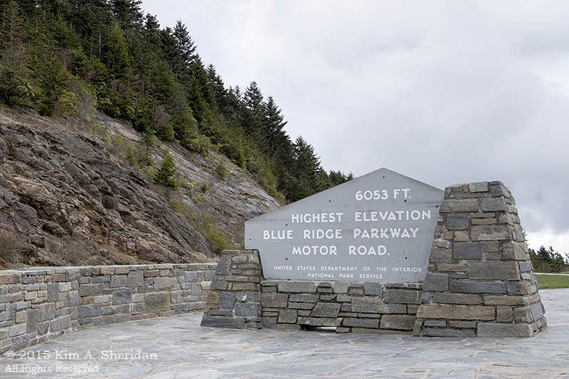
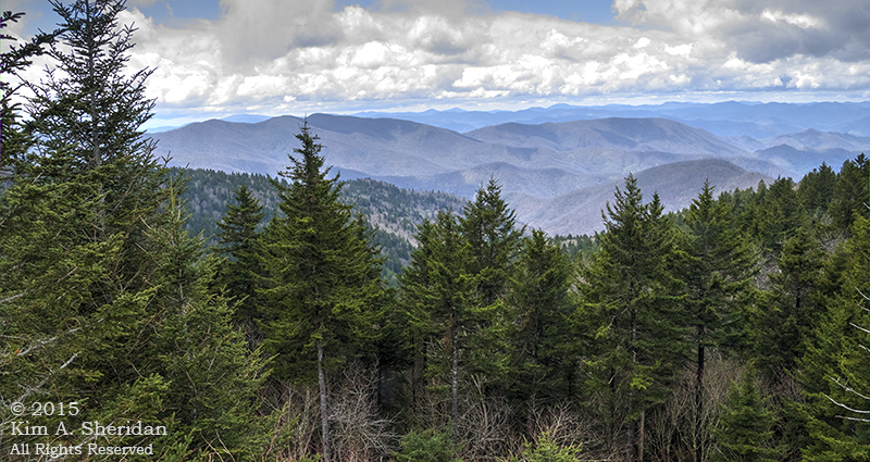
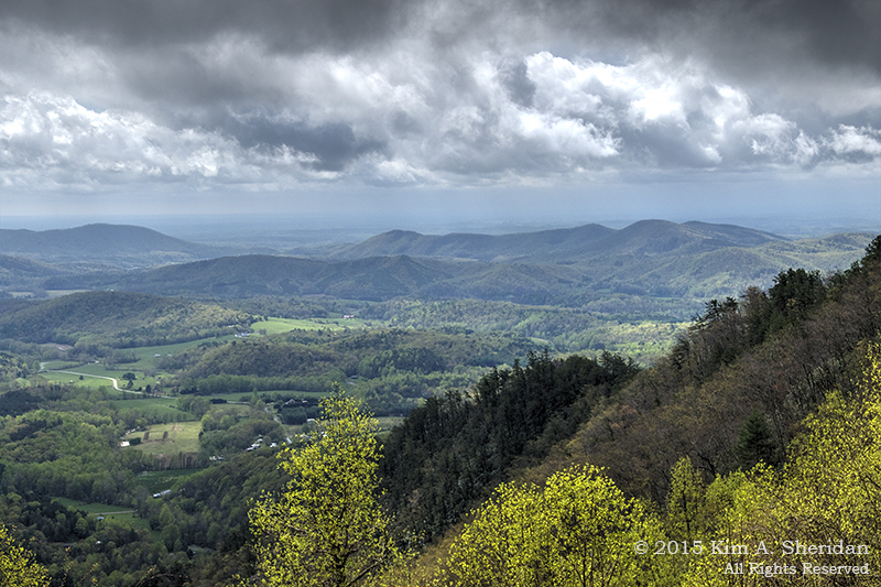
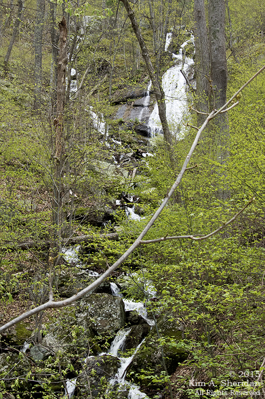
Shenandoah National Park is a long narrow park along the spine of the Blue Ridge Mountains in western Virginia. The highlight of the park is Skyline Drive, which runs the length of the Park along that spine, 105 miles from Front Royal to Rockfish, where it meets the northern terminus of the Blue Ridge Parkway. The road is a narrow two-lane byway that winds and twists along the edge of the mountains. There are numerous scenic overlooks along the road from which to see the Shenandoah Valley and Massanutten Mountain on one side and the rolling hills of the Piedmont on the other. 500 miles of hiking trails criss-cross the Park, leading to waterfalls, peaks and grand views.

Don, Robb and I had planned a visit the previous Thanksgiving, but were thwarted by a heavy snowfall. So Don and I were getting a second chance.

150408_VA SNP Skyline Drive_3770 acs (dfn)
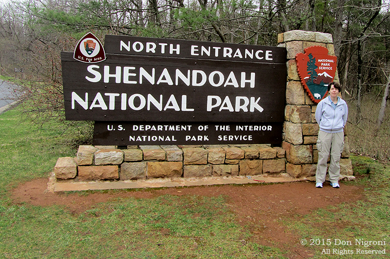
On the first day of our two-week trip, we arrived at the northern entrance of Shenandoah after nearly 7 hours on the road. Here’s the obligatory sign photo! Which was followed by the obligatory visitor’s center stop, in this case the visitor’s center and gift shop at Dickey Ridge.

150408_VA SNP Skyline Drive_3642acs
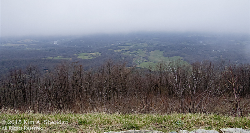
I was looking forward to driving the two-lane Skyline Drive after all those hours on the highway. Be careful what you wish for. Not long after leaving Dickey Ridge we stopped at an overlook – I think it was Signal Knob – where I took my first photo from Shenandoah National Pak, with the Shenandoah Valley and River below. Clouds hung over the mountains beyond. We tried in vain to spot Signal Knob on the northern tip of Massanutten.

150408_VA SNP Skyline Drive_3674acs
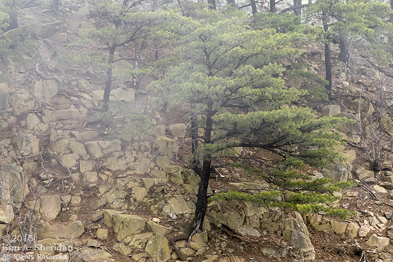
We also watched as the fog rolled in from both sides. I gave up trying to photograph the view, and turned my attention to trees clinging to the rocky slopes.

150408_VA SNP Skyline Drive_3649acs
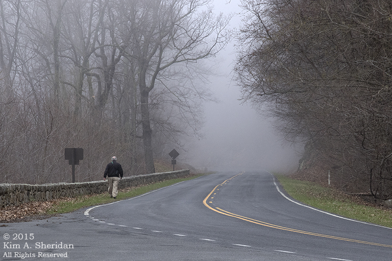
Don disappeared into the mist to investigate.

150408_VA SNP Skyline Drive_3693
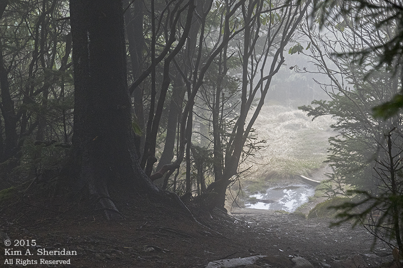
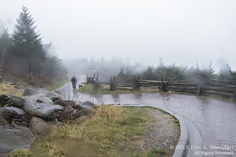
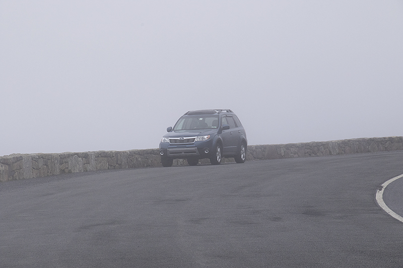
The fog quickly grew so thick it swallowed the mountains, river, valley and even the trees and shrubs just beyond the roadside. It threatened to swallow my car as well. We saw no more of Shenandoah National Park that day.

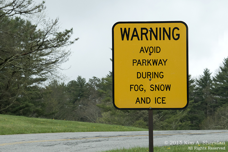
What followed was 25 miles of the most difficult driving I’ve ever experienced. We made the decision to push south to the Thornton Gap entrance, hoping the fog would lift. We couldn’t see beyond the side of the road, even the rock overhangs; much of the time I couldn’t see the left side of the road. I could see ahead of me for maybe twenty feet. I drove the with my hazard blinkers on, following the yellow lines on the road and using my GPS to anticipate the frequent twisty curves. At one point a band of bicyclists materialized out of the clouds too close for comfort. By the time we left the Park and descended out of the fog into Luray I was exhausted.

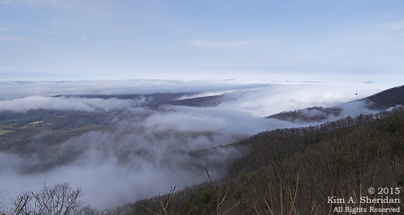
Too exhausted to sleep that night. Not surprisingly, I wasn’t feeling well the next day, so Don declared a one-day layover in Luray to rest and recuperate. After a morning of me moping about, he found a cure for my malaise by suggesting we try Shenandoah again. We entered at Thornton Gap and immediately ran into our old friend the fog at the entrance station. Don insisted we push south for a bit, and this time I’m glad he did. The gloom began to lift, my mood with it, and we pulled into an overlook.

150409_VA SNP Skyline Drive_3713acsI took one look at the amazing sight of the tops of the mountains poking out of the cloud blanket below and forgot all my troubles. Photography time!

150409_VA SNP Skyline Drive_132827acs
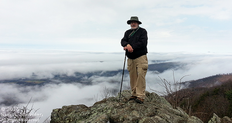
Don on top of the world.

150409_VA SNP Skyline Drive_3807acs 2 (dfn)
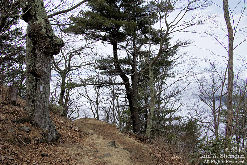
It seemed like a perfect time for a little hike along the Appalachian Trail, my first AT segment outside of Pennsylvania. The white blazes mark the Trail.

150409_VA SNP Skyline Drive_3752acs150409_VA SNP Skyline Drive_3813acs
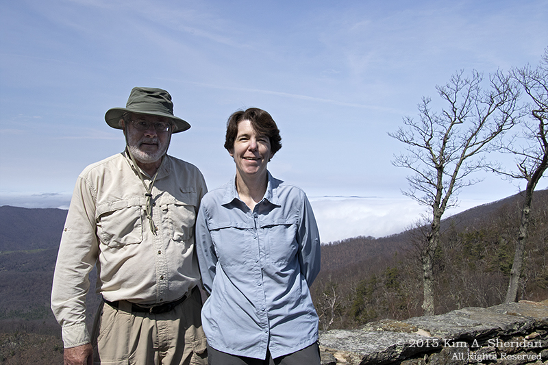
Above the clouds the sun was coming out. And suddenly it got warm! We enjoyed a close-up view of a groundhog, and posed for the only picture of both of us taken on the trip, Don trying to hide in the shadow of his hat.

Our destination for the day was Skyland Resort. It has a lodge with a gift shop and two restaurants, and we were eager for a late lunch. While there, the clouds rolled back in. It wasn’t long before we were driving through the fog again on the way back to town, but by now I was an old hand. Driving through the Mary’s Rock Tunnel was dicey, though.

150409_VA SNP Skyline Drive_3766acsThis would be the last we’d see of Shenandoah for awhile. Nashville and the Smokies awaited!

On The Blue Ridge Parkway

Appalachian Spring Title BRPThe Blue Ridge Parkway, which stretches through the Blue Ridge Mountains in Virginia and North Carolina, was conceived in the 1930s as a scenic highway that would connect Great Smoky Mountains and Shenandoah National Parks. Our Appalachian odyssey was leaving the Smokies and passing through Shenandoah on our way home. Hey, why not take a few days, avoid the highways, and drive home on the Blue Ridge Parkway?

150418_NC BRP High Peaks_5751acsLike many of our plans, this one went awry from the start. I thought I had planned it well, with short drives the first two days, where there was the most to see. The second two days would be longer drives, ending in Shenandoah. Hotel reservations were made along the route, thus assuring Don and me of a nice place to rest for the next day’s travels.

I didn’t count on a few things, though. Like detours that forced us off the Parkway in three places. Or the rain that prevented us from actually seeing anything one day. In the end, we drove 282 miles of the Parkway, about 60% of its 469 mile length. Those convenient hotel reservations meant we had deadlines to meet each night, and we lacked the flexibility to fit our trip to the Parkway, and the weather. Clearly it would have been better not to plan, for once.

150418_NC BRP High Peaks_5708acsThe first day, which turned out nice after the fog cleared, was spent driving through the highest peaks on the Parkway. We stopped at every overlook to marvel at the endless lines of mountains marching off into the distance. After awhile it all began to look the same.

150418_NC BRP High Peaks_5745acsWaterrock Knob, elevation 6400’ at Milepost 451, stood out with its panoramic views and some interesting rock formations.

150418_NC BRP High Peaks_5733acs2We declined to make the short walk to the top here.

Our legs were still worn out from climbing Andrews Bald and Clingman’s Dome the day before!

Instead we enjoyed looking down on the Parkway winding far below us.

150418_NC BRP High Peaks_5793acsThe highest point on the Blue Ridge Parkway is the Richland Balsam Overlook at 6053’, Milepost 431.

150418_NC BRP High Peaks_5781_HDR acs copyThe views are pretty nice!

After Richland Balsam, I was looking forward to Graveyard Fields, Looking Glass Rock and lunch at the Mt. Pisgah Inn. Not this time! A closure on the Parkway at Milepost 423 forced us into a long twisty side trip on some mountain road, and by the time we’d reached an intersection, it was too late in the day to drive all the way back to the Parkway. Instead, we continued on to Asheville, NC, for the night.

Day 2 was supposed to be the highlight of the trip. Craggy Gardens, Glassmine Falls, Mt. Mitchell, Linville Falls, and the Linn Cove Viaduct all waited. Only one little problem… the rain. It rained so hard Don and I could barely see the edge of the road. Fog and low clouds just made it worse. Funny thing, though; two of the highlights of the Parkway for me came on this stretch, getting to the top of Mt. Mitchell at Milepost 355 (see Climb Ev’ry Mountain) and seeing a bear run across the road (see Bearly There.) Otherwise, this section of the Parkway was pretty much a washout. (We did cover all the mileage on the trip from Asheville to Blowing Rock, NC, something we couldn’t say of any other day!)

150420_VA BRP Farm Country_5894acsThe weather on Day 3 was much better. The morning fog was picturesque for once instead of obscuring the view. This is the agricultural heart of the Blue Ridge Mountains, and the road overlooked a patchwork of farms and fields.

150420_VA BRP Farm Country_5910_HDRacs copyThe clouds on our entire trip tended towards the dramatic – when we could see them at all. This was one of the better days for cloud formations. Because he expressed an interest, I bought Don a book on weather in the Asheville Visitor’s Center. I thought maybe he’d like to learn the names of the clouds. Nope. To this day he still calls cumulus formations “fluffy white clouds.” There’s no educating some people.

150420_VA BRP Farm Country_5897acsOh, great. NOW you tell us!

At Milepost 216.9, we crossed into Virginia.

150420_VA BRP Mabry Mill_5942acsMabry Mill, at Milepost 176, is one of the highlights of the Parkway. The mill was in operation from around 1910 to the mid-1930s, when the Parkway was being planned. Now it serves as an exhibit of rural life. The mill itself is the most photographed place on the entire Parkway, particularly for catching reflections of the mill in fall foliage or spring flowering trees.

150420_VA BRP Mabry Mill_5972acsSince the trees were still bare and the water muddy, I found the mill race more interesting.

150420_VA BRP Farm Country_6078acsOur last stop on the Blue Ridge Parkway before our night in Roanoke was the Metz Run waterfall along the roadway at Milepost 128.

It was also our last stop along the Parkway. As hard as it was to leave the Blue Ridge Parkway, we opted to skip the last 121 miles.

150420_VA BRP Farm Country_6025acsOur new plan was to drive the entire length of Skyline Drive in Shenandoah National Park over the following two days. A quick trip north on the highways took us to Rockfish Gap, where the last chapter of our Appalachian odyssey awaited us.

Map of BRP


Climb Ev’ry Mountain

Appalachian Spring Title SubtitleAndrews Bald, elevation 5,906′. Clingman’s Dome, elevation 6,644′, the highest peak in the Smokies, the third highest mountain east of the Mississippi. Mt. Mitchell, 6,684’, the highest peak east of the Mississippi.

And we climbed them all.

150414_TN GSMNP Maloney Point_4575-9acs copyMany were the Appalachian Peaks that felt our boot steps. Now, can we say that Don and I climbed each of these mountains from bottom to top? No. But we did get to the summit of each. Even if getting there involved driving a nice cushy road to within a quarter mile of the peak, and walking from there!

150418_NC Bryson City Cabin_5614acsLife in the Smokies began and ended each day at Hummingbird Hollow, our little rental cabin in Bryson City. Just the driveway was an adventure. Perched on the side of a cliff and too small to turn around in, it was situated at the outer corner of a tight switchback. Don had to stand in the road to guide me in backing out. Then we’d crawl down a narrow winding gravel road to another blind corner, where he walked across the road to look for traffic before I could turn out safely. Then it was down more twisty country roads to town.

150418_NC Bryson City Cabin_5619acsI wouldn’t have traded it for the world. Our cabin was comfy and cute, a homey haven at the end of the long days. And a nice break from hotel rooms!

Don wanted to see an unusual mountain habitat known in the Appalachians as a bald. These are mountain tops devoid of trees, though there is no tree line in the Smokies. Some balds are rocky; others are covered with grasses and a few shrubs. Many people have speculated on how these balds came to be, and why they remain treeless, but no one really knows for sure. Maybe it was fire, or grazing, or dry winds… Whatever the reason for their existence, they are fascinating places.

150417_NC GSMNP Andrews Bald_5264acsDon and I walked to Andrews Bald one day. This involved driving to the Clingman’s Dome parking lot, walking down the side of Clingman’s Dome on the Forney Ridge Trail, and then back up to the top of Andrews Bald.

Down, up.

The day was damp and foggy (so what else is new?), and it got damper and foggier once on the trail. We walked through a boreal forest dripping with mist.

Don picked his way down the steep and rocky trail, over stone and log steps built by the trail crews.

150417_NC GSMNP Andrews Bald_5441acsEvery few feet a tiny run spilled out of the side of the hill, splashing over moss covered stones.

After awhile, we left the rocky trail behind as we climbed back up to Andrews Bald, striding over ground made soft with the needles of spruce and fir.

150417_NC GSMNP Andrews Bald_5295acsAfter a mile and a half, we saw the light at the end of the tunnel. The dark greenery of the trees shrouding the path formed the tunnel, and the light spilled from open meadows just beyond.

We emerged into another world. Thick hummocks of tawny grass covered the ground. Mist drifted amongst widely scattered shrubs. Nary a tree in sight.

Just walking here was an adventure. The grass was spongy, and easily hid the bumpy surface from our unsuspecting ankles. We explored for a long time and our experiences were quite different. Don’s a big-picture kind of guy. In his words:

150417_NC GSMNP Andrews Bald_5338acsThe interesting thing about the bald was the abrupt transition from grasslands to trees.  You are walking on a field of grass surrounded by fully grown trees high up on a mountain. Grass surrounded by trees happens in parks but is unexpected in the wild on a mountaintop since you’d expect as you get higher up to go from big trees to little trees to shrubs to just grasses somewhere above the tree line. 

150417_NC GSMNP Andrews Bald_5361acsA unique habitat indeed, and the grasses and shrubs were interesting. But I was captivated by the small things.

Like a cluster of very tiny orange sporophytes on some sort of lichen. And a neat dew-laden spider web.

150417_NC GSMNP Andrews Bald_5418-22_HDRacs copyThe fog started to break up, and we got hints of the spectacular views to be found here.

Then we retraced our steps. Down, up.

3.6 miles of down, up, down, up; 1200’ of elevation gain (and loss) all told.

And then… More up.

The half mile walk to the top of Clingman’s Dome awaited us. This was worse than Andrews Bald. Though it was just a paved, sloped path, it was relentless in its climb, with no variation in either topography or scenery to distract us from the 12% grade.

150417_NC GSMNP Clingmans Dome_5503acsAt the top was the Clingman’s Dome observation tower, a futuristic spaceship built in 1959.

150417_NC GSMNP Clingmans Dome_5504acsThe long curving ramp swept us through the tree tops to the lookout above the spruces and firs. Without this tower, no one would see anything from Clingman’s Dome but trees.

With the tower, from Clingman’s Dome we saw…Trees. And clouds. Ok, it wasn’t that bad; there were enough breaks in the cloud cover to see at least some of the mountains.

150417_NC GSMNP Clingmans Dome_5521-5_HDR acs copyAnd then… Down.

Walking down was harder than walking up. Particularly on the knees. I was glad to reach level ground.

By the end of this day, Don and I had walked 6 miles and climbed over 1500′ of elevation, all from a starting elevation of over 6000′. Down, up, down, up, up, down. Boy, were we tuckered! Our little cabin never looked as good as it did that night.

That was to be our last night there, and our last day in Great Smoky Mountains National Park. The next morning, we started our northbound journey on the Blue Ridge Parkway.

On the second day, we visited Mt. Mitchell State Park, just a short drive off the Parkway. Mt. Mitchell is the highest peak anywhere east of the Mississippi. And from the parking lot to the summit it’s only a quick 280 yard walk up 300’ in elevation. Of course we could do that! Easy-peasy. What could go wrong?

The weather, that’s what. This was one of the rainiest days of the trip, and the clouds pressed so close to the road we couldn’t see a thing beyond the grassy verge. On Mt. Mitchell, it was 47° and so windy it was raining sideways. Undeterred, we forged onward and upward.

150419_NC BRP Mt Mitchell_5815acsWe saw nothing the closest trees. Our best views of the mountains that surrounded us came from the photographs on the interpretive displays. We had to take the mountains on faith.

150419_NC BRP Mt Mitchell_5832acsBut at least we can say we climbed to the top of the highest peak in the Smokies, and to the top of the highest peak in the Eastern United States. I’ve got this lovely photo of Don enjoying a fine day on Mt. Mitchell to prove it.

150419_NC BRP Mt Mitchell_5833acsOur Appalachian trip was all downhill from there…

Map GSMNP Mountains