Michigan’s Natural Heritage: Cadillac Marsh

Michigan has 101 State Parks. So far, I had only seen one of them. Obviously, that had to be fixed!

Mitchell CollageIt was also time to get away from the Lake Michigan dune area, much as I love it, so I headed inland. The town of Cadillac is home to Lake Cadillac, Lake Mitchell, and in between, Mitchell State Park.

MI Mitchell SP_7198 a 
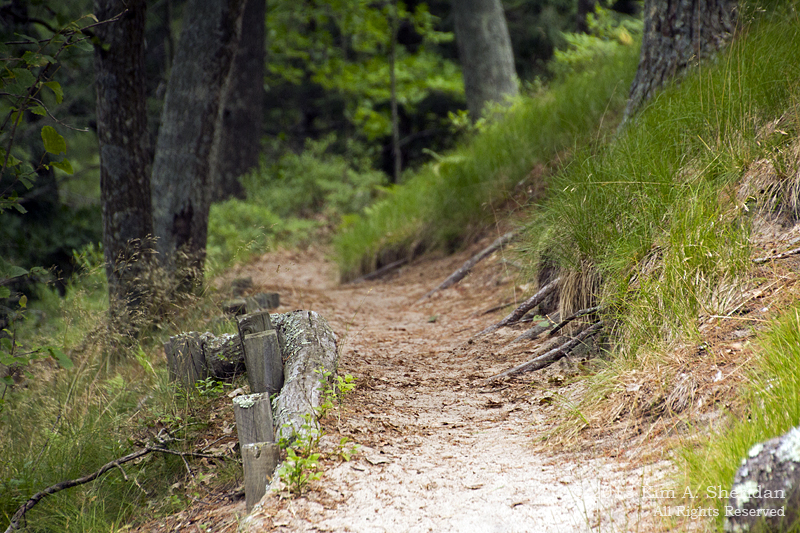
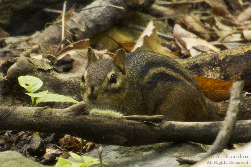
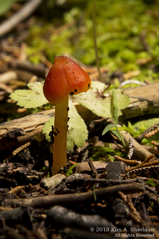
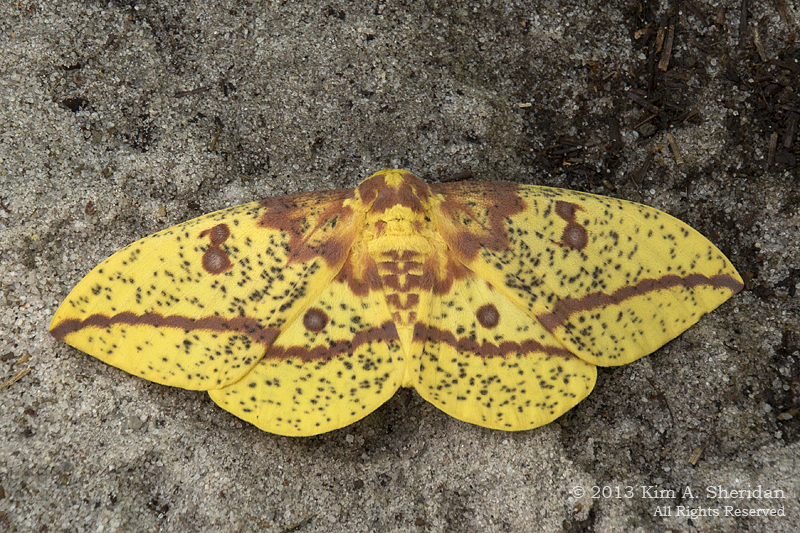
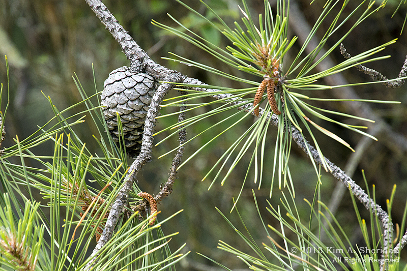
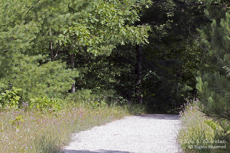
Within the park is the Mitchell Heritage Nature Trail. It’s a 2½ mile trail encircling a marsh, and just the thing to keep me out of trouble for a couple of hours. Or eaten alive, which was certainly my fear starting out. The trail began as a lovely walk through an old growth forest of maple, oak and pine. Turned out it was also home to gangs of marauding vampires in mosquito disguise. Knowing that I was headed for a marsh, I thought it could only get worse. Luckily, I was wrong; apparently these were strictly arboreal skeeters.

MI Mitchell SP_7201 a
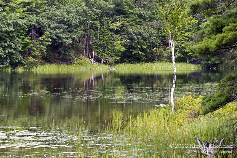
A brief meadow interlude, followed by a plunge into more woods just beyond.

MI Mitchell SP Flower_7242 a 
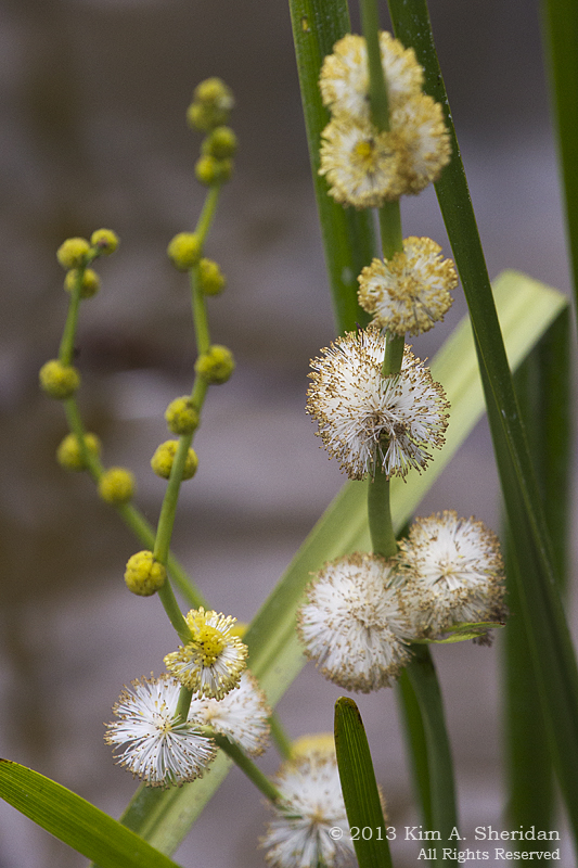
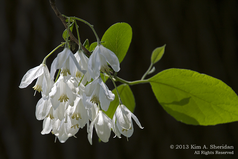
Buttonbush (Cephalanthus occidentalis.) A shrub that grows in marshes or on the edge of streams or lakes. It offers nectar to bees and butterflies, seeds for ducks and shorebirds and leaves for deer. Songbirds nest in the plant and small critters like insects, frogs and salamanders use it for cover. In other words, this is a friendly plant! (Thanks to Weed Warrior pal Mike for the identification.)

MI Mitchell SP_7239
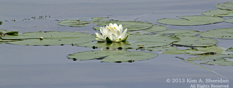
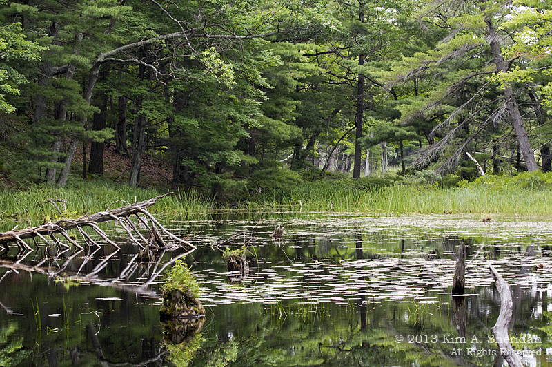
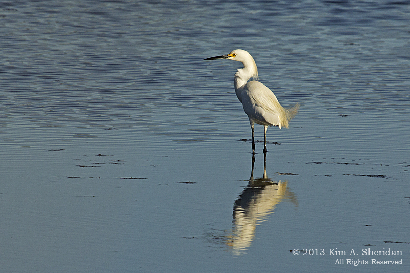
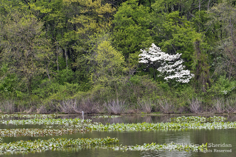
The observation deck offered a wide view of the marsh. From a distance it looks like a confusing tangle of green, doesn’t it? Look closely and you may see that there are dozens of different plants and shrubs here. Great habitat for wildlife. The Goldfinches sure loved it!

MI Mitchell SP_7264 a
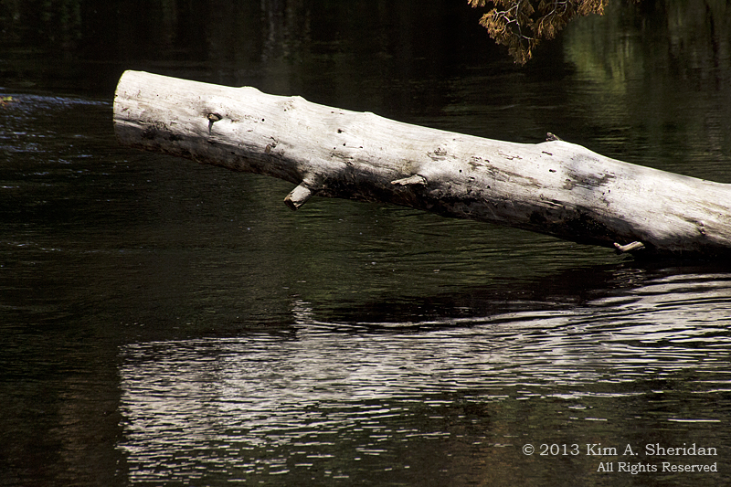
Outside the trail was a canal that reminded me of a castle moat. This was home to lots of turtles.

MI Mitchell SP_7246 a
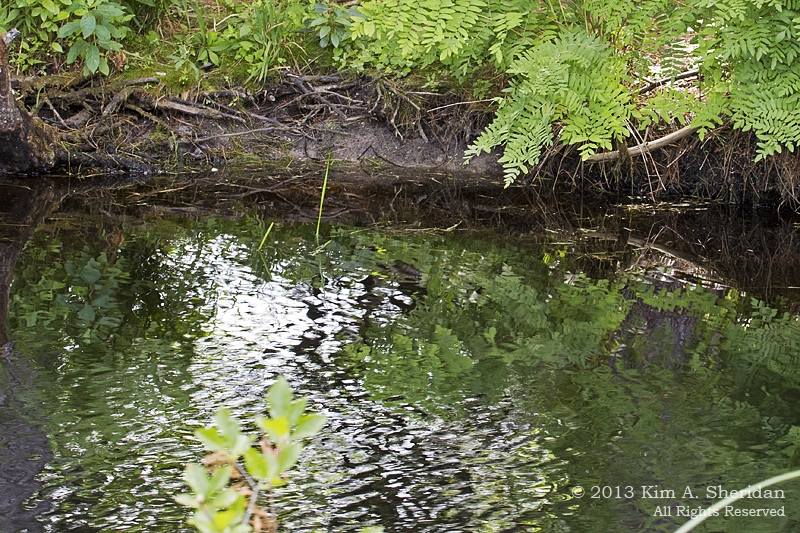
Ferns reflected in the dark waters of the canal.

MI Mitchell SP_7212 a

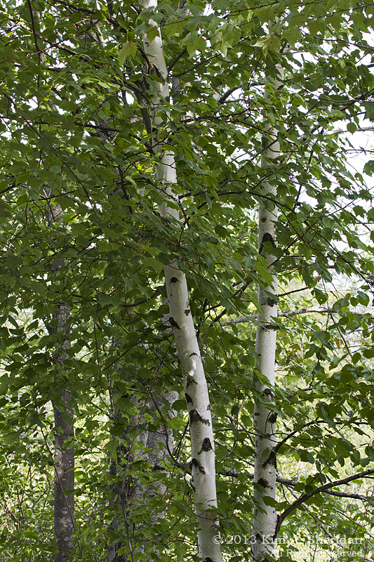
Birch trees. But of course.

MI Mitchell SP_7230 aFUN FACT: This is a secondary growth forest. The original forest of white pine was decimated by logging in the late 1800s, and fire after that. White birch is often called the “fire tree”, because fire exposes minerals that spur the growth of birches, and it’s one of the first trees to reforest a burned area. This is an older birch woodland that is already transitioning to a beech and maple forest.

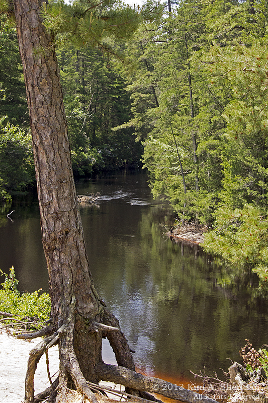
Young birch saplings often drew nourishment from the old pine stumps and grew up around them. Eventually the stumps would rot away underneath. These weird roots are the result!

MI Mitchell SP Lake Mitchell_7512 a2
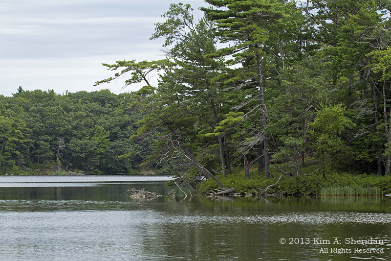
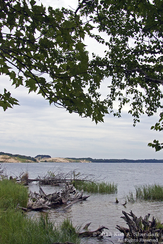
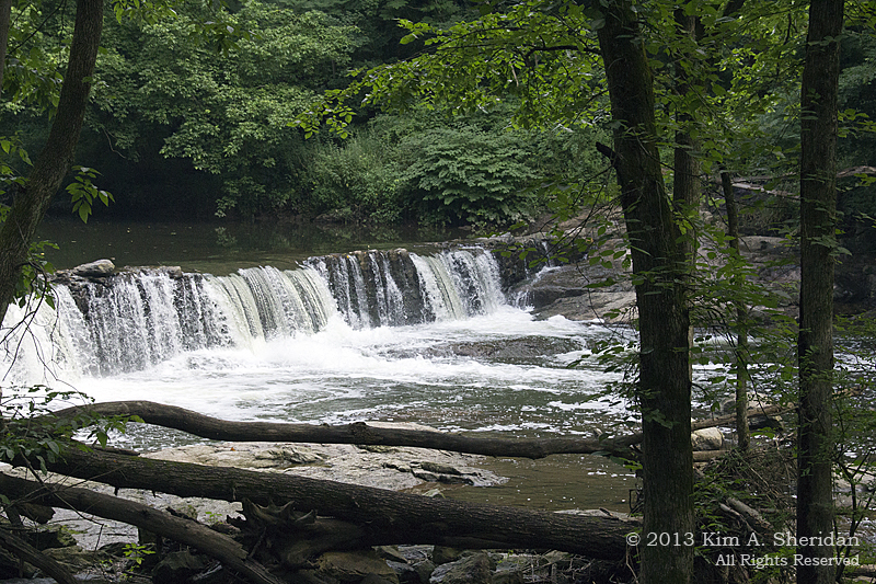
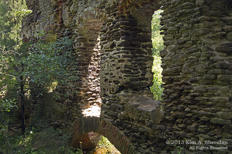
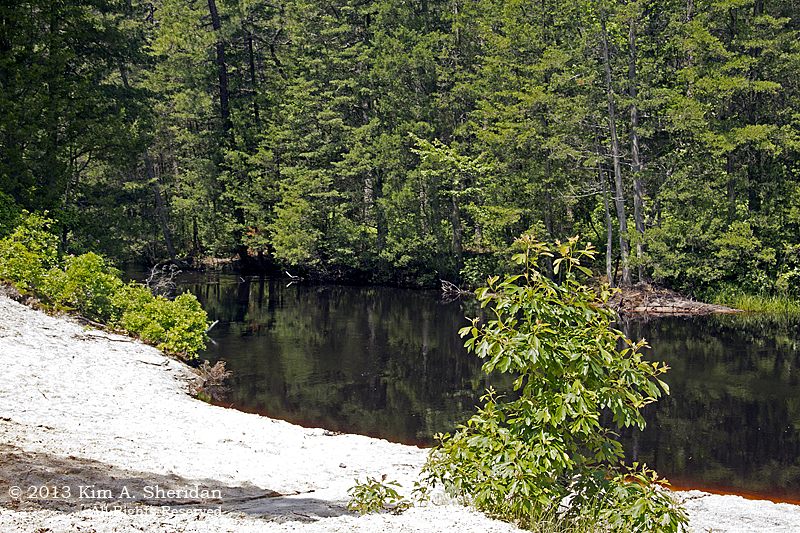
Back from the trail, at the more recreation oriented part of the park, here is Lake Mitchell (above), and the Clam Lake Canal (below.) The canal was built in 1873 to float logs between the lakes for the lumber industry, and is a third of a mile long.   MI Mitchell SP Lakes_7529 aMI Mitchell SP Lake Cadillac_7523 a
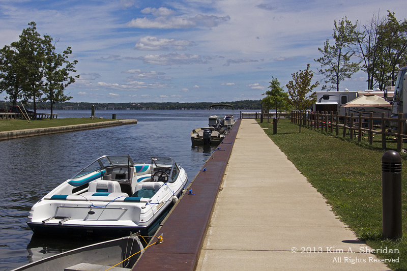
At the end of the canal, Lake Cadillac.
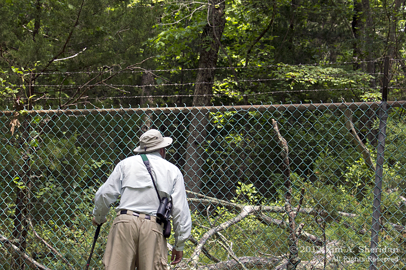
MI Mitchell SP_7378 aHappy trails!

Coming up: Back in Time: White Pine Village

Michigan’s Natural Heritage: The Ludington Dunes

MI Nordhouse Dunes Lake & Dune_5846 aMy dad told many fond tales of his boyhood summers spent on the shore of Lake Michigan. It sounded wonderful – lakes, beaches and forests – right up my alley. So when my California cousins invited me to join them at the family home in Ludington, Michigan, I jumped at the chance. This is the third summer they’ve opened their home and their hearts to me, and I’ve loved every minute of the chance to spend time with family. And, like my father, grandfather and great-grandfather, I’ve fallen in love with Michigan! During my stay, I’ve taken full advantage of the opportunity to explore the natural areas on the Northwest coast of Michigan’s Lower Peninsula. Of course, I’ve taken enough pictures to fill a multitude of blog posts. So we’d better get started!

Nordhouse Collage 2 This was the first year I got to the Nordhouse Dunes Wilderness Area north of Ludington State Park and Hamlin Lake. Lying within Manistee National Forest, the Lower Peninsula’s only federally designated Wilderness Area encompasses 3450 acres of forest, dunes and interdunal ponds and marshes. The dunes were formed nearly 4000 years ago and can range as high as 140 feet. The Ludington Dunes Ecosystem has the largest area of fresh water interdunal ponds in the world. So why is it that every pond I’ve seen between the dunes in the last two years has been dry? Drought has taken its toll, on the ponds and the critters that live in them.

MI Nordhouse Dunes Marsh_5826 aOn the way to the trail-head, I drove through Manistee National Forest along a gravel and dirt road. Along the way, I stopped to check out the marsh area of Hamlin Lake (above) and the pine woods surrounding it (below). Notice how the trees grow in straight rows close together. This is a pine plantation, an area of pines planted for reforestation after the original trees were cleared in the logging boom of the late 1800s. Naturally-growing forests don’t look like this.MI Nordhouse Dunes Tree & Trail_5833 a

The trails through the Wilderness Area are legion, and as they say, “minimally signed.” Meaning, there are NO markers. Navigation even with a map is tough, as there are numerous social trails and wildlife paths not shown on the map. I tried to take the one trail that had trail markers, only to come to an intersection of four trails where the only marker pointed back the way I came! So, I obeyed it, and went back the way I came. Never let it be said I don’t do what I’m told.

MI Nordhouse Dunes Lake & Dune_5838 aMI Nordhouse Dunes Tree & Trail_5883 aMost of my hike went along a trail that paralleled Lake Michigan, along a wooded ridge above the lake. This was easy to follow without getting lost, and offered some great “peek-a-boo” views of Lake Michigan (above). At the edge of the trail, the side of the ridge dropped steeply away to the dunes 100 feet below. Not the place to search the treetops for birds while you are walking! Birch trees are numerous among the hemlock, beech, maple and pine trees of the forest. Birches are my all-time favorite tree; I can’t resist photographing their beautiful white trunks again and again.

MI Nordhouse Dunes Mushroom_5869 aI’m sure I saw a tiny fairy peek out from under the cap of this mushroom. Didn’t you?

MI Nordhouse Dunes Tree & Trail_5926 aThe Road goes ever on and on…

Ludington Collage 3Ludington State Park is nearly 5300 acres of sand dunes, ponds, wetlands and forests on a strip of land between Lake Michigan to the west and Hamlin Lake to the east. It’s a popular place for boating, fishing, swimming and camping. The black and white striped Big Sable Lighthouse stands guard at Big Sable Point and offers a wonderful view of the dunes, woods and lakes to those who climb it, as I did last year. The eight trails winding through the varied habitats of the Park are what keep drawing me back year after year. This year I tackled the Lost Lake and Island Trail, which follows a wooded sand dune ridge along Lost Lake before turning toward Hamlin Lake and returning through marshlands over a series of small islands.

MI LSP Lost Lake-Island Trail_5992 aLost Lake (above) and water lily (below).MI LSP Lost Lake-Island Trail Flower Tree_6467 a

Views of Lost Lake. MI LSP Lost Lake-Island Trail_6188 a MI LSP Lost Lake-Island Trail Flower Tree_6037 a

MI LSP Lost Lake-Island Trail Flower Tree_6196 aMI LSP Lost Lake-Island Trail Flower Tree_6175 aMI Ludington SP_6257 a2Hamlin Lake is man-made, created in 1856 as a holding pond for logs awaiting processing at Charles Mears’ sawmill. Subsequent dam collapses wiped out the village of Hamlin, and the lumber mill closed. But the lake was becoming popular for recreation, and a new dam was built in 1914. The shoreline is dotted with old tree stumps, often with grass or tiny trees growing on them (above). Nature’s version of gardening in miniature. It amazes me where things will grow.

Sand dunes line the shore of the Hamlin Lake (right).

See? I can’t resist birch trees. Here’s why – white tree, green leaves, blue water. Can’t you just feel the breeze brushing your face here in the shade?MI LSP Sable River Trail_7179 a

Coming up: Michigan’s Natural Heritage: Cadillac Marsh

Independence Day II: A Morris Mosaic

2 Morris Plant_4809 aAfter our ramble through the Wissahickon, and lunch in an air-conditioned restaurant, my friends and I were refreshed enough to take on the Morris Arboretum in Chestnut Hill.

Originally a summer estate, it became part of the University of Pennsylvania in 1932.Besides a wealth of trees, plants and flowers, every summer the arboretum hosts a wonderful garden railway. In addition, this year it is also hosting the BIG BUGS! exhibit. Arboretum Collage White2 Morris Plant_4854 aBug CollageMorris Arboretum_6487 aTrain CollageMorris Arboretum_6769 a

Coming up: Natural Abstraction

Independence Day I: Wissahickon Wanderings

or

What I Did On The Fourth of July

1 Wissahickon_4690 aThis year ranked as one of my more unusual Independence Day holidays. Several Refuge friends and I went exploring in Fairmount Park and then the Morris Arboretum.

Fairmount Park in Philadelphia is the one of the largest urban park systems in the US, and spreads throughout much of the city. The 1800 acre portion along the Wissahickon Creek, known as the Wissahickon Valley, is actually a gorge, with the wooded slopes rising nearly 200 feet above the Creek. It’s as close to wilderness as one could be in a big city.

Our primary goal here was to see the Thomas Mill Road Covered Bridge. To reach it we took a long, easy walk down Forbidden Drive.

1 Wissahickon_4480 aKids swimming in the Creek. It was hot and humid, and later in the day I really wanted to join them.

1 Wissahickon_4487 aOne of the remnant dams along the Creek. The dams supplied water to run the waterwheels of the lumber, paper, and grist mills that once populated the Valley.

Wissahickon Valley Chipmunk_4533 acs  “Oh look – lunch!”

1 Wissahickon_4500 acsTrail art, by humans.

ButterfliesI spent some time trying to persuade at least one Eastern Tiger Swallowtail butterfly to be still long enough for a picture. Didn’t have much luck.

1 Wissahickon_4570 a More trail art. Courtesy of Mother Nature this time.

When you walk anywhere with the botanically-inclined, you can expect frequent discussions on the identity of this or that plant. Here’s Robb (in orange) and Jeff arguing, ahem, discussing the identification of a tree.Jeff & Robb“This tree over here?” “No! THAT tree over THERE!”

1 Wissahickon_4545 aReally cool old building, originally part of a nearby mill, but rebuilt by the Works Projects Administration (WPA)  in 1938. They were used to shelter the Fairmount Park Guards who once patrolled the park.

1 Wissahickon_4710 1 Wissahickon_4719 a Ahhh! At last! The Thomas Mill Road Covered Bridge.

It was built in 1737, and restored by WPA in 1938. It’s the last covered bridge in the Valley, and the only covered bridge in a major U.S. city.

There’s something picturesque about a covered bridge. I think it’s the play of red against the green foliage.

Aren’t all covered bridges red?

Here’s Don, looking every bit the bold explorer, in front of the bridge.covered bridge acs

We crossed over the Creek here, and came back to Valley Green via the trail. A totally different walk. Where the Forbidden Drive was wide, the trail was narrow; where it was flat, the trail climbed sharply up and down; where the Drive was crowded with bikers and runners and horses, the trail was – well, not empty, but certainly less crowded.

Our goal along the trail side of the Wissahickon was “The Indian”. The Valley was once the home of the Lenni-Lenape people. In 1902, after they were long gone, a 15 foot high sculpture was erected in their honor. It depicts a Lenni-Lenape warrior, kneeling and shading his brow as he watches his tribe depart from the region. Of course, the artist couldn’t be bothered to differentiate among the traditions of the various Native American nations that lived here. Which is why an Eastern Woodland Indian is wearing a Western Plains Indian headdress.

On the Forbidden Drive side we’d come upon a sign marking the Indian statue, placed high up on the far bank of the creek.  The only trouble was, we couldn’t see the statue for the trees.

With the help of some other trekkers, we found the pathway to the Indian.This was a short but tough trail that went straight up; you get some idea of the steepness of the Gorge from this set of stairs. We found ourselves below the base of the statue. This was a great view, and I wanted a great shot, but as you can see but I blew the focus. Oh, well, I will just have to go back.Indian collageUp at the top we got a perspective I am quite familiar with from my wildlife photography – the rear end. Here you can see that the statue is slightly more than two Robbs high. And since the Indian’s kneeling – well, that’s one big Indian.

Leaving our friend, we discovered a much easier path back down to where the main trail awaited. Wish we’d known that before!  From here back to the car, the trail got tougher, as we needed to clamber over roots, tree trunks, rocks and even small streams. A couple of times I found it easier to slide on my bum. Eventually we made it back to Valley Green, where another adventure awaited – finding a restaurant that was open on the Fourth of July.

1 Wissahickon_4471 aMy dad grew up very close to the Wissahickon Valley in the 1930s and ’40s, and spent a lot of time there. And told me a lot of tall tales from his boyhood. This first visit just made me more determined to see more of the area he knew so well.

Coming up: Independence Day II: A Morris Mosaic

Photo of Don courtesy of Robb Kerr

Historical information courtesy of the Friends of the Wissahickon  http://www.fow.org/about-park

Pine Barrens Ramble: Into The Woods

Pine Barrens Marthas Furnace_3343 aSo what is the Pine Barrens anyway, and why is it barren?

Pine Barrens Harrisville_3340 aThe Pine Barrens is a vast area in the southern New Jersey coastal plain, sandy and heavily forested. It was called “barren” by early European settlers, who found that the crops they planted wouldn’t grow there because of the acidic, sandy soil. The area is by no means an ecological desert. Oak and Pitch pine thrives there, including the rare pygmy Pitch Pine, and there are orchids, carnivorous plants and numerous other plant species. Amongst the forest are boggy wetlands, and tea-colored rivers. Here too are blueberry and cranberry growers, ghost towns, and preserved historic villages.

Like Batsto, which I visited with friends not long ago. Our intention had been to take a guided nature walk led by a friend of Don’s, but we arrived to find it had been cancelled. So we went exploring on our own.Pine Barrens Harrisville_3295 aThese are the ruins of the paper mill at Harrisville, one of many ghost towns dotting the Pine Barrens. Most of it is enclosed with chain link fence. While Ned and I were figuring out how to shoot over the fence, Don and Robb found another vantage point. (Wink, wink) There was just one wall left standing – but it was a really cool wall!Pine Barrens Harrisville_3314 aWe then decided to take the trail to Martha’s Furnace ourselves. Why, is anyone’s guess, as you’ll see in a minute. The trail was my first taste of hiking in the Pine Barrens. The sand road wound through a forest of predominantly pitch pine. The soft white sand is known as “sugar sand” for its consistency. I could hear lots of birds, but didn’t have much luck seeing them in the dense trees. And no bears!Pine Barrens Marthas Furnace_3359 aWe did find an Imperial Moth (above) that was so still, the boys mistook it for a leaf. Then they thought it was dead. (It wasn’t.) We also spent some time with a Fowler’s Toad, (below) wearing Toad Army camouflage. I was the one to find both of these creatures; maybe my wildlife spotting skills are improving.Pine Barrens Marthas Furnace_3426 a

Pine Barrens Marthas Furnace_3371 a

Pine Barrens Marthas Furnace_3397 a2At a couple of points the road ran down to the Oswego River. Definitely my favorite part of the trip. The dark brown water gets its color from tannins from the cedar tress combining with iron in the ground. Looks like you are canoeing in a tea cup!

Martha is another ghost town, this time centering on a bog-iron furnace. Years ago the state surveyed the ruins, and then buried it and fenced it in. So, of course, when we got there, there was nothing to see but a mound of dirt covered with weedy shrubs and trees inside a fence.

Actually, if the scheduled walk had happened, we’d have had a knowledgeable naturalist to show us numerous interesting plants and critters. It was never really about Martha itself.

Pine Barrens Marthas Furnace_3439 aHere’s Don trying to figure out why we came. Well, the walk was nice.

Even on our own, my first taste of the Pine Barrens whetted my appetite for more.Pine Barrens Marthas Furnace_3395 Conservation Piece: In 1978, the Pine Barrens became the country’s first National Reserve, when 1,100,000 acres was designated the New Jersey Pinelands National Preserve.  The area comprises most of seven counties, three state forests, and two National Wild and Scenic Rivers. The Reserve was created to protect not only the natural beauty of the area, but its history, folklore, and unique culture. The place continues to be largely rural, and may be the closest New Jersey gets to “wilderness”.Pine Barrens Marthas Furnace_3382 a

Coming Thursday: The Stars and Stripes Forever

Cape May Potpourri

CM Point SP Bluebird_9640 aEarly in May, a friend and I went to Cape May in search of migrating warblers. First stop: Cape May Point State Park. Surprisingly, we had no luck in the warbler department, although we got this obliging Eastern Bluebird to pose for us.

CM Higbee Beach Towhee_9902 aCM Higbee Beach_9823 a

Our next stop was Higbee Beach WMA, along the Delaware Bayshore. This is a wonderfully confusing tangle of woods, meadows, dune scrub and beach. We got lost at least twice. It was worth it though, as we did find the warblers we’d been seeking, as well as this Eastern Towhee (above). Flowering trees drew swarms of bees, but I was more bothered by the jumbo mosquitos. Some of them were bigger than the birds!

CM Thompsons Beach Rail_0160 comboNext up: Thompson’s Beach, further north along Delaware Bay. Our sole purpose here was to see the elusive Clapper Rail. We searched first from the observation deck at the end of the road, then took a long walk out to the beach and back. For the duration of our trek we could hear the constant laughing call of the bird, but we didn’t spot a single Rail. Finally back at the deck we saw one, who gave us a good look while he was preening. Imagine my joy when my camera suddenly declared “Card Full”… Fortunately I came away with one good shot. Here you can see why they’re so hard to find (above). Not only do they blend in so well, they are usually are deep in the grass.

CM Matts Landing Rookery_3189Our last port-of-call was Matt’s Landing Road at Heislerville WMA. There’s an island there covered with trees – and Cormorants. And Egrets. And Herons… Basically it’s a rookery, a place for birds to roost and nest. I was happy not to be too close – I can only imagine the smell. CM Matts Landing Night Heron_3291 acsOn the drive around the impoundment we spotted this Black-crowned Night Heron (above) in a tree, and a Snowy Egret in the wonderful evening light. CM Matts Landing_3339 Egret a

FUN FACT: The male Eastern Bluebird chooses the nest site, in tree cavities or nest boxes. He entices the female to nest there by displaying and carrying nesting material in and out of the hole. That’s it! The rest is up to her – building the nest, and incubating the eggs. She keeps him around though, as pair bonds last for several seasons. A male will defend his nest sites against any bird he considers a threat, so maybe he’s good for something after all!CM Point SP Bluebird_9657 a

Coming soon: Ready or Knot

The Buds and the Bees

HNWR Crabapple with Bee_9593 a

Ha! You thought I would say “The Birds and the Bees”, didn’t you? Believe it or not, I do take photos of things besides birds. Herewith, a sampler of Spring Flowers and their Friends.

HNWR Dogwood_0569 acsHNWR Crabapple_9468HNWR Yellow Iris_9488 a Dogwood, Yellow Iris and Crabapple blossoms at Heinz NWR. Of all the flowering trees, I think I like the Crabapples the best. What’s missing from these photos is the wonderful aroma that wafts over you as you pass near them.

Macro Flower_3432 aA simple Dandelion in my yard, when I was playing with my macro set-up. I should have picked it long before it got to this point, but then I wouldn’t have been able to take its picture. Oh, well, more dandelions for me to photograph in the future!

Longwood_9329One day we went to Longwood Gardens. These are just some of the wonderful blooms we saw. And no, I don’t know all their names.

Longwood_9402 Longwood_9342  Longwood_9319Longwood_9294

HNWR Crabapple with Bee_9584 aFlowers need pollinators to reproduce, and here are a few busily at work in Crabapple and Wisteria.


Longwood Bee_9257

It’s not at all unusual for me to get photos of the back end of critters. I guess you could say I’m often a little bee-hind.

FUN FACT: There are nearly 4,000 species of native bees in North America, at least 50 of which are bumblebees. This does NOT include the honeybees, which are non-native, having been imported from other parts of the world for pollination and honey production. One way bumblebees extract pollen is by a process called “buzz pollination.” The familiar buzzing of bumblebees is produced by the vibration of flight muscles, which in turn shakes the pollen out of the flowers. Pretty clever.Longwood Bee_9262 a