Sealed With A Kiss

ANNOUNCER: Good evening. You’re listening to 99.9 KRTR, Critter Radio, and this is Earth Rise, the talk show that teaches. Please give a warm Critter welcome to your host, Gary Gullagher. [muffled sound of paws, flippers and wings clapping]

GARY GULLAGHER: Hello, hello! Greetings to everyone out there in Critter Land, and welcome to Earth Rise. I just flew in from L.A., and boy, are my wings tired. [audience groans] Hey, did you hear the one about the Mafia mussel who got caught by the police? When they tried to question him, he just clammed up! [audience boos]

Wow, this is a crabby crowd!

I have just the guest to cheer you up. Sir David Fattenblubber, nature documentary filmmaker extraordinaire, is here to talk about his latest film, Sealed with a Kiss, about the celebrities of the winter beach – the Harbor Seals! As a special treat, I understand he’s brought along some stills from the film. Sir David, welcome!

SIR DAVID FATTENBLUBBER: It’s an honor to be here!

GARY: Sir David, you’ve made dozens of award-winning documentaries, yet this is the first time you’ve turned the camera on your own species. So, tell a little bit about yourself.

SIR DAVID: Well, we’re Harbor Seals, Gary.

GARY: Oh, gotta love that dry seal humor! While we’re looking at some stills, tell us more about harbor seals, please.

Continue reading

A Woodland Surprise

161126_nj-hartshorne-woods_6537acsIt started as a typical walk through the woods. After all, the word “woods” is in its name: Hartshorne Woods Park. So we weren’t too surprised to find ourselves walking through a woodland that felt all too familiar.

My friends and I had come to the northernmost tip of the Jersey Shore on Thanksgiving weekend specifically to visit Sandy Hook and the Twin Lights of Navesink. These were places we’d not been before, places with a different flavor than the southern Jersey coast. A visit to nearby Hartshorne Woods, a small Monmouth County park, wasn’t on the original itinerary. Heck, we didn’t even know it existed until we arrived in the area. A short morning walk there was mostly a way to kill time until Sandy Hook Light opened for tours in the afternoon.

It ended up being the highlight of the day.

161126_nj-hartshorne-woods_6656acsNot for the woods, though they were nice enough. We hiked down, up and back down steep hills, more akin to our native Piedmont than the Atlantic Coastal Plain.

The maple, oaks and hickories were still adorned in a smattering of gold and russet, set off by the dark green of abundant American hollies.

161126_nj-hartshorne-woods_6558acsThe first glimpses of blue water through the trees tipped us off: this was NOT a typical Piedmont walk. The trail traveled along the top of a bluff overlooking the Shrewsbury River. Beyond the river lay a narrow spit of land, the town of Sea Bright, and the Atlantic Ocean. Nope, don’t see that in Pennsylvania!

161126_nj-hartshorne-woods_6549acsA little further along, the Navesink River joins the Shrewsbury. By this time, we were actively seeking a way to get down the hill to the water. If we are anywhere near water, we want to be at its edge. Not up above it.

The bluff was too steep to brave a descent. We continued along the trail until we came to a green lawn that sloped downhill –  to the pier and boat launch of Black Fish Cove. Ah, much better.

161126_nj-hartshorne-woods_6582acsOnce on the beach, the walk suddenly became much more interesting.  All thoughts of completing the 2.3-mile Rocky Point Trail loop were quickly abandoned in favor of exploring along the river’s edge. With views like this? The beach beckoned.

161126_nj-hartshorne-woods_6593acs-copyGolden leaf on sand. Seems a strange juxtaposition to me. Should be either beach, or woods, not both. That’s a South Jersey conceit, though. There are many wonderful places where the two habitats play nicely with each other.

161126_nj-hartshorne-woods_6620acsHere the boundary between woods and beach was quite dramatic. A tall cliff loomed, topped by towering trees that clung to its edge, their roots exposed for all to see.

Don, for scale, risking life and limb under a widow maker tree.

161126_nj-hartshorne-woods_6626acsThe view upriver. The sand was yellowish, picking up the strange ocher tones of the exposed soil above the beach.

161126_nj-hartshorne-woods_6697acsWe ventured downriver, picking our way over fallen branches and trees. There’s only so much erosion a tree can take before it loses its grip and falls. The beach widened, covered in cordgrass and phragmites and cottony groundsel trees. Pathways to the water led us to troves of mussels.

161126_nj-hartshorne-woods_6699acsAt the water’s edge. Weathered white driftwood was everywhere. I wanted to take it all home and decorate my house with its silken beauty. But no – best to leave it where it lies for others to enjoy.

161126_nj-hartshorne-woods_6683acsUnder the water, a bed of pebbles and shells. And what is this on the largest of shells? “A tube worm,” I said, not sure why I thought so. “NO!” said Robb. “It’s not a tube worm!”

Well, guess what? It is a tube worm – or rather the tubes that tube worms used to live in.

FUN FACT: Tube worms are invertebrates in the class Polychaeta. They are sessile animals, meaning they are anchored to a hard surface underwater. Once its tail is anchored, a worm secretes a calcium carbonate substance that hardens into a whitish tube. The worm can retreat into this shell completely. It cannot survive for long outside of the tube. Tubes of some species of polychaeta worms are long and snakelike; other species coil into a spiral.

All too soon, we came to a place where the beach ended, where there was nowhere else to go but up. Up, using exposed tree roots as hand holds and steps. Up, along the Rocky Point Trail. Up, through the hilly woods and back to our car.

161126_nj-hartshorne-woods_6607aNever again will I take for granted a simple walk in the woods.

The Twin Lights of Navesink

161125_nj-gateway-nra-sandy-hook_6105acsSeafaring is a dangerous business. Be they sail or steam, passenger or cargo, many ships have gone down along the Atlantic Coast over the centuries. Powerful storms and strong, tricky currents make navigating harbors a challenge that in darkness is nigh unto impossible.

Which is why man made lighthouses.

Towers topped with bright lights visible for miles dot the coasts and Great Lakes of North America. Sandy Hook Light has guarded the southern entrance to New York Harbor since before the American Revolution. In 1828, help arrived: the Navesink Highlands Light Station, otherwise known as the Twin Lights.

161125_nj-gateway-nra-sandy-hook_6154acsThe name says it all – there are TWO lights to this light station. Rebuilt of local brownstone in 1862, the towers are linked by keeper’s quarters. They stand 64 feet high atop a 200’ hill overlooking the Shrewsbury River.

161125_nj-navesink-twin-lights_6368acsThe two towers are different shapes, the North being octagonal and the South square.

At night, the two beacons, one fixed and one flashing, were easy to distinguish from the light at Sandy Hook.

They were also easy to see. The Twin Lights were the first in America to use the revolutionary Fresnel lens design, when two of these beehive shaped lights were installed in 1841.

161125_nj-navesink-twin-lights_6223acsThe South Tower’s beehive light was replaced in 1898 with an electric-arc bivalve lens. This light could be seen 22 miles out to sea, the brightest light in the U.S. at the time. It was so bright the North Tower light was taken out of service.

161125_nj-navesink-twin-lights_6248acsIn 1941 Navesink Light Station was decommissioned and extinguished.

161125_nj-navesink-twin-lights_6316aThe 9’ bivalve lens needed its own generator to power it. Today that lens is on display in the Electric Power Station building.

161125_nj-navesink-twin-lights_6309acsClose up of the bivalve light.

161125_nj-navesink-twin-lights_6254aThe front of the building that connects the two lights. The battlements along the roof and the towers at each end give the Twin Lights a fortress-like feel.

161125_nj-navesink-twin-lights_6268acsThe cannon adds to the ambience. On clear days the New York skyline is visible from the Twin Lights site. So is the Statue of Liberty, according to Robb.

161125_nj-navesink-twin-lights_6360acsThe view from the top of the North Tower.

161125_nj-navesink-twin-lights_6335acsThe South Tower and the Shrewsbury River.

161125_nj-navesink-twin-lights_6349acsLooking across to Sandy Hook. The first demonstration of Marconi’s wireless telegraph took place here in 1899, at the America’s Cup yacht races off Sandy Hook.

161125_nj-navesink-twin-lights_6375aThe North Tower.

Now a National Historic Landmark, this life-saving light station reminds us of the years it stood watch over the harbor, its beacons a comfort to all who passed.

161125_nj-navesink-twin-lights_6338acsThe Twin Lights of Navesink.

Sandy Hook to the Rescue

161125_nj-gateway-nra-sandy-hook-light_6510acs

HOEK (Dutch): Corner, angle; spit of land.

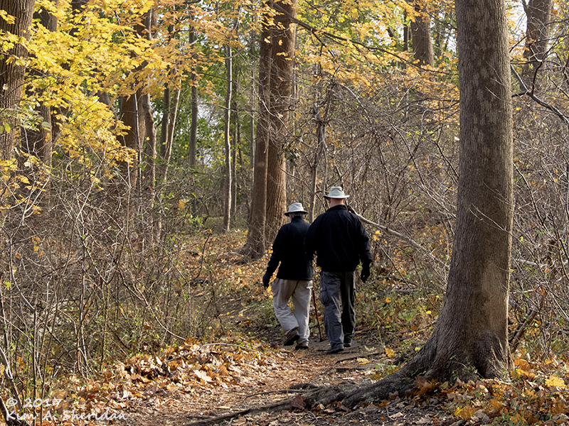
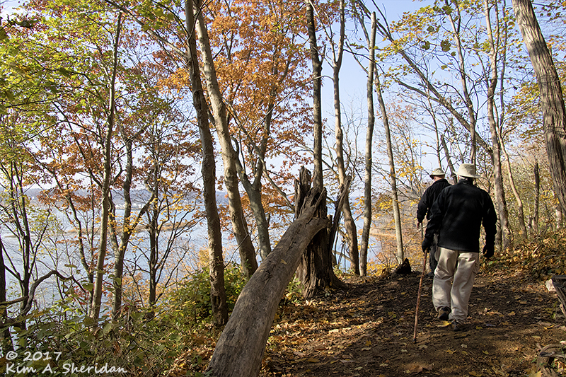
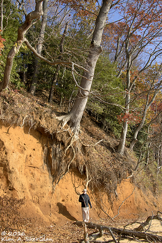
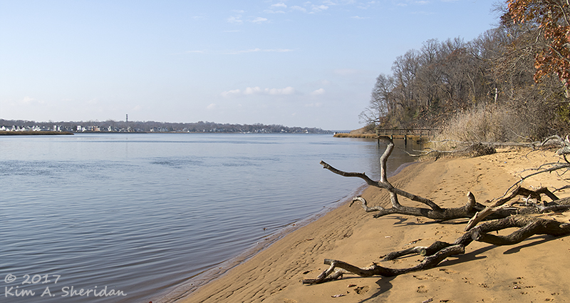
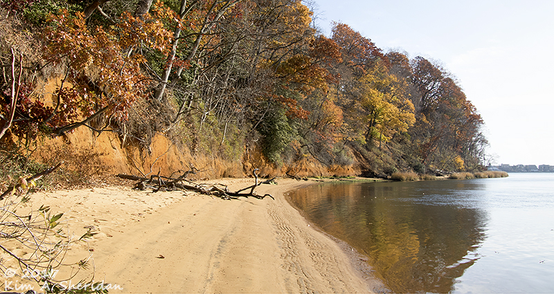
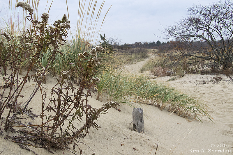
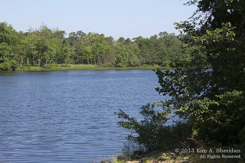
The long spit of land known as Sandy Hook, comprised of beaches, dunes and maritime forest, is a recreational wonderland. It serves a higher purpose, though. For centuries the spit has guarded the entrance to New York Harbor. The peninsula, owned by the federal government since 1814, has long been essential to the safety of mariners and the defense of New York. There’s a lot of history resting on the shifting sands of Sandy Hook!

161126_nj-gateway-nra-sandy-hook-lifesaving-station_6768acs
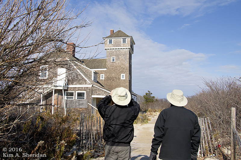
New York Harbor is one of the busiest in the nation. Seafaring is always treacherous, and many ships foundered off the Jersey Coast. In the 1870s, the U. S. Life-Saving Service was established, to watch the coast and rescue stranded seamen. Life-saving stations like this one were built along the coast. Spermaceti Cove Station No. 2, built in 1894, housed a six man crew of “surfmen” and their rescue equipment.

161126_nj-gateway-nra-sandy-hook-lifesaving-station_6815acsThe Spermaceti Cove station was used by the Life-Saving Service and subsequently by the U.S. Coast Guard until the 1940s. It has served as the Visitor Center for the Sandy Hook unit of Gateway National Recreation Area since the 1970s. Damaged in Hurricane Sandy, it’s now closed, to our deep disappointment. We could only admire the old girl from the outside.

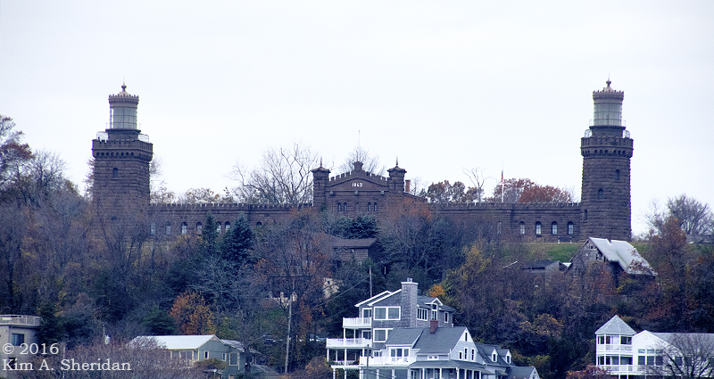
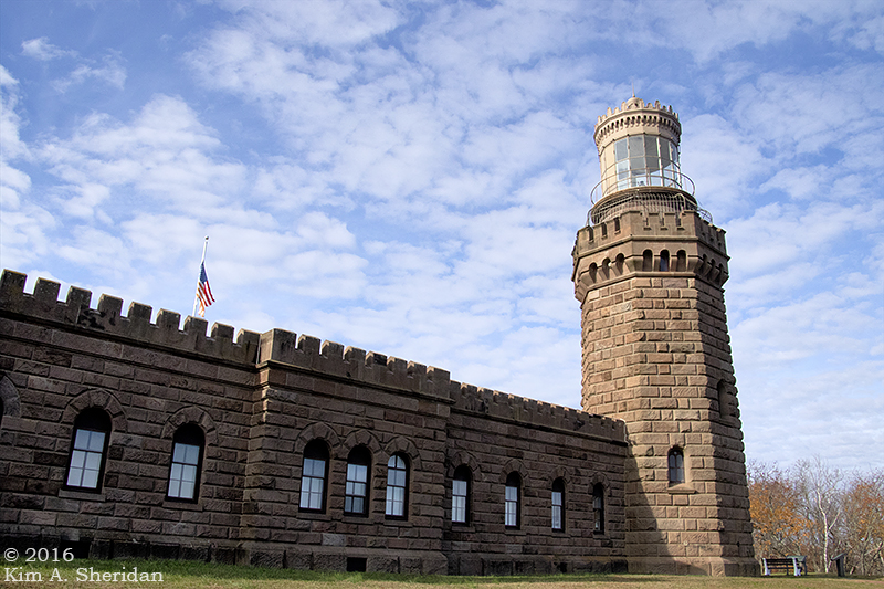
Also guarding the harbor is the Sandy Hook Light.

161125_nj-gateway-nra-sandy-hook-light_6506acsFirst lit in 1764, it was captured by the British in 1776, withstood an American attack, and was held until the end of the Revolution.

161125_nj-gateway-nra-sandy-hook-light_6497acs
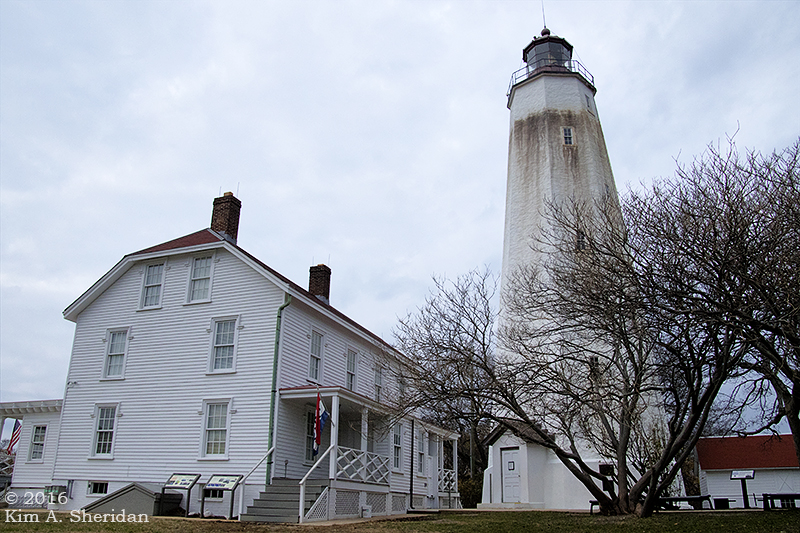
The Lighthouse Keeper’s Quarters now standing on the site was built in 1883. It also saw life as a U.S. Life-Saving Station.

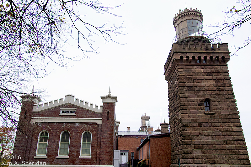
Sandy Hook Light is still in operation 24 hours a day, using an automated, fixed 3rd-order Fresnel lens. When it was built in 1764, water lapped the shore just 500 feet away. The light now stands a mile and a half from the tip of Sandy Hook.

161126_nj-gateway-nra-sandy-hook-light_6894acsWe took advantage of a chance to climb the 103’ tower. Along the way, deep set windows gave peek-a-boo views of Fort Hancock below.

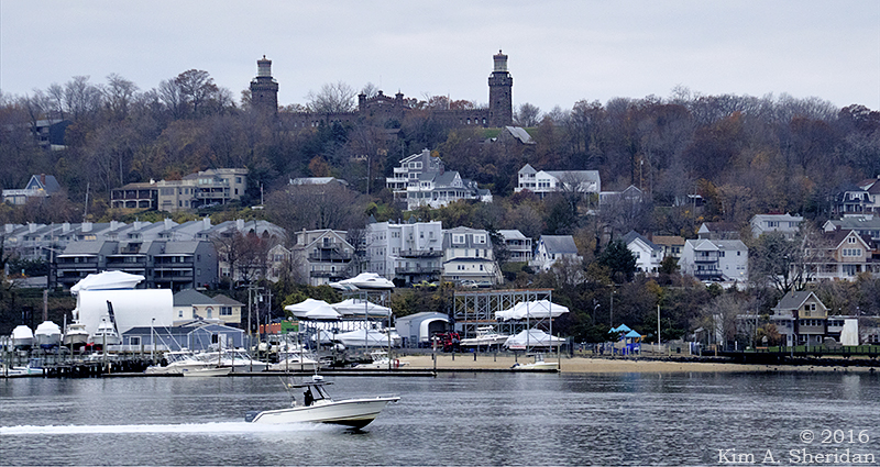
Sandy Hook’s location at the mouth of New York harbor made it the perfect place to build a fort to defend the harbor and New York City.

A wooden fort called Fort Gates served during the War of 1812. Fort Hancock replaced it in the late 1800s.

161126_nj-gateway-nra-sandy-hook-light_6902acsA view of Fort Hancock from the lighthouse. This is Officers Row, a group of yellow brick residences. Enlisted men lived in barracks and a small village of supporting buildings sprouted up over the years. The population of Fort Hancock peaked during World War II at nearly 12,000 military personnel.

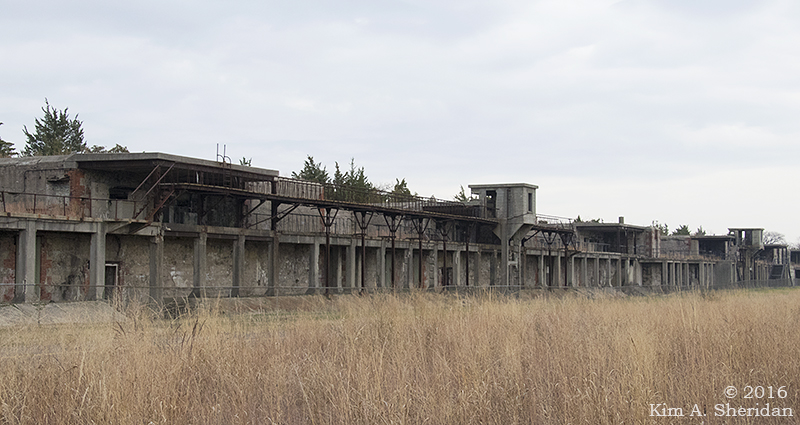
Much of the fort’s defenses centered on concrete gun batteries using the most powerful cannons of the day. After WWII, the fort’s mission shifted to an array of Nike air defense missiles. At the end of 1974, Fort Hancock was officially decommissioned. It now is part of Gateway National Recreation Area.

161125_nj-gateway-nra-sandy-hook-fort-hancock_6402acsFort Hancock’s Nine-gun Battery.

161125_nj-gateway-nra-sandy-hook-fort-hancock_6419acsThese old gun batteries were quite picturesque, in a moody sort of way.

161125_nj-gateway-nra-sandy-hook-fort-hancock_6485acsBattery Peck.

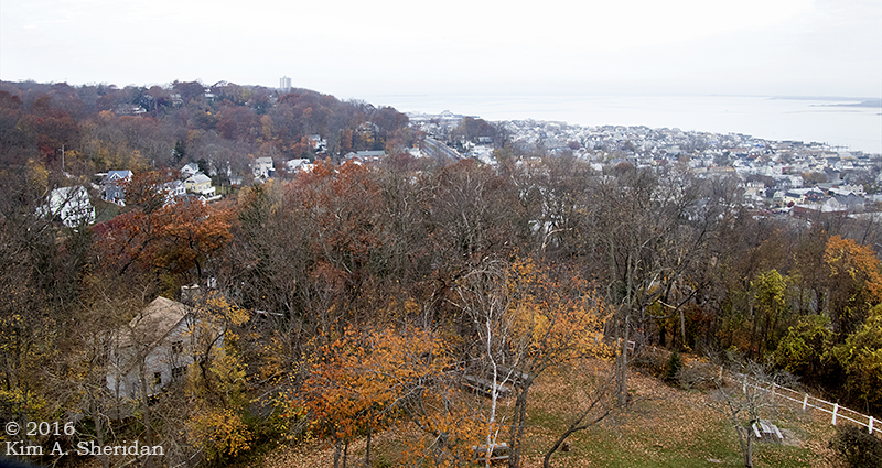
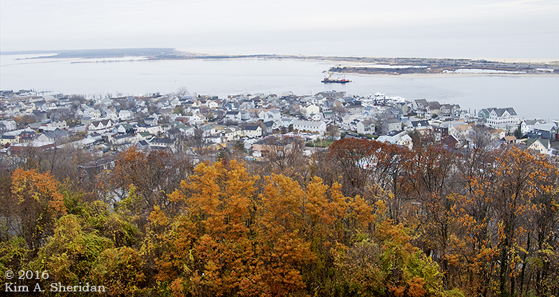
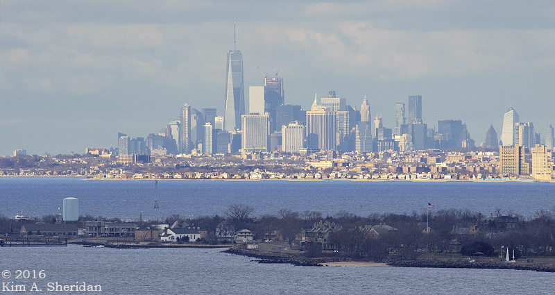
Near Sandy Hook, in Atlantic Highlands, is Mount Mitchill Scenic Overlook. Perched at 266’, the highest natural elevation on the Atlantic Coastal Plain, it offers sweeping vistas of Sandy Hook, Raritan Bay and New York City. You get a feel for the strategic importance of Sandy Hook to the defense of New York and the safety of seamen traveling into the harbor.

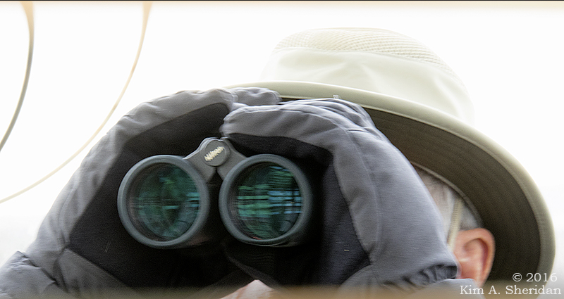
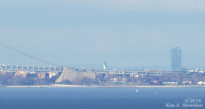
Throughout the weekend, from every high point and lighthouse, we searched for the Statue of Liberty. Throughout the weekend, from every high point and lighthouse, Robb claimed to see her.

Atop the Sandy Hook Light,  Robb declared that he could see the Statue. Again,

161126_nj-gateway-nra-sandy-hook-light_6945aDon was skeptical. She never seemed to be where Robb said she was.

After two days of following Robb’s guidance, to no avail, I sought the aid of other visitors to Mount Mitchill. Within minutes, thanks to them, I had found what I was looking for.

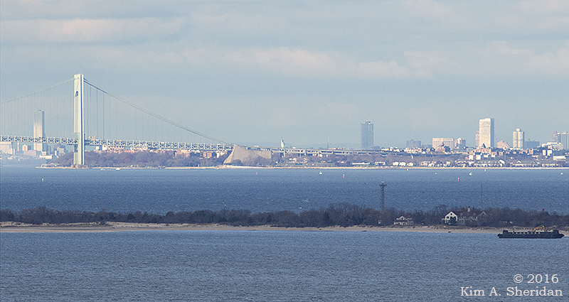
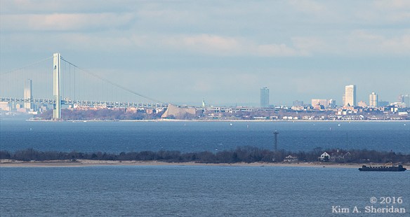
At last! Lady Liberty! Let’s zoom in…

161126_nj-mt-mitchill-overlook_7002acs2There she stands, the symbol of freedom, the symbol of welcome to all who come to our beautiful land.

And guarding her flanks, Sandy Hook, ever vigilant.

Sandy Hook Au Naturel

161126_nj-gateway-nra-sandy-hook-lifesaving-station_6769acs2Ahhh, Thanksgiving! Autumn draws to a close with a harvest feast. Now thoughts turn to the holidays and the coming winter: shopping, caroling and celebrations, cold and snow and ice. The long dark season approaches. So naturally on Turkey Day, we went to… the beach!

Not just any beach though. Sandy Hook, the Far North of the Jersey Shore, in sight of New York City’s towering skyscrapers. Unexplored territory, as far as I was concerned.

161125_nj-gateway-nra-sandy-hook_6429acsOn the trail to the tip of Sandy Hook. Sandy Hook is a peninsula nearly 6 miles long and part of Gateway National Recreation Area. It juts out between the Atlantic Ocean and Sandy Hook Bay, at the entrance to New York Harbor. A variety of habitats comprise Sandy Hook. Glad to see some late fall color in the sand dune and shrub thicket.

161125_nj-gateway-nra-sandy-hook_6473acs161125_nj-gateway-nra-sandy-hook_6432acs161125_nj-gateway-nra-sandy-hook_6448acsMore dunes. Other habitats in the park include grasslands, ponds, maritime forests and saltmarshes.

FUN FACT: Sandy Hook is a peninsula, but furthermore it is a sand spit. The Jersey Coast runs generally north-south. But the mainland at Highlands New Jersey takes a sharp turn to the northwest. This change of direction is called re-entry. The longshore current which has been carrying sand northward reaches this point and dissipates, dropping its sediment load.

Longshore drift continues to carry sand along the sand bar in the direction of breaking waves. Soon an above-water spit forms. Vegetation takes root and grows, establishing a stable peninsula. In the lee of the spit, salt marshes develop. Wave refraction (the change in direction of a wave) occurring carries sand and sediment around the end to form a hook. Hence, Sandy Hook!

161125_nj-gateway-nra-sandy-hook_6451acsAt last we reached the point. It was a gloomy day, but still picturesque. A gloomy day at the beach beats a good day indoors. Winter will be full of dark, cold, gloomy days. We have found the beach to be the perfect antidote. Visiting the Shore on Thanksgiving is like getting a vaccination against the malaise of winter.

161125_nj-gateway-nra-sandy-hook_6455aThe beach at the point was a treasure trove of shells. Shells upon shells upon shells. Those smaller shells aren’t just resting there, folks. They’re attached to the shells below them.

I could have stayed here for hours beachcombing through the shells. Alas, my companions had other priorities.

161126_nj-gateway-nra-sandy-hook-lifesaving-station_6789acsOver on the Atlantic side of the spit a long sandy beach lines the shore. The only thing different than other beaches along the Jersey Coast is the view of New York City in the distance. (See top photo.) Oh, and the thin layer of teeny tiny pebbles covering the sand.

161125_nj-gateway-nra-sandy-hook_6170acsBrant along the Shrewsbury River at the southern end of the park. The brant is a small goose that hangs out near oceans. Adult brant have black heads and wear a white necklace at their throats.

161126_nj-gateway-nra-sandy-hook_6855acsSpermaceti Cove is one of several coves on the Sandy Hook Bay side of the spit. A trail led to a boardwalk across the marsh.

161126_nj-gateway-nra-sandy-hook_6849acsThe tide was dropping. In one of the nearly dry channels, we spotted this cloud of fish. They’d been left stranded by the outgoing water in a small pool, with no way out. How many fish do you think there are?

161126_nj-gateway-nra-sandy-hook_6846acsHere are a few of them, up close and personal. They were quite small, maybe an inch or two long.

Some of them appeared to have dark stripes or blotches.

I really need to learn more about fish.

161126_nj-gateway-nra-sandy-hook_6853acsNext to the pool there were other critters afoot, who had written their tales in the open book of sand. A heron had been here, and a raccoon, and at least one fox. Bet the fishing was good, for those content with hors d’oeuvres.

161126_nj-gateway-nra-sandy-hook_6873acsCedars, hollies and marsh grasses.

161126_nj-mt-mitchill-overlook_6958Spermaceti Cove from afar. Blue water, white sand, green trees. Who can think of winter with a view like this?

Watery New Horizons: Part II

141030_Lake OswegoLaunch_124522acsOh, the places we’ll go!

No longer tied to the land, limited in our vision to the edge of the shore. Now the whole watery world opens up before us, and we are free to explore each cove, each inlet, each river bend. Wildlife, once skittish, will meet our gaze with fearlessness and dance for our pleasure. Oh, the places we’ll go!

141009_New Kayak _132554aYup, I finally got my own kayak. Here she is still in the store. She’s officially a “Pungo” model, but I have dubbed her Calypso, in honor of explorer and conservationist Jacques Cousteau.

141011_New Kayak_9248aReady to go home. The first thing everyone says is “It’s the same color as your car!” As if I would get anything other than blue. Blue, the color of the clear sky, azure butterflies, bluebells, and blueberries. Blue, the color of water…

Oh, the places we’ll go!

Like Lake Oswego in the Pine Barrens, for Calypso’s maiden voyage on a cool but bright October day.

141030_Lake Oswego Kayak Launch_2080aUnlike friends Don and Robb, I chose a hard-shell kayak over an inflatable model. No PUMPA-PUMPA-PUMPA for me. I just have to lift a 50 pound boat onto and off my car. That turned out to be easy. Reaching the tie-down straps, however, is another story. Nice to have a handy-dandy stepladder available.

141030_Lake Oswego Kayak Launch_2094acsA journey of a thousand miles begins with a single paddle stroke.

141030_Lake Oswego Kayak Launch_2096acsI had the lake to myself. Unfortunately, finding a warm calm day on a weekend to get the three of us together had proven impossible. On Launch Day, Robb was at work. Though Don accompanied me to the lake, he declined to paddle.  Something about a new book. No worries. I enjoyed the peace and solitude and the chance to get to know my new craft.

Oh, the places we’ll go!

130615_Pine Barrens Marthas Furnace_3371 aAnd where might we three voyagers go? Why, there’s a world of possibilities! We might explore the Oswego River downstream from the lake that shares its name.

131026_Pine Barrens_9849aThe tea-colored water of the Mullica River in the Pine Barrens looks inviting…

130615_Pine Barrens Batsto_3230 aAs do Batsto Lake and River.

Oh, the places we’ll go!

130927_OC 51st Street_5847 aThe Jersey Shore is a treasure trove of bays, marshes and tidal creeks to explore, like this creek near Ocean City.

140422_HNWR Ducky_9986 acsOf course I want to explore Heinz Refuge on Darby Creek. The guys had already ventured out in their itty-bitty blow-up tub toys. On the canoe launch, their mascot awaited their safe return.

140511_Nockamixon Fishing Pier_8239 acsLake Nockamixon beckons, with Haycock Mountain looming on the watery horizon.

With the approach of winter, it’s likely that this would be my only trip with Calypso this year. But come next spring, I will be ready for adventure at the first hint of warmth.

For now, I have dreams, dreams of paddling…

Around the bend and out of sight, with a whole watery world shining on the horizon.

141030 Lake Oswego Kayak Launch_2097 acsOh, the places we’ll go!

Storm Morning

140924_OC Stormy Beach_2878acsSometimes a day at the beach isn’t “a Day at the Beach”…

140924_OC Stormy Beach_2886acsFor two days the Jersey Shore was buffeted by high winds and draped with ominous gray clouds. The heavy rains came at night.

140924_OC Stormy Beach_2870acs140924_OC Stormy Beach_2816acsGreat Black-backed Gulls have the bulk to cope with the wind. The tiny Sanderlings were blown this way and that.

140924_OC Stormy Beach Seafoam_2774aSea foam at the water’s edge jiggled in its best Jell-o impression, trembling violently before breaking loose to dance up the beach. Small dollops skimmed just above the sand’s surface like pucks on an air hockey table.

FUN FACT: A scientifically-minded friend saw sea foam and burdened it with the moniker of “surfactant”. Unromantic, but partially correct. Foam is formed of air, water and a surfactant. Surfactants are compounds that reduce the surface tension of water, allowing air bubbles to form. Each surfactant molecule has a hydrophobic (water-repellent) end and a hydrophilic (water-loving) end. In a group, they line up in such a way that a thin layer of water is between the hydrophilic ends and takes the shape of a sphere – a bubble. Put lots of bubbles together, throw in wind-agitated wave action, and you’ve got foam.

140924_OC Stormy Beach_2885acsSurfactants can be man-made, like fertilizers, emulsifiers and detergents; that’s why soap lathers into bubbles when you take a bath. In the ocean, the surfactants are usually dissolved organic matter such as algae, seaweed, and other tiny marine organisms. That organic matter is a vital part of the marine food web that would otherwise go unnoticed. In a way, sea foam is microscopic life made visible in quivering, dancing morsels of bubbles.

A Tempestuous Tanka
Or, The Downside of Scientific Correctness

Tempest-tossed waves crash
Wind-blown surfactant dances
‘Neath scudding gray skies.
Surfactant? No! On my beach,
Wind-blown sea-foam dances by.

140924_OC Stormy Beach_2696acs A creamy mist hovered inches above the ground. Creamy, by appearance. The sensation was of being pelted with a thousand stinging little grains of sand.

140924_OC Stormy Beach_2888acs…Which didn’t dissuade these two beach goers. There’s always someone who will sit on the beach, no matter what the weather.

140924_OC Stormy Beach_2899acsA bad day at the beach is better than a good day anywhere else!

140924_OC Stormy Beach_2679acs