A Sleeping Bear Sundae

Dozens of flavors of ice cream, and each one more delicious than the last. How does anyone choose? That’s the way I feel at Sleeping Bear Dunes National Lakeshore in Michigan. There are so many great trails. How do I choose?

Too hot on an August day for the wide-open trails through the dunes. Too crowded for the Cottonwood Trail. The Empire Bluffs Trail? My favorite, but I’ve done it before. Maybe something new? Maybe something with a meadow, and cool woods that open onto Lake Michigan. A triple-scoop Sleeping Bear Sundae, as it were. Maybe the Pyramid Point Trail? Continue reading

On Empire Bluff

The old ones say “the journey is the destination,” and many times that is true. There were wonders to be found along the trail in Sleeping Bear Dunes, to be sure. But the destination – oh, my, the destination…

The destination at the end of this trail quickly became my new favorite place in Sleeping Bear: Empire Bluff, a sandy ridge high above Lake Michigan. The path to it snaked through thick forests of beech and maple, ending at a boardwalk along the bluff. 160725_mi-sleeping-bear-dunes-4-empire-bluffs_4791acsOpenings in the greenery offered a sneak peak of the vistas to come.

160725_mi-sleeping-bear-dunes-4-empire-bluffs_4806acsLooking down at Lake Michigan 400 feet below. The variety of hues never cease to amaze me. How many names are there for these shades? Blue, green, turquoise, aquamarine, cerulean, azure, beryl, cobalt, peacock… I don’t think there are nearly enough words to describe the colors of the lake.

160725_mi-sleeping-bear-dunes-4-empire-bluffs_4846acsThe view from the Empire Bluff Overlook. The shoreline stretches north along the Empire Embayment. A sand bar separates South Bar Lake from Lake Michigan. Sleeping Bear Dune itself – or what is left of it after years of wind erosion – is a small dark hill perched on the tip of the sandy bluff in the distance. Offshore to the left, partially obscured by cedar trees, is South Manitou Island.

160725_mi-sleeping-bear-dunes-4-empire-bluffs_4895acsEveryone comes for the view. Not everyone pays attention to it. Sometimes I wonder where the next generation of conservationists will come from if kids never get their faces out of their phones, even when in the presence of beauty such as this.

At least some folks are putting their phones to good use. I took cell photos here too, mostly to tease my friends: “I’m on top of the world, and you’re not!”

160725_mi-sleeping-bear-dunes-4-empire-bluffs_4873acsNot all is right with that world up here, but it’s hard to find fault with this loveliness. I was enthralled with the purple flowers that covered the open sandy slopes. I couldn’t resist them, even though I knew them for what they were – a dreaded invasive plant.

Spotted Knapweed, Centaurea stoebe, to be precise. It’s an Eastern European aster that arrived on the West Coast in the 1800s, probably in an alfalfa shipment. In 80 or 90 years, it spread to 26 counties in the Pacific Northwest. 20 years later, it was in 45 of 50 states. A pioneer species, it takes over fields, road sides, sand prairies, anywhere there is open disturbed land. Nasty, nasty, nasty.

But it’s such a pretty nasty

160725_mi-sleeping-bear-dunes-4-empire-bluffs_4834acs2This metallic green sweat bee thought so, too. There are a lot of species of sweat bees all over the world. Which one this is, I have no idea. It was enough to just watch it flashing emerald green in the sun, busily pollinating the invasive plants.

160725_mi-sleeping-bear-dunes-4-empire-bluffs_4885acsDriftwood and weathered old logs made for decorative accents among the wildflowers, grasses and small shrubs.

160725_mi-sleeping-bear-dunes-4-empire-bluffs_4880acsA pair of Bald Eagles soared over the ridge.

160725_mi-sleeping-bear-dunes-4-empire-bluffs_4919acsThe joint was jumping, literally. Grasshoppers abounded. If I got too close, they’d hop a foot or two in the air, and fly away with buzzing wings. In flight, they looked like butterflies. Here’s the Grasshopper King, about to take up his scepter.

160725_mi-sleeping-bear-dunes-4-empire-bluffs_4933acsLooking up the hill to the east.

160725_mi-sleeping-bear-dunes-4-empire-bluffs_4898acsBeyond the boardwalk, the sandy trail continued along the knife’s edge of the bluff. To the south is Platte Bay. I turned back here, leaving other wonders to be discovered another time.

160725_mi-sleeping-bear-dunes-4-empire-bluffs_4811acsThat’s the thing about favorite places. They always leave you wanting more.

On The Trail of A Sleeping Bear

160725_mi-sleeping-bear-dunes-6-otter-creek_5015acsIf it’s Michigan, it must be Sleeping Bear Dunes.

160725_mi-sleeping-bear-dunes-5-empire-trail_4997acsEvery summer that I visit Michigan, I try to spend a day in the sprawling Sleeping Bear Dunes National Lakeshore.

Every summer I discover a new favorite place.

The Pierce Stocking Scenic Drive and Glen Haven.

The Port Oneida Rural Historic District and Platter River Point.

This year it was…

Wait. We have to get there first. In Sleeping Bear Dunes, the journey is the destination. Here are some scenes from the trail.

160725_mi-sleeping-bear-dunes-3-empire-trail_4734acsGlaciers played a large role in shaping the hills and lakes of the area, depositing deep layers of sand and debris. In this poor soil grows a dense forest of maple and birch. Scattered boulders known as “erratics” were carried here by glaciers from their origins far away.

160725_mi-sleeping-bear-dunes-3-empire-trail_4776acsAlong the path I look at every fern. Finally, a wood fern I can identify. See the spores along the margins of the frond’s pinnules? It’s a Marginal Wood Fern!

160725_mi-sleeping-bear-dunes-6-otter-creek_5049acsOtter Creek.

160725_mi-sleeping-bear-dunes-2-stocking-drive_4644acsMy new friend is bright-eyed and curious.

160725_mi-sleeping-bear-dunes-3-empire-trail_4737acs 160725_mi-sleeping-bear-dunes-7-otter-lake_5070acsSunny opening in the woods along the shore of Otter Lake.

160725_mi-sleeping-bear-dunes-7-otter-lake_5059acsOtter Lake.

160725_mi-sleeping-bear-dunes-5-empire-trail_4987acsThe best destinations offer journeys of their own. This path took me to my new favorite place in Sleeping Bear Dunes…

Up North

140703_MI 1 SLBE Platte River_0724acsUp North: more than a location, it’s a distinctly Michigan state of mind. At once relaxed and adventurous, and in tune with the natural beauty of the land.

140703_MI 3 Leland_0873acsNo time in Michigan would be complete without a road trip to Sleeping Bear Dunes National Lakeshore, the beating heart of Up North.

This year, however, I expanded my northern Michigan horizons beyond Sleeping Bear.

I traveled the scenic byway of M-22 from Manistee to Leland, covering 76 miles of its 116-mile length.

Just south of Leland, I crossed the 45th parallel, which I can say without doubt is the farthest north I have ever been.

140703_MI 3 Leland_0843aAlong the mouth of the Leland River lies Fishtown, a collection of preserved rustic fishing shanties. Most now house quaint shops, but Fishtown remains an active working waterfront. The weathered walls of these shanties have withstood many years of Michigan’s brutally harsh winters, and they wear their tenacity proudly.

140703_MI 3 Leland_0845acsThe Janice Sue is one of two vintage fish tugs still actively working among more modern vessels, while serving as a symbol of the village’s fishing heritage.

140703_MI 1 SLBE Platte River_0712acsThe main attraction Up North is Sleeping Bear Dunes. My first stop was the Platte River, just north of Point Betsie in the southern end of the National Lakeshore. Doesn’t this look like fun? These canoeists are close to the end of their journey, at the mouth of the river where it joins Lake Michigan.

140703_MI 5 SLBE Alligator Hill_0982acsThere’s a lot of ground to cover Up North, and lots to see. My legs needed stretching after all that driving, and the Alligator Hill Trail fit the bill perfectly.

Sunflowers graced the small meadow at the trail head, and small bugs graced the sunflowers.

140703_MI 5 SLBE Alligator Hill_0989acsEarly on, the trail wound through birches and white pines, underlain with a carpet of ferns. As the path climbed the hill, the forest grew darker and deeper, with beech and maple trees replacing the birches and pines.

140703_MI 5 SLBE Alligator Hill_1031aAt the top of the hill, the payoff: a stunning view of Lake Michigan. Looking south, with North Manitou Island on the horizon.

140703_MI 5 SLBE Alligator Hill_1030aLooking north, Up North

FUN FACT: Lake Michigan is the sixth largest freshwater lake in the world, and the only one of the five Great Lakes that lies entirely within the United States. Its freshwater sand dunes, some of which are in Sleeping Bear, are the largest in the world.

140703_MI 4 SLBE Port Oneida_0942acsA pastoral scene in the Port Oneida Rural Historic District.

140703_MI 6 Arcadia Bluff_1059acsWith daylight waning, it was time to push on towards home.

A roadside sign said “Scenic Overlook”, so I stopped to overlook the scenery. I always do what I’m told.

Wow. This is Arcadia Bluff. What a view.

There are steps that scale the bluff, with landings every so often for rest and reflection. I climbed every one of those steps, and was glad I did.

At the top, I met a man who, having made the trek, was in no hurry to leave. He’d brought a chair and a beverage, and had been perched there for over an hour, happily smoking a cigar, chatting with travelers and watching the sun set. Now that’s the life. Laid back and soaking up the wonders of Michigan.

Up North. It’s more than a location; it’s a state of mind.

140703_MI 6 Arcadia Bluff_1055acs

Michigan Rara Avis

MI Grayling State Forest Kirtlands_8872acsHow far would you travel to see a rare bird?

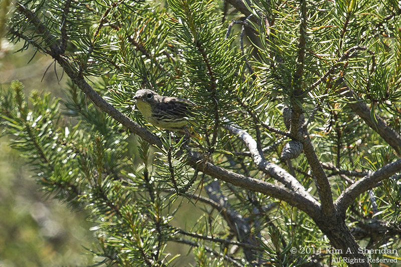
I flew 800 miles and then drove 150 more to see this one: a Kirtland’s Warbler (Life Bird #188).

Okay, full disclosure; I was going to Michigan anyway. I did plan my trip for late June and then drive across the state for a glimpse of this bird, though. I didn’t fool around trying to find this rare, flitty little warbler by myself, either. I took a tour sponsored by Michigan Audubon and led by a very knowledgeable young woman.

What’s so special about this bird that people travel hundreds of miles and take tours to see it?

MI Grayling State Forest Kirtlands_8914aKirtland’s Warbler is a Federal Endangered Species, and it nests only in young jack pine forests in Michigan and Wisconsin. It was listed as an Endangered Species in 1967. In 1973 the Kirtland’s Warbler Recovery Team was created, with representatives from the U.S. Fish and Wildlife Service, U.S. Forest Service, Michigan Department of Natural Resources, Michigan Audubon and other organizations. The following year 167 singing male warblers were recorded, a record low number.

Conservation measures enacted by the Kirtland’s Warbler Recovery Team are working. In 2011, 1,828 singing males were recorded, well beyond the plan goal of 1,000. In fact, the number of warblers has exceeded the recovery goal for over a decade.

MI Grayling State Forest Jack Pine_8868a
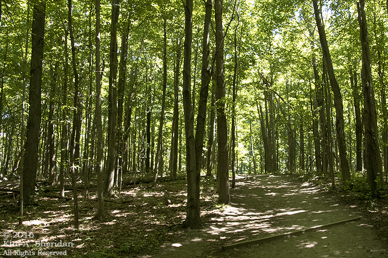
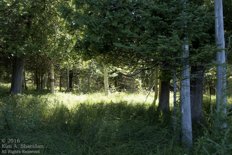
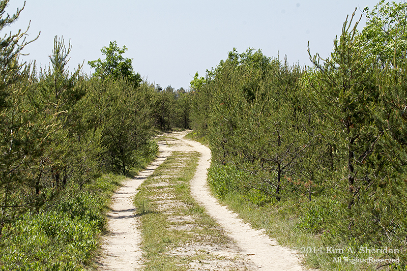
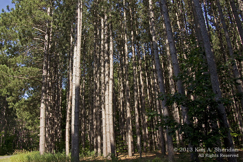
Two-track road through a jack pine plantation in Grayling State Forest, an area actively managed for Kirtland’s Warbler.

MI Grayling State Forest Jack Pine_9039acsPine cone of a jack pine tree. See how it’s closed up, with its seeds still inside? This is a serotinous cone. It only opens and drops its seeds under the high temperatures of a wildfire. Jack pines have adapted to take advantage of frequent fires.

MI Grayling State Forest Kirtlands_8892acsKirtland’s Warblers have adapted to take advantage of jack pines. Young pines, that is. They nest on the ground under cover of the drooping lower branches. One pair needs at least 8 acres, and maybe as much as 30, of small pines. Once those trees reach twenty feet, the birds no longer nest there. Historically, frequent wildfires maintained this young jack pine habitat. Since this is the only tree the warblers nest in, they are dependent not only on jack pines, but frequent fire.

Except that fire is a tricky thing to manage. In 1980 a controlled burn got out of control and led to a wildfire that burned 25,000 acres and killed a USFS biologist. So now the Recovery Team relies on that nemesis of many environmentalists, clear-cutting. Areas of about 4,000 acres each year are logged and replanted with jack pine seedlings on a rotating basis, ensuring that there is always suitable habitat for the Kirtland’s Warbler.

Also, Brown-headed Cowbirds frequently lay their eggs in Kirtland’s Warbler nests, leading the warblers to raise cowbirds rather than their own young. So cowbird control is a critical part of the plan.

MI Grayling State Forest Kirtlands_8901acsEven though the Kirtland’s Warbler has exceeded its recovery goal, the need to suppress natural wildfires to protect life and property means that continued management with human intervention will be needed. But it’s not just this little half-ounce warbler that benefits. Young jack pine habitat is beneficial for wild turkeys, badgers, white-tailed deer, snowshoe hares, numerous birds and at least two threatened plant species.

MI Grayling State Forest Kirtlands_9054aOh, it figures. My closest and sharpest photo of a Kirtland’s, and what do I get? A bird butt! Turn around, please…

Please?

MI Grayling State Forest Kirtlands_9055a
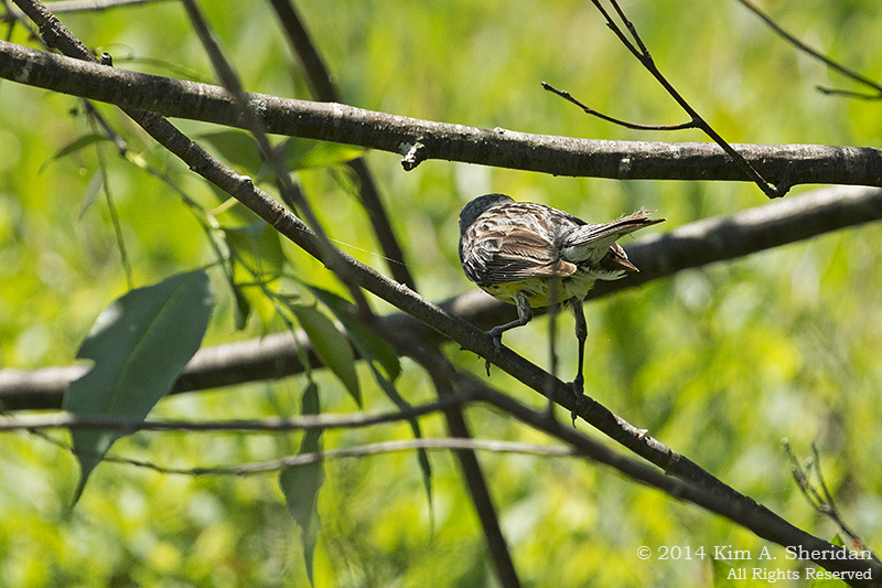
That’s better, but now there’s a stick in the way. Move a little to the left, please?

These fashion models, they’re just so flighty.

MI 2 Buttersville South Breakwater_9960acsHere’s a bird I did not plan for. This is a Piping Plover (Life Bird #189). I found him in Buttersville Park, just south of the Ludington South Breakwater.

On the Atlantic Coast Piping Plovers have Threatened status, but in the Great Lakes region they are officially Endangered. These little guys like to nest right on the beach and dunes, in cobblestones or sparse vegetation. Humans and pets using the beach disturb the birds, sometimes leading to nest abandonment. In addition, people and vehicles may accidentally crush eggs or tiny young chicks. Add in predation by wild animals and habitat loss due to beach development and it’s no wonder this tiny bird is in trouble.

People are helping the Piping Plover, though. Nesting habitat is identified and monitored, with human access restricted where necessary. Active nests are fenced to keep people and predators out.

MI 2 Buttersville South Breakwater_9976aWait! Don’t fly away mad!

MI 4 SLBE Port Oneida Grouse_0916a
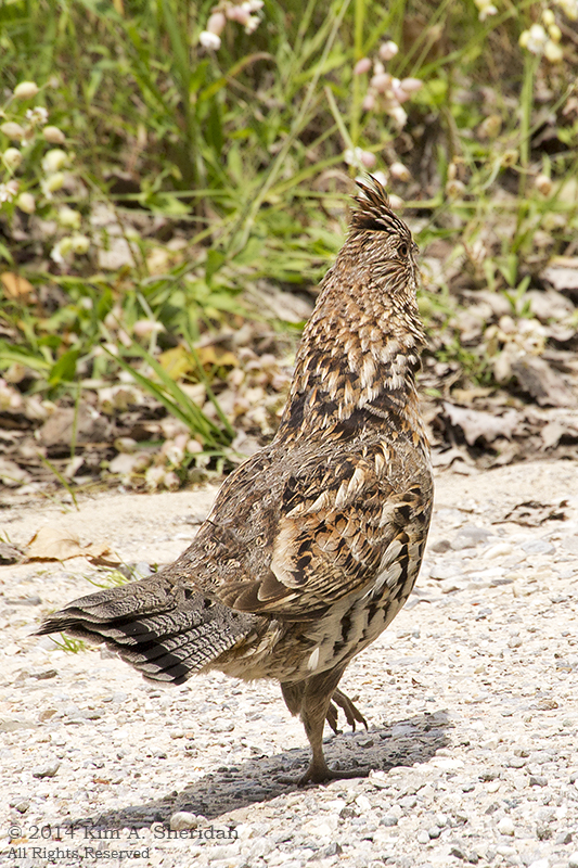
Another completely unexpected bird, this Ruffed Grouse (Life Bird #190) is anything but rare. In fact, they are widespread all across the U.S. They are really elusive and hard to see, though – in some areas.

My friend Don, convinced he’ll never see a Ruffed Grouse, has made it his life’s goal to hear one drumming in its spring courtship ritual.

Imagine his surprise when I e-mailed this photo taken at Sleeping Bear Dunes National Lakeshore.

MI 4 SLBE Port Oneida Grouse_0892acsFor that matter, imagine my surprise when I turned down a dirt road and came upon this bird strutting around. It paraded slowly down the road for quite some time while I took photos right from the front seat of my car. It didn’t seem at all concerned by my presence. It appears that, unlike shy Eastern grouse, Midwestern birds are much bolder.

MI 4 SLBE Port Oneida Grouse_0890acs

I’m ready for my close-up now.
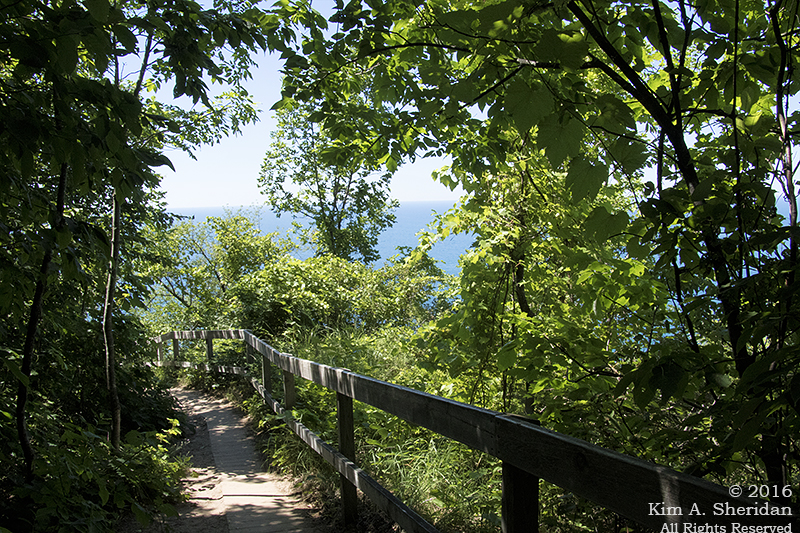
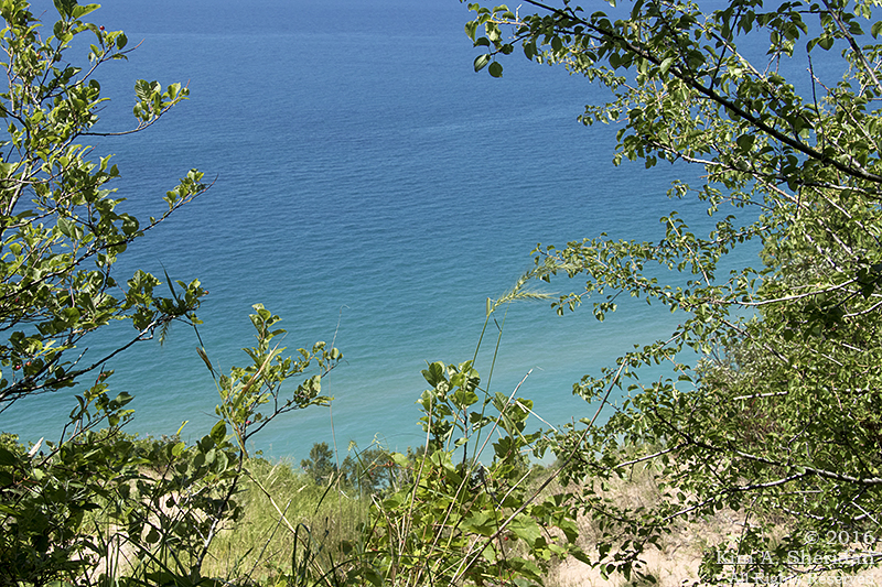
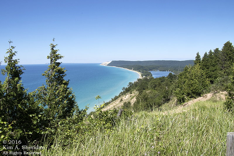
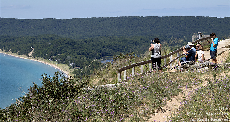
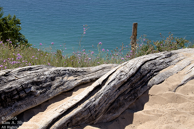
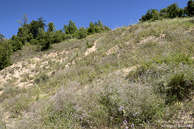
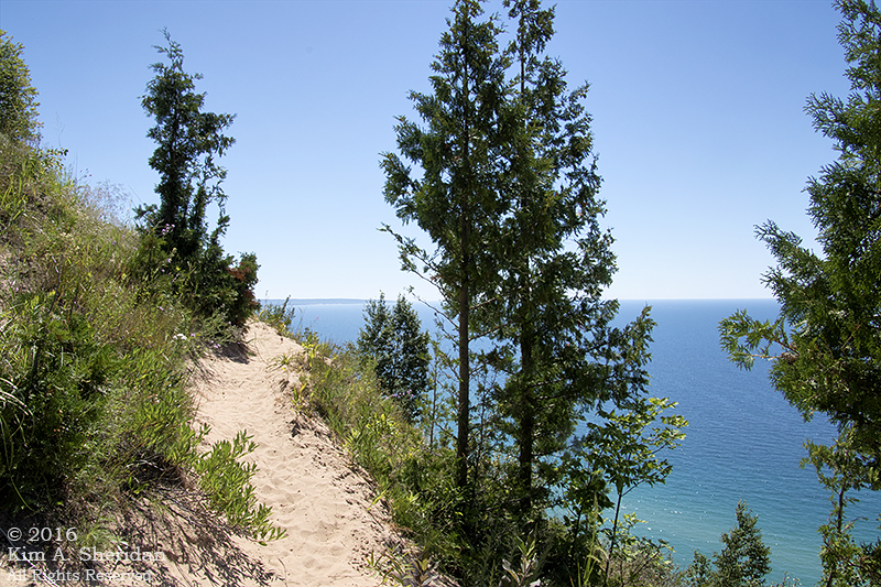
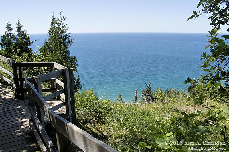
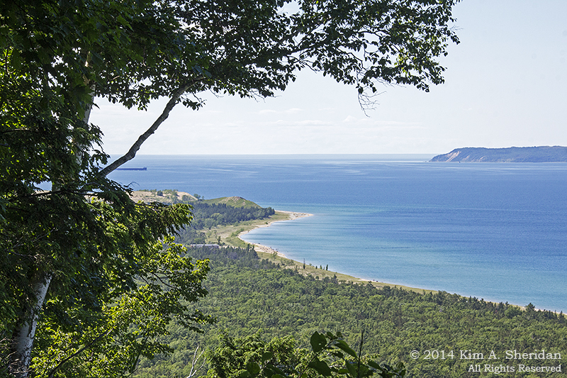
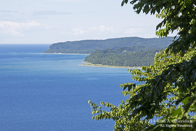
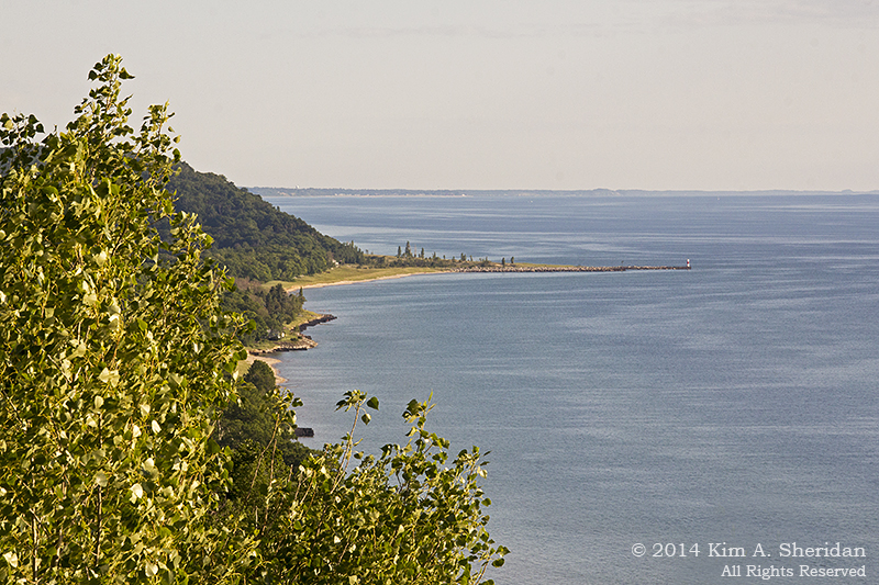
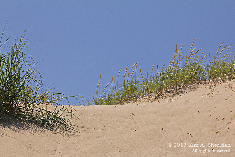
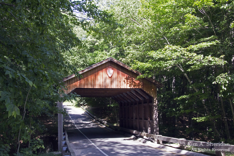
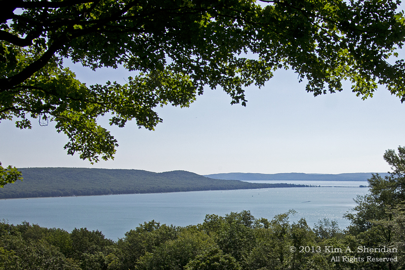
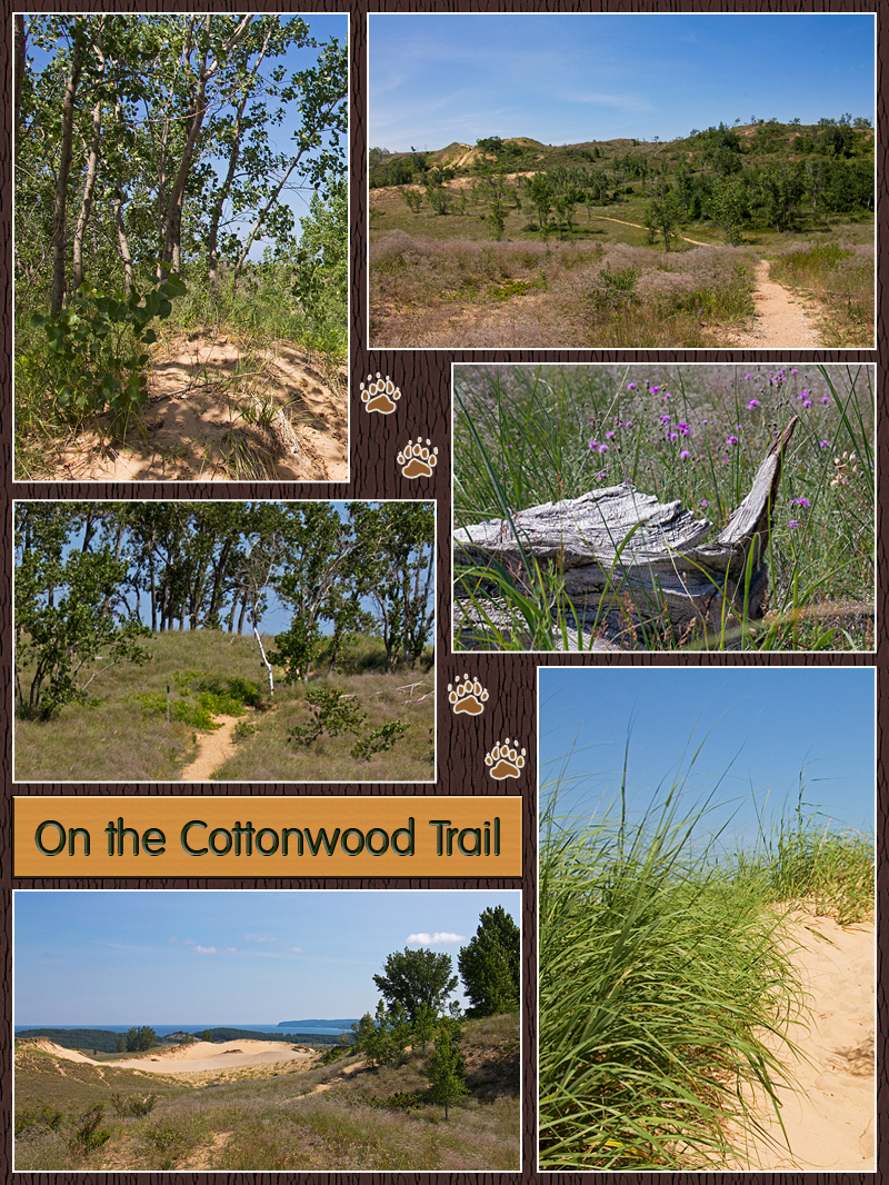
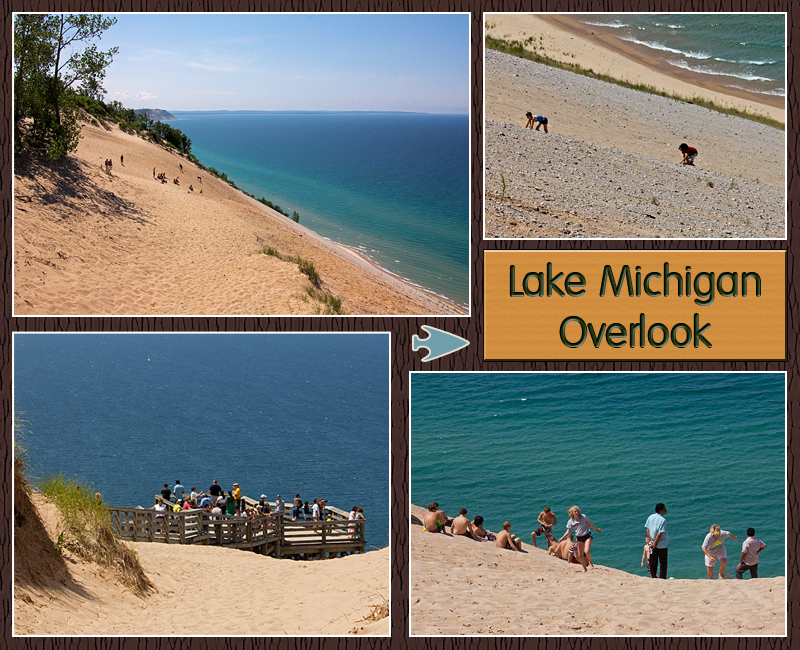
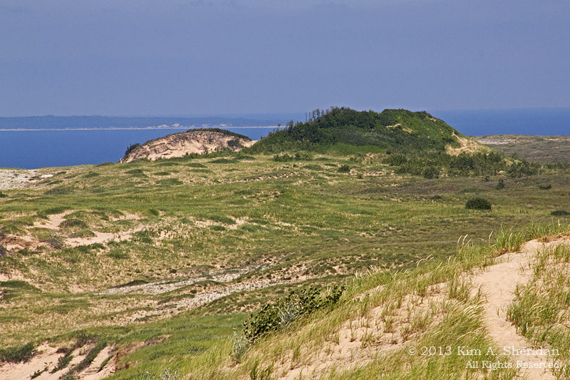
Sleeping Bear Dunes: Dune Culture

MI Sleeping Bear Dunes_6846ac What else is there to do on a warm and sunny day at Sleeping Bear Dunes National Lakeshore, after spending several hours on the Scenic Drive? Why, the Dune Climb, of course.

MI Sleeping Bear Dunes_6600aThe National Park Service would really prefer that visitors not climb just any dune in the park, due to their fragility and steepness. So the Service has set up this 150’ high dune where people can climb safely. And what a set up it is: There’s a huge parking lot, restrooms, a Park store, picnic tables and vending machines. All of which is smartly situated at the bottom of the dune. When you climb, you get the hard part over first, and then get the fun of running back down.

Dune Climb Collage Nearby a wooden beam shows the progress of the moving dune. It was placed here in 1985, and the edge of the dune is now sitting around 66’ in from the end; that means the dune is moving at a rate of 2.36’ a year.

I was a bit of a party pooper here, and didn’t climb the dune. I don’t really like going uphill in soft sand under a hot sun. Besides, the NPS vending machine ate my money without giving me a Klondike Bar, so I was cranky. I did go for a peaceful walk in the woods along part of the paved Sleeping Bear Heritage Trail. I also enjoyed reading the license plates in the parking lot. There were people that drove from as far away as Idaho and Vermont.

Glen Haven Collage 1Glen Haven is a village restored to its heyday as a company town and port for steamboats. Sleeping Bearville, as it was once known, was active from 1865 on. Above, clockwise from top left: The Sleeping Bear Inn, which was built in 1857 and served guests until 1972. The awning of the Glen Haven General Store, as it appeared in the 1920s, when it was run by local lumber baron D. H. Day. The Blacksmith shop.

Glen Haven Collage 2David Henry (D.H.) Day ran the town of Glen Haven from the late 1800s to the 1930s. He financed and built houses for the workers, and was school superintendent. Above, clockwise from top left: The house Day built in 1890 for his wife – she preferred living over the store! The Glen Haven Canning Company, started in the 1920s by David Day Jr. after the collapse of the lumber industry, canned cherries, peaches and apples; today it houses a small fleet of old Lake Michigan boats. A house for a worker’s family. One of the boats on display in the Cannery.

MI Sleeping Bear Dunes_6913aSky, lake and the fishing boat Aloha.

In 1901, a United States Life Saving Service station was built on Sleeping Bear Point. It was much needed – there have been more than 50 shipwrecks in this vicinity. The Service became part of the U.S. Coast Guard in 1915. By 1931, the station had been nearly buried by sand, and the buildings were pulled, by horses, to their present location. The introduction of “unsinkable” 36’ motor boats, which could only be launched from harbors, made beachside stations like Sleeping Bear Point obsolete, and it closed for good in the early 1940s. Today it houses a museum showcasing crew life, the Life Saving Service and Great Lakes maritime history.

Maritime Museum Collage Above, clockwise from top left: the main crew quarters. The boat house. A view of the lake from an upstairs window. Part of the crew’s bunk room. The room housed seven men, who each had their own bed and small closet. Quite an austere existence for men who stood ready to risk their lives in the worst of conditions on a daily basis.

In the evening I drove around the Port Oneida Rural Historic District, a community northeast of Glen Haven that includes 16 historic farms. Several of the barn photographs that appeared in the earlier “Farm Country” post were taken here, including D.H. Day’s elaborate white barn. I wandered down a dirt and gravel road for a long time, and had to wonder why I did, after nearly getting stuck on a sandy hill. Then, when I reached a pull-out at the side of the road, it all became clear.

MI Sleeping Bear Dunes_6993aDeep green trees, crystalline blue water: this is what I remember when I think of Michigan.

Coming up: Michigan’s Shy Wildlife

Sleeping Bear Dunes: The Scenic Drive

00 A LegendSleeping Bear Dunes National Lakeshore in northwest Michigan’s Lower Peninsula encompasses 50,000 acres, including 65 miles of Lake Michigan shoreline, and the Manitou Islands. There are 100 miles of hiking trails, winding through forests, lakes, beaches and those famous dunes. Within the Lakeshore are historic sites like the company town of Glen Haven, three former U.S. Life-Saving Service Stations, and the Port Oneida Rural Historic District.

00 Lake Mich Pan 2 ACWith only a day at Sleeping Bear Dunes, and so much to see and do, where do you start? That’s easy: with all the “touristy” things! Chief among them is the Pierce Stocking Scenic Drive. This 7.4 mile drive was built in the late 1960s by lumberman Pierce Stocking to show visitors the natural wonders of the area he loved. It became part of the Lakeshore after his death in 1976. The drive winds through the woods and along the dunes, offering spectacular views at 12 stops along the way.

01 MI Sleeping Bear Dunes_6493 aThe Covered Bridge. I’m a sucker for covered bridges anywhere, but this one is especially scenic. And topped with a National Park Service arrowhead, no less. It’s nestled in a forest of maple and beech trees which blankets the steep hills and valleys.

02 MI Sleeping Bear Dunes_6499 aGlen Lake Overlook. Glen Lake, like Lake Michigan and the other smaller lakes of the area, was carved out by glaciers long ago. As the ice melted, deposits of sand and gravel were left behind to form hills. The hill at the left is known as Alligator Hill because of its resemblance to an alligator’s snout, not because there are alligators on the hill!

03 MI Sleeping Bear Dunes_6526aDune Overlook. Here you can see some of the dunes that make up the Lakeshore. Most of the dunes have been around for ages, and the vegetation that covers their surfaces helps to stabilize them. Occasionally the wind scours a depression free of plants and creates an area known as a “blowout”.

04 Cottonwood CollageThe Cottonwood Trail. One and a half miles through the dunes, up and down hills of soft sand in a blazing sun. Not usually my idea of a good time, but I really enjoyed this walk. There were great views to be had at the top of those sand hills: the “Dune Climb”, the D. H. Day Farm, Glen Lake and Lake Michigan.  The trail gets its name from the stands of Cottonwood trees that provide welcome shade as well as beauty. Lots of interesting wildflowers and shrubs can be found here, including buffaloberry, dune grass, the threatened Pitcher’s Thistle, and bearberry. I recognized not a single one, not being smart enough to pick up a trail map until I got back from the hike.  I wished more than once that my Weed Warrior friends were along; they would have had a blast identifying plants.

07 Beech Maple Collage aThe Maple/ Beech Forest. Coming down the backside of the dunes, you plunge into a cool, leafy green forest. The predominant trees here are Sugar Maple and American Beech, with Hemlock, Basswood and Black Cherry trees scattered throughout. This is a climax forest, the last stage in the transition of ecosystems from dunes to woods.

09  A MI Sleeping Bear Dunes_6718 a Lake Michigan Overlook. Lake Michigan was carved out by glaciers, and filled when the ice melted nearly 12,000 years ago. The water shimmers through crystalline shades of blue and aqua, varying with the lake depth. The bluffs that line the shore are 450 feet high, and precariously steep. The NPS warns people not to run down the dunes, both to protect the fragile ecology of the dunes and prevent further erosion, and to protect visitors.

Sure, it’s easy to go DOWN the dune, and there’s an inviting swim at the bottom. But then you have to climb back UP, a chore that can take up to two hours as you crawl upwards over gravel and loose sand.  Occasionally people need to be rescued, and the nearby town of Glen Arbor has a four wheel drive vehicle for just that purpose.

09 Lake Mich Overlook CollageAll the warnings don’t stop people from trying it. You can see how steep it is, and how hard it is to get back up. Better to take in the view from the observation platform, but hold onto your hat! It’s windy out there.

10 MI Sleeping Bear Dunes_6746a Sleeping Bear Dune. Here is the dune of legend. At one time it did look like a sleeping black bear. It was also inland from the edge of the bluff, and stood 234′ high. Over the years the front of the bluff has eroded away, as has part of the dune itself. It is now at the edge of the bluff and only 132′ high. In time it will disappear altogether. Across the water at the left is one of the Manitou Islands.

11 MI Sleeping Bear Dunes_6834aNorth Bar Lake. North Bar Lake was once a bay. Over time wave action has worked to carry sand across the mouth of the bay and close it off nearly completely. Only a small channel remains to connect it to the Big Lake. The warm waters make the lake a popular swimming destination and children can’t resist playing in the channel.

12 MI Sleeping Bear Dunes_6488aPine Plantation. A few posts back we talked about the stands of pines planted to replace the forests that had been logged a century ago. These are red pines, and you can see how they are planted close together in uniform rows. When trees grow like this, it is difficult for other vegetation and other types of trees to get the space, light and nutrients they need. In Sleeping Bear Dunes, the National Park Service is gradually and selectively cutting pines to encourage a more natural mixed forest. That’s the kind of logging I can get behind.

 FUN FACT: Sleeping Bear Dune, like many of the high dunes along the Lake Michigan coast, is a “perched dune”. What is a perched dune, you ask? No, it doesn’t perch on a tree branch like a bird. What it perches on is a glacial moraine bluff. Okay, what’s a “moraine”? It’s any accumulation of debris left behind by glaciers, in this case gravel and sand. Much of the geology of this area was formed by glaciers, from the deep depressions that became lakes, to the bluffs and hills deposited by retreating ice.

13 Lake Mich Bar Lake Pan ACSSleeping Bear Dunes National Lakeshore was established in 1973, and is run by the National Park Service; in 2011, a “Good Morning America” viewer poll named it the “Most Beautiful Place in America”. Who am I to argue with that?

Coming up: Dune Culture