The Twin Lights of Navesink

161125_nj-gateway-nra-sandy-hook_6105acs
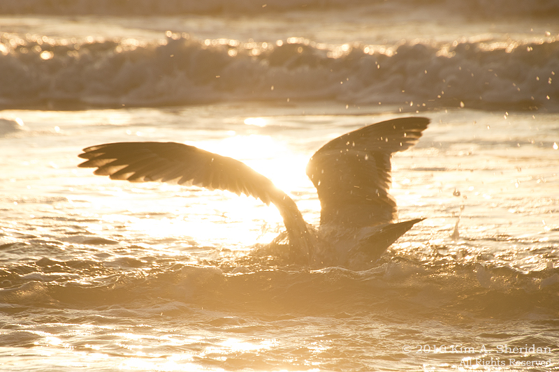
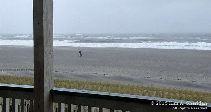
Seafaring is a dangerous business. Be they sail or steam, passenger or cargo, many ships have gone down along the Atlantic Coast over the centuries. Powerful storms and strong, tricky currents make navigating harbors a challenge that in darkness is nigh unto impossible.

Which is why man made lighthouses.

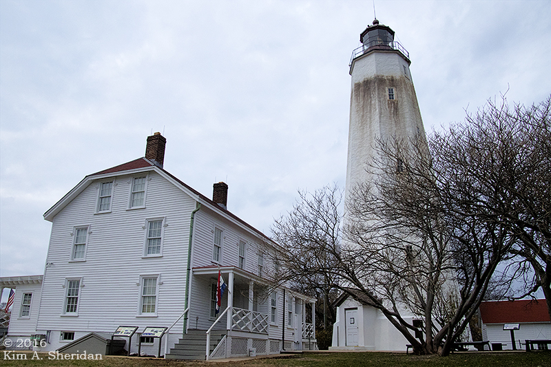
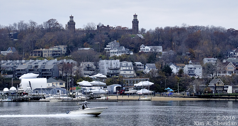
Towers topped with bright lights visible for miles dot the coasts and Great Lakes of North America. Sandy Hook Light has guarded the southern entrance to New York Harbor since before the American Revolution. In 1828, help arrived: the Navesink Highlands Light Station, otherwise known as the Twin Lights.

161125_nj-gateway-nra-sandy-hook_6154acs
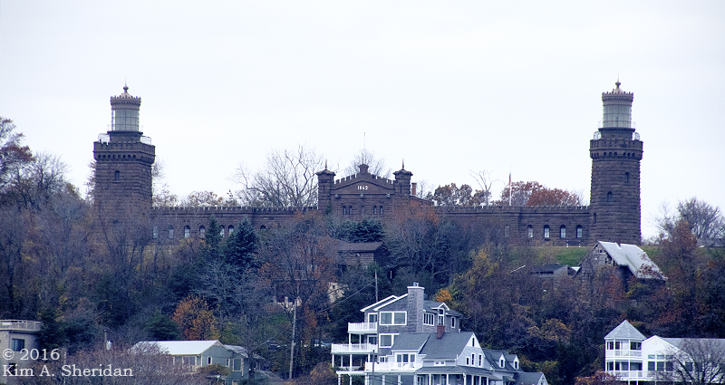
The name says it all – there are TWO lights to this light station. Rebuilt of local brownstone in 1862, the towers are linked by keeper’s quarters. They stand 64 feet high atop a 200’ hill overlooking the Shrewsbury River.

161125_nj-navesink-twin-lights_6368acsThe two towers are different shapes, the North being octagonal and the South square.

At night, the two beacons, one fixed and one flashing, were easy to distinguish from the light at Sandy Hook.

They were also easy to see. The Twin Lights were the first in America to use the revolutionary Fresnel lens design, when two of these beehive shaped lights were installed in 1841.

161125_nj-navesink-twin-lights_6223acsThe South Tower’s beehive light was replaced in 1898 with an electric-arc bivalve lens. This light could be seen 22 miles out to sea, the brightest light in the U.S. at the time. It was so bright the North Tower light was taken out of service.

161125_nj-navesink-twin-lights_6248acsIn 1941 Navesink Light Station was decommissioned and extinguished.

161125_nj-navesink-twin-lights_6316aThe 9’ bivalve lens needed its own generator to power it. Today that lens is on display in the Electric Power Station building.

161125_nj-navesink-twin-lights_6309acsClose up of the bivalve light.

161125_nj-navesink-twin-lights_6254a
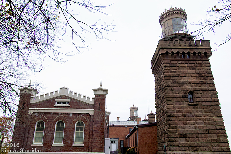
The front of the building that connects the two lights. The battlements along the roof and the towers at each end give the Twin Lights a fortress-like feel.

161125_nj-navesink-twin-lights_6268acs
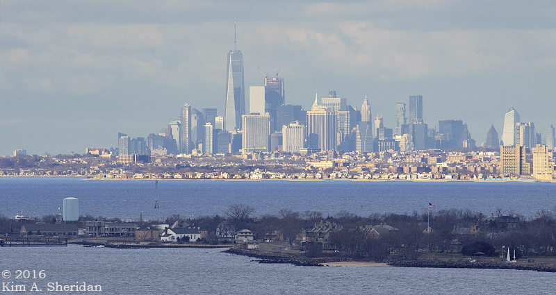
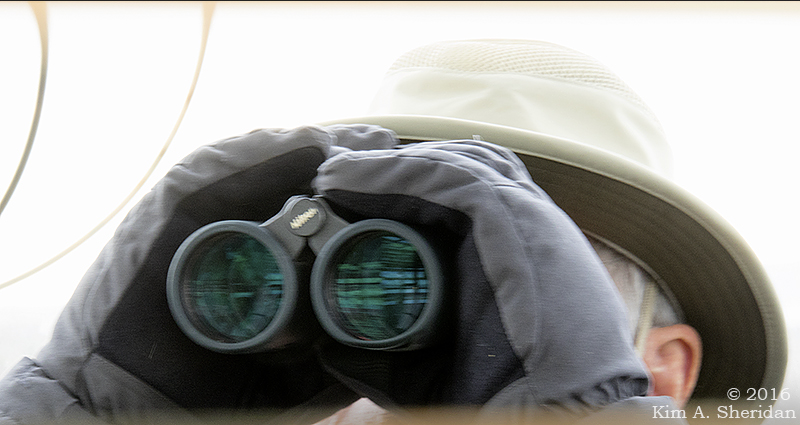
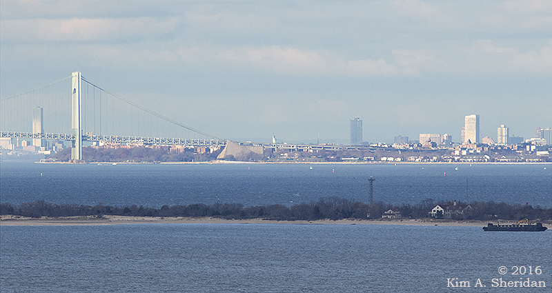
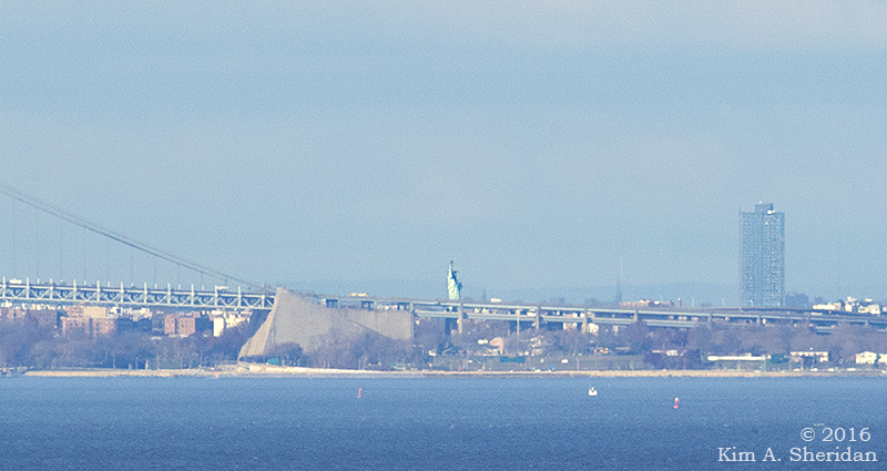
The cannon adds to the ambience. On clear days the New York skyline is visible from the Twin Lights site. So is the Statue of Liberty, according to Robb.

161125_nj-navesink-twin-lights_6360acs
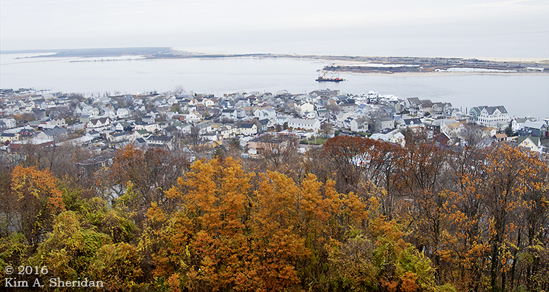
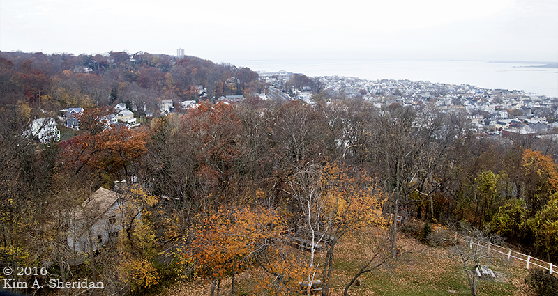
The view from the top of the North Tower.

161125_nj-navesink-twin-lights_6335acsThe South Tower and the Shrewsbury River.

161125_nj-navesink-twin-lights_6349acsLooking across to Sandy Hook. The first demonstration of Marconi’s wireless telegraph took place here in 1899, at the America’s Cup yacht races off Sandy Hook.
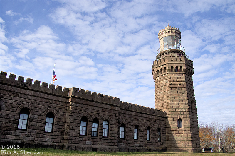
161125_nj-navesink-twin-lights_6375aThe North Tower.

Now a National Historic Landmark, this life-saving light station reminds us of the years it stood watch over the harbor, its beacons a comfort to all who passed.

161125_nj-navesink-twin-lights_6338acsThe Twin Lights of Navesink.

Sandy Hook to the Rescue

161125_nj-gateway-nra-sandy-hook-light_6510acs

HOEK (Dutch): Corner, angle; spit of land.

The long spit of land known as Sandy Hook, comprised of beaches, dunes and maritime forest, is a recreational wonderland. It serves a higher purpose, though. For centuries the spit has guarded the entrance to New York Harbor. The peninsula, owned by the federal government since 1814, has long been essential to the safety of mariners and the defense of New York. There’s a lot of history resting on the shifting sands of Sandy Hook!

161126_nj-gateway-nra-sandy-hook-lifesaving-station_6768acsNew York Harbor is one of the busiest in the nation. Seafaring is always treacherous, and many ships foundered off the Jersey Coast. In the 1870s, the U. S. Life-Saving Service was established, to watch the coast and rescue stranded seamen. Life-saving stations like this one were built along the coast. Spermaceti Cove Station No. 2, built in 1894, housed a six man crew of “surfmen” and their rescue equipment.

161126_nj-gateway-nra-sandy-hook-lifesaving-station_6815acsThe Spermaceti Cove station was used by the Life-Saving Service and subsequently by the U.S. Coast Guard until the 1940s. It has served as the Visitor Center for the Sandy Hook unit of Gateway National Recreation Area since the 1970s. Damaged in Hurricane Sandy, it’s now closed, to our deep disappointment. We could only admire the old girl from the outside.

Also guarding the harbor is the Sandy Hook Light.

161125_nj-gateway-nra-sandy-hook-light_6506acsFirst lit in 1764, it was captured by the British in 1776, withstood an American attack, and was held until the end of the Revolution.

161125_nj-gateway-nra-sandy-hook-light_6497acsThe Lighthouse Keeper’s Quarters now standing on the site was built in 1883. It also saw life as a U.S. Life-Saving Station.

Sandy Hook Light is still in operation 24 hours a day, using an automated, fixed 3rd-order Fresnel lens. When it was built in 1764, water lapped the shore just 500 feet away. The light now stands a mile and a half from the tip of Sandy Hook.

161126_nj-gateway-nra-sandy-hook-light_6894acsWe took advantage of a chance to climb the 103’ tower. Along the way, deep set windows gave peek-a-boo views of Fort Hancock below.

Sandy Hook’s location at the mouth of New York harbor made it the perfect place to build a fort to defend the harbor and New York City.

A wooden fort called Fort Gates served during the War of 1812. Fort Hancock replaced it in the late 1800s.

161126_nj-gateway-nra-sandy-hook-light_6902acsA view of Fort Hancock from the lighthouse. This is Officers Row, a group of yellow brick residences. Enlisted men lived in barracks and a small village of supporting buildings sprouted up over the years. The population of Fort Hancock peaked during World War II at nearly 12,000 military personnel.

Much of the fort’s defenses centered on concrete gun batteries using the most powerful cannons of the day. After WWII, the fort’s mission shifted to an array of Nike air defense missiles. At the end of 1974, Fort Hancock was officially decommissioned. It now is part of Gateway National Recreation Area.

161125_nj-gateway-nra-sandy-hook-fort-hancock_6402acsFort Hancock’s Nine-gun Battery.

161125_nj-gateway-nra-sandy-hook-fort-hancock_6419acsThese old gun batteries were quite picturesque, in a moody sort of way.

161125_nj-gateway-nra-sandy-hook-fort-hancock_6485acsBattery Peck.

Near Sandy Hook, in Atlantic Highlands, is Mount Mitchill Scenic Overlook. Perched at 266’, the highest natural elevation on the Atlantic Coastal Plain, it offers sweeping vistas of Sandy Hook, Raritan Bay and New York City. You get a feel for the strategic importance of Sandy Hook to the defense of New York and the safety of seamen traveling into the harbor.

Throughout the weekend, from every high point and lighthouse, we searched for the Statue of Liberty. Throughout the weekend, from every high point and lighthouse, Robb claimed to see her.

Atop the Sandy Hook Light,  Robb declared that he could see the Statue. Again,

161126_nj-gateway-nra-sandy-hook-light_6945aDon was skeptical. She never seemed to be where Robb said she was.

After two days of following Robb’s guidance, to no avail, I sought the aid of other visitors to Mount Mitchill. Within minutes, thanks to them, I had found what I was looking for.

At last! Lady Liberty! Let’s zoom in…

161126_nj-mt-mitchill-overlook_7002acs2There she stands, the symbol of freedom, the symbol of welcome to all who come to our beautiful land.

And guarding her flanks, Sandy Hook, ever vigilant.

Sandy Hook Au Naturel

161126_nj-gateway-nra-sandy-hook-lifesaving-station_6769acs2Ahhh, Thanksgiving! Autumn draws to a close with a harvest feast. Now thoughts turn to the holidays and the coming winter: shopping, caroling and celebrations, cold and snow and ice. The long dark season approaches. So naturally on Turkey Day, we went to… the beach!

Not just any beach though. Sandy Hook, the Far North of the Jersey Shore, in sight of New York City’s towering skyscrapers. Unexplored territory, as far as I was concerned.

161125_nj-gateway-nra-sandy-hook_6429acsOn the trail to the tip of Sandy Hook. Sandy Hook is a peninsula nearly 6 miles long and part of Gateway National Recreation Area. It juts out between the Atlantic Ocean and Sandy Hook Bay, at the entrance to New York Harbor. A variety of habitats comprise Sandy Hook. Glad to see some late fall color in the sand dune and shrub thicket.

161125_nj-gateway-nra-sandy-hook_6473acs161125_nj-gateway-nra-sandy-hook_6432acs161125_nj-gateway-nra-sandy-hook_6448acsMore dunes. Other habitats in the park include grasslands, ponds, maritime forests and saltmarshes.

FUN FACT: Sandy Hook is a peninsula, but furthermore it is a sand spit. The Jersey Coast runs generally north-south. But the mainland at Highlands New Jersey takes a sharp turn to the northwest. This change of direction is called re-entry. The longshore current which has been carrying sand northward reaches this point and dissipates, dropping its sediment load.

Longshore drift continues to carry sand along the sand bar in the direction of breaking waves. Soon an above-water spit forms. Vegetation takes root and grows, establishing a stable peninsula. In the lee of the spit, salt marshes develop. Wave refraction (the change in direction of a wave) occurring carries sand and sediment around the end to form a hook. Hence, Sandy Hook!

161125_nj-gateway-nra-sandy-hook_6451acsAt last we reached the point. It was a gloomy day, but still picturesque. A gloomy day at the beach beats a good day indoors. Winter will be full of dark, cold, gloomy days. We have found the beach to be the perfect antidote. Visiting the Shore on Thanksgiving is like getting a vaccination against the malaise of winter.

161125_nj-gateway-nra-sandy-hook_6455aThe beach at the point was a treasure trove of shells. Shells upon shells upon shells. Those smaller shells aren’t just resting there, folks. They’re attached to the shells below them.

I could have stayed here for hours beachcombing through the shells. Alas, my companions had other priorities.

161126_nj-gateway-nra-sandy-hook-lifesaving-station_6789acsOver on the Atlantic side of the spit a long sandy beach lines the shore. The only thing different than other beaches along the Jersey Coast is the view of New York City in the distance. (See top photo.) Oh, and the thin layer of teeny tiny pebbles covering the sand.

161125_nj-gateway-nra-sandy-hook_6170acsBrant along the Shrewsbury River at the southern end of the park. The brant is a small goose that hangs out near oceans. Adult brant have black heads and wear a white necklace at their throats.

161126_nj-gateway-nra-sandy-hook_6855acsSpermaceti Cove is one of several coves on the Sandy Hook Bay side of the spit. A trail led to a boardwalk across the marsh.

161126_nj-gateway-nra-sandy-hook_6849acsThe tide was dropping. In one of the nearly dry channels, we spotted this cloud of fish. They’d been left stranded by the outgoing water in a small pool, with no way out. How many fish do you think there are?

161126_nj-gateway-nra-sandy-hook_6846acsHere are a few of them, up close and personal. They were quite small, maybe an inch or two long.

Some of them appeared to have dark stripes or blotches.

I really need to learn more about fish.

161126_nj-gateway-nra-sandy-hook_6853acsNext to the pool there were other critters afoot, who had written their tales in the open book of sand. A heron had been here, and a raccoon, and at least one fox. Bet the fishing was good, for those content with hors d’oeuvres.

161126_nj-gateway-nra-sandy-hook_6873acsCedars, hollies and marsh grasses.

161126_nj-mt-mitchill-overlook_6958Spermaceti Cove from afar. Blue water, white sand, green trees. Who can think of winter with a view like this?

A Watery Cave

161029_pa-penns-cave_2373acsWe like caves.

My friends and I have been trying to get to Penn’s Cave for three years now. We’ve been to Crystal Cave and Lost River Caverns in Pennsylvania, Seneca Caverns in West Virginia, and Luray Cavern in Virginia. We’ve learned about stalactites and stalagmites, cave bacon, frozen waterfalls, cave draperies and fried eggs. We’ve seen columns and straws and flowstone. We’ve learned how dark it gets in a cave when the lights go out, and we’ve endured just about every bad joke a cave tour guide could come up with.

Luray Cavern pretty much spoiled me for any other cave experience. But Penn’s Cave, in the center of Pennsylvania, looked unique – an all-water journey through the cave in a boat. I mentioned it in my post about Crystal Cave three years ago; we’ve been talking about going to see it for a long time. At the end of October, we finally made it.

161029_pa-penns-cave_2287acsDown a long flight of stairs to the cave we went. A fleet of flat-bottomed boats awaited. These proved to be really tippy as the cave tourists came on board.

Our boat was also packed pretty tight. Turning to take photos was a challenge, and although the boat ceased to rock when it got underway, it was a far from motionless shooting platform. As if shooting in a dark cave wasn’t hard enough!

161029_pa-penns-cave_2294acsThere were fish in the water. Trout, of some sort. I know next to nothing about fish, unfortunately. I do know that’s a fish swimming there in the foreground of this photo.

The waterway flowing through Penn’s Cave is Penns Creek. Named for William Penn’s brother John, one of its sources is a spring in the cave.

161029_pa-penns-cave_2472acsCave curtains, one type of formation typically found in caverns.

All caverns are caves, but not all caves are caverns. Wait, what?

Any cavity in the ground large enough that some portion does not receive sunlight is a cave. A cavern is a specific type of cave formed in soluble rock and decorated with speleothems.

With what?!?

A speleothem is a cave formation. You don’t remember learning all this from the Wild Edge three years ago? Read it again here, there will be a quiz later.

161029_pa-penns-cave_2334acsThe ceiling of Penns Cave. The scale is lost in this photo, but this room was huge, and the ceiling far away.

Like every cavern I’ve toured, the formations have names. Fittingly, there’s the Nittany Lion. The Statue of Liberty. The Straits of Gibraltar was a narrow passage with rock angling in on both sides. We had to duck.

161029_pa-penns-cave_2520acsThe light at the end of the tunnel. Penns Creek exits the cavern into a small man-made lake called Lake Nitanee.

161029_pa-penns-cave_2538acsLooking over Don’s shoulder as we approach Lake Nitanee. After a short cruise, we turned around and returned through the cavern to the entrance.

Quiz-time! (Didn’t believe me, did you?)

How do speleothems form?

161029_pa-penns-cave_2702acsBack on top of the earth. The surrounding area is mountainous and agricultural. Penn’s Cave offers a Farm, Nature & Wildlife Tour. The park’s 1600 acres are home to longhorn cattle, bison, bighorn sheep, black bears, mountain lions, bobcats and wolves.

161029_pa-penns-cave_3046acsSome live in roomy fenced enclosures, like this handsome wolf.

161029_pa-penns-cave_3072acsThere are five wolves in the Penn’s Cave pack.

Like all wolf packs, there’s a pecking order, with an alpha male and an alpha female.

These wolves were hand-raised from pups, so they are accustomed to humans.

161029_pa-penns-cave_3310acsYou’re in Lion Country now, son. Penn State’s mascot, the Nittany Lion, is a mountain lion like this. She was housed in a zoo-like enclosure behind glass. When she heard my camera’s shutter, she turned and looked right at me for a long moment.

161029_pa-penns-cave_3377acsOur last wildlife of the day, a red squirrel. Not behind an enclosure, but free and strolling across the replica mining sluice. These critters make a call most unlike our familiar gray squirrels.

Got your quiz answer ready?

How do speleothems form?

That’s right, speleothems form when rainwater and calcium carbonate form an acid that eats through soluble rock like limestone. As it drips, it leaves behind calcite deposits.

Give yourself an A!

My friends and I gave Penn’s Cave an A, too. Three years we waited, and it was well worth it.

A Nittany Ramble

161030_pa-mt-nittany_3691acsGuided tours are fine. But sometimes I just want to get out in the woods and ramble!

My friends and I traveled to the center of Pennsylvania on Halloween weekend, to tour Penn’s Cave and Wildlife Park. It was a fascinating and enjoyable visit. It did, however, consist of sitting. In a boat and then a bus, with a small group of other tourists, all confined to a pre-planned route.

By the next day, we three free spirits were ready to strike out on our own for some leisurely exploring.

I’d attended Penn State University before health issues ended my freshman year. Lacking a car in those days, I’d never explored much beyond the campus boundaries.

This was the first time I’d gone back to the region. When Don and Robb were looking for places to hike on this trip, I quickly suggested we climb Mount Nittany. I was delighted when they agreed.

Mount Nittany is a ridge in the Ridge-and-Valley province of the Appalachian Mountains with a peak elevation of 2077’. Penn State lies a couple of miles to the southwest in the Nittany Valley. Penn State’s mountain lion mascot, the Nittany Lion, is named for Mount Nittany.

161030_pa-mt-nittany_3413acsThe hike started with a bit of a climb – 600 feet in the first half mile, up an uneven and rocky trail. Robb and Don clambered up it like a pair of billy goats.

161030_pa-mt-nittany_3495acsI had thought that the trees would have lost all their leaves by late October. I was pleasantly surprised to see lots of fall color on the mountain. This leaf couldn’t make up its mind what hue it wanted to be.

161030_pa-mt-nittany_3575acsOnce we reached the top, the ridge leveled out, and the walking became easier. Two trails go around the top of Mount Nittany. We took the shorter loop. Moss, leaves and a weathered log along the trail.

161030_pa-mt-nittany_3440acsSoon we came to the highlight of a Mount Nittany hike, the Mike Lynch Overlook. From here we had a great view of the campus of Penn State. I hadn’t seen the campus from above before. Happy Valley!

161030_pa-mt-nittany_3476aOf course, before I even got into position, Robb insinuated himself into the view, and my photographs. This is a frequent occurrence. Don joined him to examine a leaf. Because obviously a leaf is more fascinating than the expansive view of Nittany Valley.

161030_pa-mt-nittany_3432acsBeaver Stadium, home of Penn State football. I went to a few games there, long ago.

161030_pa-mt-nittany_3470acsThe cluster of buildings in the center include my old dorm. I don’t remember the buildings around it; they’re either new or remodeled. Somehow the campus seems much more built up than I remember it. But I can still find my dorm!

161030_pa-mt-nittany_3541acsBack on the trail. The path led through woodlands of oaks, maples, mountain laurel and stands of white pine, dark green against the vibrant splashes of red and gold.

161030_pa-mt-nittany_3545acsWitch hazel blossoms. Witch hazel blooms late in the year, a welcome spot of color in a landscape soon to turn brown.

At some point, as often happens when we are in likely habitat, someone suggested we should keep our eyes out for Lycopdium, a clubmoss we refer to as “teeny tiny Christmas trees.”

161030_pa-mt-nittany_3622acsSure enough, we found it. Or rather, I found it. It’s not often I spot something first, so I was pleased to have something to show the guys for a change. Here it is, Lycopdium dendroideum, aka ground pine, everybody’s favorite clubmoss.

161030_pa-mt-nittany_3671acsAnd here’s everybody’s favorite tiny mammal, the irrepressible chipmunk. There were lots of these cute little critters scurrying around. Photography was tough in the gloom of the deep forest, and I wish my images from the day were of a higher quality. But I was glad this fellow stopped long enough for me to get a photo of any kind.

161030_pa-mt-nittany_3699acsWhat goes up must come down, and all too soon we found ourselves making our way down the mountain. Cute critters, wonderful views and beautiful autumn foliage – what more could one ask of a Mount Nittany ramble?

Harvest Soup

161102_pa-ridley-creek-fall_3977acsLady Autumn drifted through the forest on a sparkling day, leaves rustling crisply under her feet. Wrapping her cloak tightly around herself against the chill, she swept her amber eyes across the landscape, seeking spices and herbs for her harvest soup.

A main ingredient was needed. Pumpkin?161102_pa-ridley-creek-fall_3934acs

161102_pa-ridley-creek-fall_3945acsButternut squash?


Or perhaps…

161105_pa-glen-providence-park-fall_4423acsCantaloupe?

161102_pa-ridley-creek-fall_4087acsAh, a pinch of saffron.

161110_pa-home-fall_5165acsSome cinnamon and nutmeg.

161102_pa-ridley-creek-fall_4046acsRusset potatoes, finally chopped to give the broth some heft.

161102_pa-ridley-creek-fall_3883acsAnd mushrooms. Always mushrooms.

Already her imagination conjured the aroma of bubbling broth, hearty and savory, laced with the essence of wood smoke.

161102_pa-ridley-creek-fall_4150acsA zest of lemon would do nicely, she thought.

Even a little lime.

161102_pa-ridley-creek-fall_3962acsNuts would have been a nice touch. Alas, one of Her Ladyship’s small footmen had found these acorns first. A field mouse, a chipmunk, or perhaps a gray squirrel had taken them for his larder.

Lady Autumn didn’t mind. She would not begrudge her creatures a tasty and nutritious morsel when they have need of such sustenance.

161103_pa-crec-fall_4365acsA splash of claret.

A good soup tastes better with wine, Her Ladyship knew.

161102_pa-ridley-creek-fall_3973acsA sprinkle of sage…

161105_pa-glen-providence-park-fall_4384acsGinger…

161110_pa-home-fall_5172acsAnd a generous dash of paprika to top it off.

161103_pa-crec-fall_4233acsLady Autumn walked through the forest on a golden afternoon, gathering the seasonings for a fine harvest soup.

161102_pa-ridley-creek-fall_3849acsWhat do you think it will taste like?

A Shore Thing: A Day For the Birds

160928_nj-oc-sunrise_9034acsThe sun rises on a new day, setting the sea aflame in glittering gold. This beauty is of no consequence to a Herring Gull. Neither is the turbulent surf. Just another day at the office.

160928_nj-oc-sunrise_9062acsTaking wing and then diving, he expertly snatches breakfast on the go.

160921_nj-devils-island-kayak_9281acsOut on the marsh, Great Egrets congregate. Three stand watch while others attend to their beauty routine. Behind them, Snowy Egrets look for a midmorning snack.

160921_nj-devils-island-kayak_9348acsRuffled by the wind but not the bridge traffic in the distance, a Great Blue Heron surveys a wide expanse of saltmarsh cordgrass.

160926_nj-middle-thoroughfare-kayak_9652adsOn the mudflats, Yellowlegs forage.

Greater Yellowlegs? Lesser Yellowlegs? Or one of each? Who’s to say?

(Yellowlegs identification is a challenge. For the record, I think these are Greater Yellowlegs. At least the one on the left with the long bill. But I could be wrong.)

160928_nj-strathmere-point-birds_9566acsThe beach is a ballroom brimming with tuxedoed birds. Black and white with orange-red accents, these Black Skimmers (front) and American Oystercatchers (rear) await the next dance.

160928_nj-strathmere-point-oystercatcher_9376acsMy, what big eyes you have, grandmother! The American Oystercatcher enhances its clownlike appearance with oversized pink feet and a long red bill.

160928_nj-strathmere-point-oystercatcher_9793acsAhhh, lunch! Oysters are not on the menu today, but crabs are. This Oystercatcher carries his entrée into a nearby puddle. Apparently, it’s considered good manners to wash one’s food before one eats it.

How to tell these birds apart? The American Oystercatcher has an all-black head, red bill, and those marvelous red-rimmed golden eyes. The Black Skimmer in the background is a stockier bird with a white chin and unremarkable dark eyes.

160928_nj-strathmere-point-skimmer_9761acsBut then there’s that bill. Razor thin, with a lower bill much longer than the top. Skimmers feed by flying over the water, bill open and lower mandible cutting through the surface. The bill snaps shut as soon as it touches a fish. Gotcha!

160928_nj-strathmere-point-oystercatcher_0350acsAfter lunch, it’s time for preening. An American Oystercatcher goes to great lengths to keep those feathers clean.

160928_nj-strathmere-point-skimmer_9917acsAlso a contortionist, the Black Skimmer turns upside down to get those hard to reach spots.

160928_nj-strathmere-point-skimmer_9491acsThere go the Skimmers. Evening is the time for them to feed along the ocean’s edge, knifing their bills through the calm water in search of fish.

160918_nj-oc-beach_8353acsJoining the Skimmers on this lovely evening are the Sanderlings. These small shorebirds chase retreating waves down the beach, while probing for tiny invertebrates and crustaceans.

160918_nj-oc-beach_8485acsOnly to flee from the incoming wave in a blur of constant motion. Back and forth, back and forth, back and forth…

…in the sunset glow of another fine day at the beach.

A Shore Thing: The Many Moods of Beach and Bay

160918_nj-oc-beach_8321acsIn two weeks at the Jersey Shore, one witnesses the ocean and her surrounding waters in many moods. Expansive and serene one day…

160919_074732a…she is moody and ominous the next.

160921_nj-oc-devils-island-kayak_4445acsOn a kayaking trip to Devil’s Island in the saltwater marshes: rain and gloom.

160921_nj-oc-devils-island-kayak_4447acs160926_nj-middle-thoroughfare-kayak_9582acsAnother day afloat in Middle Thoroughfare: clear blue skies and lightly riffled water.

160928_nj-oc-sunrise_8977acsRed sky at morning, sailor take warning. Sunrise on the day before…

160929_nj-oc-noreaster_0727acs…the big Nor’easter. Three days of howling northeast winds and driving rain.

Don didn’t believe me when I told him the storm was truly a nor’easter – until he was on the beach in the teeth of it.

160929_nj-oc-noreaster_0735acsAngry, dramatic – beautiful! I will meet the sea in any mood she cares to share with me…

Sunflowers and Gourds

161013_pa-sugartown-sunflowers_1362acs

161013_pa-sugartown-sunflowers_0843a

161013_pa-sugartown-sunflowers_0983acsFUN FACT: Sunflowers are composite flowers, where all is not what it seems. What look like petals are actually infertile ray flowers that attract vital pollinator species to the plant. The center of the sunflower is made up of hundreds of small flowers, each with five petals, a male stamen and a female stigma, where pollination takes place.

161013_pa-sugartown-sunflowers_0909acsGrasshopper.

161013_pa-sugartown-sunflowers_1114acsSoybean pods.

161013_pa-sugartown-sunflowers_0862acs161013_pa-sugartown-sunflowers_0995acs161013_pa-sugartown-sunflowers_0851acs161013_pa-sugartown-sunflowers_1331acs2161013_pa-sugartown-sunflowers_1103acsSquash.

161013_pa-sugartown-sunflowers_1322acs161013_pa-sugartown-sunflowers_0949acsWheel Bug, Arilus cristatus.

FUN FACT: One of a group of true bugs known as assassin bugs, in the ambush bug family, Reduviidae. They eat soft-bodied insects, stink bugs and, as we witnessed, bees. A wheel bug injects enzyme-laced saliva into its prey, which paralyzes the victim and liquefies their internal parts, which the wheel bug proceeds to consume. Yuck! Adding to their allure, they inflict a painful bite on humans.

They have their good side, though; many of their preferred prey are pests, so they are welcomed in gardens and on farms. And they just look cool.

161013_pa-sugartown-sunflowers_0873acsThis gourd looked just like a goose to me. I took him home and cleaned him up.

Behold – Gourdon Goose.

161013_pa-sugartown-sunflowers_0880acs161013_pa-sugartown-sunflowers_1092acsLeft behind.

161013_pa-sugartown-sunflowers_0868acs

161013_pa-sugartown-sunflowers_0981aLooking back on a fun fall day on the farm.